Related Research Articles

Protected areas of Australia include Commonwealth and off-shore protected areas managed by the Australian government, as well as protected areas within each of the six states of Australia and two self-governing territories, the Australian Capital Territory and the Northern Territory, which are managed by the eight state and territory governments.

The protected areas of the Northern Territory consists of protected areas managed by the governments of the Northern Territory and Australia and private organisations with a reported total area of 335,527 square kilometres (129,548 sq mi) being 24.8% of the total area of the Northern Territory of Australia.

Protected areas of South Australia, consisting of protected areas located within South Australia and its immediate onshore waters and which are managed by South Australian Government agencies. As of 2018, South Australia contained 359 separate protected areas declared under the National Parks and Wildlife Act 1972, the Crown Land Management Act 2009 and the Wilderness Protection Act 1992. Together, they cover a total land area of 211,387.48 km2 (81,617.16 sq mi) or 21.5% of the state's area.
Victoria is the smallest mainland state in Australia. As of 2022 it contained 5,081 separate protected areas with a total land area of 4,012,888 ha.

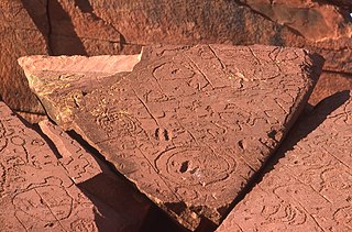
Kakadu National Park is a protected area in the Northern Territory of Australia, 171 km (106 mi) southeast of Darwin. It is a World Heritage Site. Kakadu is also gazetted as a locality, covering the same area as the national park, with 313 people recorded living there in the 2016 Australian census.
Deen Maar Indigenous Protected Area is an Indigenous Protected Area (IPA) located in south-west Victoria, Australia, on land bounded by the Eumeralla River and Bass Strait. The nearest town is Yambuk.

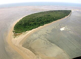
Warul Kawa Indigenous Protected Area is a small island that is part of Australia's National Reserve System, located 34 kilometres (21 mi) south of Papua New Guinea and about 200 kilometres (120 mi) north of Thursday Island, Torres Strait. The protected area and island are the most north westerly of the Torres Strait Islands located in the water of Torres Strait, part of Queensland in Australia, and 74 kilometres (46 mi) from Indonesia, at the border of Papua province.
The Crocodile Islands are a group of islands belonging to the Yan-nhaŋu people of the Northern Territory of Australia. They are located off the coast of Arnhem Land in the Arafura Sea.

An Indigenous Protected Area (IPA) is a class of protected area used in Australia; each is formed by voluntary agreement with Indigenous Australians, and declared by Aboriginal Australians and Torres Strait Islander representative organisations. Each is formally recognised by the Australian Government as being part of its National Reserve System. The areas may comprise land and sea, and are managed by Indigenous groups for the conservation of biodiversity. Managing IPAs also helps to protect the cultural values of their country for future generations, and has benefits for Indigenous health, education, economic and social cohesion.
Mount Willoughby Indigenous Protected Area is an indigenous protected area in the Australian state of South Australia located in the gazetted localities of Mount Willoughby and Evelyn Downs about 150 kilometres north-west of the town of Coober Pedy.
Indigenous ranger programs enable First Nations people across Australia to protect and manage their land, sea and culture through a combination of traditional knowledge with Western science and conservation practices.

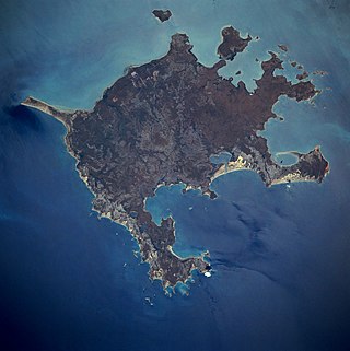
The Anindilyakwa Indigenous Protected Area (IPA) is a region off the coast of Northern mainland Australia, which includes Groote Eylandt, Bickerton Island and other islands in the archipelago, managed by Anindilyakwa people. It is located around 50 km (31 mi) opposite Blue Mud Bay on the eastern coast of Arnhem Land in the Northern Territory, about 630 kilometres (390 mi) from Darwin. It covers an area of approximately 10,000km2.
The DhimurruIndigenous Protected Area (IPA) is a region inclusive around 5,500 square kilometres (2,100 sq mi) of Yolŋu land and sea country in northeast Arnhem Land in the Northern Territory of Australia. It is managed by Dhimurru Aboriginal Corporation through the Dhimurru’s Rangers.
The Katiti-Petermann Indigenous Protected Area (IPA) is a 50,000 km2 (19,000 sq mi) area surrounding Uluru-Kata Tjuta National Park in Central Australia, managed by Anangu Traditional Owners. The region is larger than Switzerland and includes tri-border area of the Northern Territory, Western Australia and South Australia.

The Southern Tanami Indigenous Protected Area (IPA) is Walpiri-managed region of the Tanami Desert in Central Australia. At 101,600 km2, it is Australia's largest IPA.
The Djelk Indigenous Protected Area (IPA) is a 6,700 km2 (2,600 sq mi) area stretching from central Arnhem Land plateau to the Arafura Sea extending west and east of Maningrida in the Northern Territory of Australia, managed by Bawinanga Rangers.
The GanaIanga-Mindibirrina Indigenous Protected Area (IPA) encompases over 10,000 km2 (3,900 sq mi) of the Waanyi Garawa Aboriginal Land Trust area in the southern Gulf of Carpentariain the Northern Territory of Australia, the traditional lands of the Waanyi and Garawa people. The IPA is managed by them through the Waanyi Garawa and Garawa Ranger groups, administered by the Carpentaria Land Council Aboriginal Corporation.
The Laynhapuy Indigenous Protected Area (IPA) is a 14,728 km2 (5,687 sq mi) area of both land and marine estate located in north-east Arnhem Land in the Northern Territory of Australia, managed by Yolŋu people. The area was extended in 2018.
The Marri-Jabin Indigenous Protected Area (IPA) is a 712 km2 (275 sq mi) area around the Moyle and Little Moyle River area in the Northern Territory of Australia.
References
- 1 2 "'We want it to stay as it is': Indigenous Protected Area declared in Crocodile Islands". ABC News. 2023-07-16. Retrieved 2024-09-14.
- ↑ "Indigenous Protected Areas (IPA) | NIAA". www.niaa.gov.au. Retrieved 2024-09-14.
- ↑ Maxwell, Rudi (17 July 2023). "Traditional owners sign Crocodile Islands agreement". National Indigenous Times. Retrieved 14 September 2024.
- ↑ "Celebration of the Crocodile Islands Indigenous Protected Area". Department of the Prime Minister and Cabinet. Retrieved 2024-09-14.