The Au Sable River in Michigan, United States runs approximately 138 miles (222 km) through the northern Lower Peninsula, through the towns of Grayling and Mio, and enters Lake Huron at Au Sable. It is considered one of the best brown trout fisheries east of the Rockies and has been designated a blue ribbon trout stream by the Michigan Department of Natural Resources. In French, au sable literally means "at the sand." A 1795 map calls it the Beauais River.

Alanson is a village in Emmet County in the U.S. state of Michigan. The population was 738 at the 2010 census.
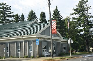
Littlefield Township is a civil township of Emmet County in the U.S. state of Michigan. The population was 2,783 at the 2000 census.

Bear River is a small clear slow-moving river in the U.S. state of Michigan. 14.7 miles (23.7 km) long, it is the largest tributary of Little Traverse Bay in the northwest of the lower peninsula. Traverse Bay is on Lake Michigan. The river is formed as the outflow of Walloon Lake on the boundary between Charlevoix County and Emmet County, draining from the southeast end of the lake at 45°15′40″N84°56′01″W near the community of Walloon Lake in Melrose Township. M-75 has its northern terminus in a junction with US 131 nearby.
The Black Mallard River, also known as Carp Creek, is a short river in the Lower Peninsula of the U.S. state of Michigan. The river is approximately 10 miles (16 km) long and flows into Lake Huron about 15 miles (24 km) east of Cheboygan at 45°32′24″N84°07′51″W.
The Whitefish River is an 11.9-mile-long (19.2 km) river on the Upper Peninsula of the U.S. state of Michigan. The mouth of the river is in Delta County at 45°54′34″N86°58′01″W on the Little Bay De Noc of Lake Michigan. The main branch of the river is formed by the confluence of the east and west branches at 46°03′25″N86°52′17″W.

The Inland Waterway or Inland Water Route is a 38-mile-long (61 km) series of rivers and lakes in the U.S. state of Michigan. With only a short portage, it forms a navigable route for small craft connecting Lake Huron and Lake Michigan across the Northern Michigan region.
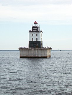
The Cheboygan River is a short but significant river in the Lake Huron drainage basin of the U.S. state of Michigan.
Boyne River is a stream in Northern Michigan, named for the River Boyne in Leinster, Ireland. Together with the north and south branches, the river system has approximately 22 miles (35 km) of mainstream and the water basin drains 40,320 acres (163.2 km2). Boyne River is Lake Charlevoix's second-largest tributary, after the Jordan River.

The Ocqueoc River is stream in Presque Isle County in the northeastern part of the lower peninsula in the U.S. state of Michigan. It is 34.2 miles (55.0 km) long and encompasses a watershed of approximately 94,394 acres (382.00 km2).
The Moran River is a 2.2-mile-long (3.5 km) river on the Upper Peninsula of Michigan in the United States. It begins at the outlet of Chain Lake just west of St. Ignace and flows west through Freschette Lake to Lake Michigan at West Moran Bay.

Sturgeon River may refer to any of the following streams in the U.S. state of Michigan:
The Little Black River is a 6.1-mile-long (9.8 km) stream in Cheboygan County in the U.S. state of Michigan. It rises in Beaugrand Township at 45°40′28″N84°35′48″W and flows eastward into Lake Huron in the city of Cheboygan at 45°39′47″N84°29′21″W, less than a mile west of the mouth of the Cheboygan River.
Sturgeon River is a 40.8-mile-long (65.7 km) river in the U.S. state of Michigan, flowing mostly northward through Otsego and Cheboygan counties.
Sturgeon River is a 63.6-mile-long (102.4 km) river in the U.S. state of Michigan, flowing mostly southward through Alger County and Delta County counties on the Upper Peninsula.

Indian River is a 59.1-mile-long (95.1 km) tributary of the Manistique River on the Upper Peninsula of Michigan in the United States. It rises out of Hovey Lake at 46°17′36″N86°42′20″W on Hiawatha National Forest land in Alger County and flows south and east through a lake district and on through Schoolcraft County. The river flows into the 8,659 acre (35 km²) Indian Lake at 46°17′36″N86°42′20″W and flows out at 45°59′30″N86°17′15″W. It then flows east and south about 2.5 miles where it merges with the Manistique River, which then flows through Manistique and into Lake Michigan at 45°56′56″N86°14′45″W.

Indian River in the Lower Peninsula of Michigan is a 3.9-mile-long (6.3 km) waterway in Cheboygan County that flows from Burt Lake at 45°24′37″N84°37′19″W to Mullett Lake at 45°27′05″N84°34′39″W. The unincorporated community of Indian River is named after the river.
The Little Carp River is a 1.6-mile-long (2.6 km) stream in Cheboygan County in the U.S. state of Michigan.
The Little Pigeon River is a 6.0-mile-long (9.7 km) stream in Cheboygan County in the U.S. state of Michigan.
The Little Pigeon River is a 10.2-mile-long (16.4 km) stream in Otsego and Cheboygan counties in the U.S. state of Michigan.