Maiden Newton is a village and civil parish in the county of Dorset in south-west England. It lies within the Dorset Council administrative area, about 9 miles (14 km) north-west of the county town, Dorchester.

Puddletown is a village and civil parish in Dorset, England. It is situated by the River Piddle, from which it derives its name, about 4.5 miles (7 km) northeast of the county town Dorchester. Its earlier name Piddletown fell out of favour, probably because of connotations of the word "piddle". The name Puddletown was officially sanctioned in the late 1950s. Puddletown's civil parish covers 2,908 hectares and extends to the River Frome to the south. In 2013, the estimated population of the civil parish was 1450.

Bradford Peverell is a village and civil parish in the English county of Dorset, 2 miles (3.2 km) north-west of the county town Dorchester. It is sited by the south bank of the River Frome, among low chalk hills on the dip slope of the Dorset Downs. The A37 road between Dorchester and Yeovil passes to the north of the village on the other side of the river's water meadows. In the 2011 census the population of the parish was 370.

Cattistock is a village and civil parish in west Dorset, England, sited in the upper reaches of the Frome Valley, 8 miles (13 km) northwest of the county town Dorchester. The Dorset poet William Barnes called it "elbow-streeted Cattstock", a comment on the less-than-linear village street. In the 2011 census the parish had a population of 509.

Evershot is a village and civil parish in the county of Dorset in southwest England, situated approximately 7 miles (11 km) south of Yeovil in Somerset. It is the second highest village in the county at 175 metres (574 ft) above sea-level. Evershot parish encompasses part of the nearby hamlet of Holywell, 1.25 miles (2.01 km) east of Evershot village. Dorset County Council's latest (2013) estimate of the parish population is 210. The village has connections with the writer Thomas Hardy.

Frome St Quintin is a village in the county of Dorset in southern England, situated approximately 11 miles (18 km) northwest of the county town Dorchester. It is sited on an outcrop of greensand near the head of the Frome valley, among chalk hills of the Dorset Downs. Dorset County Council's latest (2013) estimate of the parish population is 150. There are naturally occurring springs in the area and the first habitation is likely to have been during the Roman era. The parish church dates from the 13th century. Just over 0.5 miles (0.80 km) west of the village and in Cattistock parish is Chantmarle, a 15th-century manor house with later additions.

Frome Vauchurch is a parish in the county of Dorset in southern England, situated approximately 7 miles (11 km) northwest of the county town Dorchester. It includes the hamlets of Frome Vauchurch, Higher Frome Vauchurch, Lower Frome Vauchurch and Tollerford. Frome Vauchurch is sited in the Frome valley amongst the chalk hills of the Dorset Downs. The parish is adjacent to the village of Maiden Newton, with which the parish's hamlets are virtually contiguous. Dorset County Council's latest (2013) estimate of the parish population is 160.

Rampisham is a village and civil parish in the county of Dorset in southern England, situated approximately 11 miles (18 km) northwest of the county town Dorchester. The village is sited on greensand in a valley surrounded by the chalk hills of the Dorset Downs. The parish includes the hamlet of Uphall northwest of the main village.

Seaborough is a small village and civil parish in the county of Dorset in southwest England. It is sited in the valley of the River Axe and lies approximately 2 miles (3.2 km) south of Crewkerne in Somerset. The parish was previously part of the hundred of Crewkerne, but was transferred to within Dorset in 1896. In 2013 the estimated population of the civil parish was 60.

Woodsford is a village and civil parish beside the River Frome, Dorset, England, about 4 miles (6.4 km) east of the county town Dorchester. Dorset County Council's 2013 mid-year estimate of the parish population is 80.

Wootton Fitzpaine is a village and civil parish in the county of Dorset in South West England. It lies approximately 3 miles (4.8 km) north-east of Lyme Regis in a small side valley of the River Char, close to the Marshwood Vale. The civil parish covers an area of 3,307 acres (1,338 ha) and includes the ecclesiastical parish and small settlement of Monkton Wyld to the west. In the 2011 census the civil parish had 180 dwellings, 134 households and a population of 345.

Lillington is a hamlet and civil parish in north west Dorset, England, situated 3 miles (4.8 km) south of Sherborne. Dorset County Council estimate that the population of the civil parish was 50 in 2013.

Frampton is a village and civil parish in the county of Dorset in southern England, situated approximately 5 miles (8.0 km) northwest of the county town Dorchester. It is sited in the Frome valley among chalk hills of the Dorset Downs. The village's name is a derivation from "Frome Town".
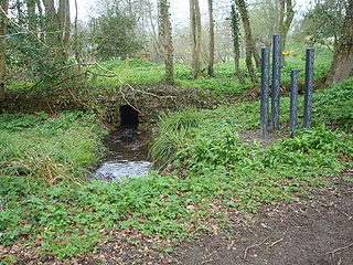
The River Hooke is a small river in the county of Dorset in southern England. It runs from its source at Toller Whelme through the villages and hamlets of Hooke, Kingcombe, Toller Porcorum and Toller Fratrum to join the River Frome at Maiden Newton, a course of some 6 miles. The river was formerly called the River Toller, whence the name of the three Toller villages, as well as of the hundred of Tollerford. At some point, however, this former name was replaced in use by reference to a particular feature in the river's course: "Hooke" is a derivation of hoc, Old English for "sharp bend in a stream". It is possible that this description gave the village of Hooke its name, which then transferred to the river by back-formation.

North Wootton is a hamlet and civil parish in Dorset, England, situated approximately 1.5 miles (2.4 km) southeast of Sherborne. It is sited on a narrow band of Cornbrash limestone, with Oxford clay adjacent to the southeast and Forest Marble to the northwest. In 2013 the estimated population of the parish was 50.
West Compton is a hamlet and civil parish in the county of Dorset, England. It lies in western Dorset, about 7 miles to the east of the town of Bridport. The county town of Dorchester lies about 9 miles east-southeast. The A35 trunk road, which runs between these two towns, is about 2 miles to the south. Dorset County Council estimate that in 2013 the parish had a population of 24.

Chilfrome is a small village and civil parish in the county of Dorset in southwest England. It lies in the Dorset unitary authority administrative area, approximately 9 miles (14 km) northwest of the county town Dorchester. It is situated between the villages of Cattistock and Maiden Newton in the upper reaches of the Frome Valley in the Dorset Downs. The parish church was largely restored in 1864, though it has a thirteenth-century chancel-arch, a partly fourteenth-century nave, and windows dating from the fifteenth century. The parish church dates from the 14th century and is a Grade II* Listed Building. Dorset County Council estimate that in 2013 the population of the civil parish was 40.

Dorset is a county located in the middle of the south coast of England. It lies between the latitudes 50.512°N and 51.081°N and the longitudes 1.682°W and 2.958°W, and occupies an area of 2,653 km2. It spans 90 kilometres (56 mi) from east to west and 63 kilometres (39 mi) from north to south.
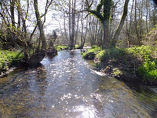
The Frome Valley Trail is a long-distance footpath in Dorset, England which follows the River Frome from Evershot to Dorchester and will, when completed, extend to Poole Harbour.