The Mexican Riviera refers collectively to twenty cities and lagoons lying on the western coast of Mexico. Although there are long distances between these cities, they are often collectively referred to as the Mexican Riviera because of their many oceanfront resorts and their popularity among tourists. Cruise ships often visit three or four of these destinations on their longer cruises. In a 2005 interview Stanley McDonald, the founder of Princess Cruises, mentioned:
The call of the "Mexican Riviera" was coined by Princess Cruise Line. Now everyone refers to it as the Mexican Riviera. I believe that it really spoke to the quality and beauty of what people would see down there. We all know the French Riviera -- the Mexican Riviera was something we had in the western hemisphere.
Aeolus Valley is a village in the Yallahs district of the Jamaican parish of Saint Thomas. Although there has been a recent wave of violence and murders, residents still say that the community is a wonderful place.
German submarine U-2501 was a Type XXI U-boat of Nazi Germany's Kriegsmarine, built for service in World War II. The submarine was laid down on 3 April 1944 at the Blohm & Voss yard at Hamburg, launched on 12 May 1944, and commissioned on 27 June 1944 under the command of Oberleutnant zur See Otto Hübschen, who commanded her for her entire career.
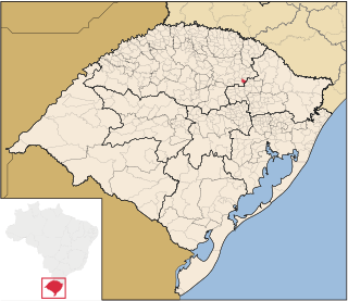
São Domingos do Sul is a municipality in the Brazilian state of Rio Grande do Sul. It is situated at a latitude of 28º31'51 South and a longitude of 51º53'16" West. As of 2004, it has an estimated population of 2,970 inhabitants on an area of 81.24 km². Its current mayor is Domingos Scartazzini.
Torremayor is a municipality located in the province of Badajoz, Extremadura, Spain. According to the 2005 census (INE), the municipality has a population of 1020 inhabitants.

Cabañas de Yepes is a municipality located in the province of Toledo, Castile-La Mancha, Spain. According to the 2006 census (INE), the municipality has a population of 265 inhabitants.

Ciruelos de Cervera is a municipality located in the province of Burgos, Castile and León, Spain.
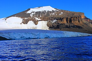
Brown Bluff is a basalt tuya located on the Tabarin Peninsula of northern Antarctica. It formed in the past 1 million years, which erupted subglacially within an englacial lake. The volcano's original diameter is thought to have been about 12-15 kilometers, and probably formed by a single vent. Brown Bluff is subdivided into four stages: pillow volcano, tuff cone, slope failure, and hyaloclastite delta and into five structural units.
Río Grande de Matagalpa is a river of Nicaragua. Running 430 kilometers (270 mi) from its source near Matagalpa to the Caribbean Sea in the northern part of the South Caribbean Autonomous Region it is the second longest river in Nicaragua. It gives it name to the city and municipality of La Cruz de Río Grande. The Tumarín Dam is being constructed on its lower reaches.
Kankossa is a town and commune the Assaba region of Mauritania.
Touil is a town and commune in Mauritania.
Ninh Sơn is a commune (xã) and village in Việt Yên District, Bắc Giang Province, in northeastern Vietnam.
Coxcatlán Municipality is a municipality in San Luis Potosí in central Mexico.
Bowhill is a village off the A708, in the Scottish Borders area of Scotland, near Selkirk, by the Yarrow Water
Malki Stanchovtsi is a village in Tryavna Municipality, in Gabrovo Province, in northern central Bulgaria.
Popraykovtsi is a village in Tryavna Municipality, in Gabrovo Province, in northern central Bulgaria.
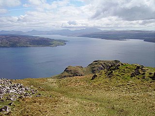
The Sound of Mull is a sound between the Inner Hebridean island of Mull and Scotland. It forms part of the Atlantic Ocean.

Ilumäe is a village in Haljala Parish, Lääne-Viru County, in northeastern Estonia.
Paaduotsa is a village in Märjamaa Parish, Rapla County in western Estonia.
Heggeri is a village in Dharwad district of Karnataka, India.