The Rockaway Peninsula, commonly referred to as The Rockaways or Rockaway, is a peninsula at the southern edge of the New York City borough of Queens on Long Island, New York. Relatively isolated from Manhattan and other more urban parts of the city, Rockaway became a popular summer retreat in the 1830s. It has since become a mixture of lower, middle, and upper-class neighborhoods. In the 2010s, it became one of the city's most quickly gentrifying areas.

Woodhaven is a neighborhood in the southwestern section of the New York City borough of Queens. It is bordered on the north by Park Lane South and Forest Park, on the east by Richmond Hill, on the south by Ozone Park and Atlantic Avenue, and the west by the Cypress Hills neighborhood of Brooklyn.

Far Rockaway is a neighborhood on the eastern part of the Rockaway peninsula in the New York City borough of Queens. It is the easternmost section of the Rockaways. The neighborhood extends from Beach 32nd Street east to the Nassau County line. Its southern boundary is the Atlantic Ocean; it is one of the neighborhoods along Rockaway Beach.
Belle Harbor is a small residential neighborhood in the New York City borough of Queens, located on the western half of the Rockaway Peninsula, the southernmost area of the borough. Belle Harbor commonly refers to the area from Beach 126th to Beach 141st Streets.

The Far Rockaway Branch is an electrified rail line and service owned and operated by the Long Island Rail Road in the U.S. state of New York. The branch begins at Valley Interlocking, just east of Valley Stream station. From Valley Stream, the line heads south and southwest through southwestern Nassau County, ending at Far Rockaway in Queens, thus reentering New York City. LIRR maps and schedules indicate that the Far Rockaway Branch service continues west along the Atlantic Branch to Jamaica. This two-track branch provides all day service in both directions to Grand Central Madison and Penn Station, both in Midtown Manhattan.

The Outer Barrier, also known as the Long Island and New York City barrier islands, refers to the string of barrier islands that divide the lagoons south of Long Island, New York from the Atlantic Ocean. These islands include Long Beach Barrier Island, Barnum Island, Jones Beach Island, Fire Island and Westhampton Island. The outer barrier extends 75 miles (121 km) along the South Shore of Long Island, from the Rockaway Peninsula in New York City to the east end of Shinnecock Bay in Suffolk County.

The Rockaway Park–Beach 116th Street station is the western terminal station on the IND Rockaway Line of the New York City Subway, located on Beach 116th Street near Rockaway Beach Boulevard in Rockaway Beach, Queens. It is served by the Rockaway Park Shuttle at all times and ten daily rush-hour A trains in the peak direction.

The Montauk Branch is a rail line owned and operated by the Long Island Rail Road in the U.S. state of New York. The line runs the length of Long Island, 115 miles (185 km) from Long Island City to Montauk. However, in LIRR maps and schedules for public use, the term Montauk Branch refers to the line east of Babylon; service from Jamaica to Babylon is covered by separate Babylon Branch schedules, while the line west of Jamaica is currently unused for passenger service. A select number of Montauk Branch trains operate via the Main Line during peak hours.

Rockaway Park is a neighborhood in the New York City borough of Queens. The area is on the Rockaway Peninsula, nestled between Jamaica Bay to the north and the Atlantic Ocean to the south. The neighborhood of Rockaway Beach lies on its eastern border while the community of Belle Harbor is situated on its western side. The neighborhood is part of Queens Community Board 14.

Pier Village is a Victorian-inspired mixed-use community located in Long Branch, New Jersey along the Atlantic Ocean. It opened in 2005.

Hammels is an area within Rockaway Beach on the Rockaway Peninsula in the New York City borough of Queens. It is located west of Arverne and east of Seaside, and is centered on Beach 84th Street. Its main thoroughfare is Beach Channel Drive. The New York City Subway's A train travels through the neighborhood on the IND Rockaway Line. The Hammel Houses, a public housing project built in 1955, is located in the neighborhood.

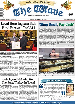
The Wave is the longest-lived and most widely circulated newspaper in the Rockaway Peninsula, New York City Borough of Queens. The weekly newspaper, currently under Editor In Chief Mark C. Healey, is well known to Rockaway residents for coverage of community events and local politics. The paper contains considerable historical information about Rockaway, largely provided by historian Emil Lucev. The Wave's US Postal Statement of Management and Circulation for 2018 indicates the paper was sold to the owners of The Queens Ledger group ending 125 years of independent local control and ownership. Since 2018, the new publisher, lifelong Queens resident, Walter H. Sanchez and his son, John Sanchez, have continued the local charm of the paper with a number of glossy editions including the yearly Rockaway Almanac, Summer Guide, Anniversary Issue and a yearly glossy Rockaway Health and Wellness Guide. On October 1, 2022, The Wave operated a 'Rockaway Family Fun Day Festival' on Beach 116th Street - featuring live bands, rides, health agencies like St. Johns Episcopal Hospital and The Joseph P. Addabbo Family Health Center. The event was also the debut of the yearly 'Meat-Up-Grill' Burger Eating Contest.

Rockaway Beach Boulevard, opened in 1886, was the first major east-west thoroughfare on the Rockaway Peninsula in the Borough of Queens in New York City. Much of its route parallels the Rockaway Freeway and the IND Rockaway Line above the Freeway. The boulevard first forks off at its eastern end from Beach Channel Drive at Beach 35th Street in Edgemere and merges once again with Beach Channel Drive by Jacob Riis Park shortly before the Marine Parkway–Gil Hodges Memorial Bridge.

The Rockaway Freeway is a road in the New York City borough of Queens that was created from the old right-of-way of the Long Island Rail Road Rockaway Division in 1941–1942 as part of the project to eliminate grade crossings within New York City. The railroad line itself was elevated over the new automotive route and was incorporated into the New York City Subway system as the IND Rockaway Line in June 1956.
The Rockaway Beach Hotel, also known as the Hotel Imperial, was a large hotel built in Rockaway, Queens, New York City during the late 1870s and early 1880s by the Rockaway Improvement Company. The hotel, promoted as the "biggest hotel in the world", ran along the Rockaway beachfront from the present-day Beach 110th Street to Beach 116th Street, thus locating it in the contemporary Rockaway Park neighborhood rather than Rockaway Beach as the name implies.

The East Rockaway Inlet is an arm of the Atlantic Ocean which separates the Rockaway Peninsula from the barrier island which includes the Nassau County, New York communities of Atlantic Beach, Long Beach and Lido Beach. The inlet is on the south shore of Long Island. It provides for a channel 12 feet deep and 250 feet wide. A 3,000 foot jetty on the western side of the channel was authorized but never constructed, and was eventually deauthorized by Congress in 1977.

Howard was a former Long Island Rail Road station on the Rockaway Beach Branch. Located on marshland along the coast of Jamaica Bay south of the "WD Tower" near Hawtree Creek, it had no fixed address, and was south of what is today 165th Avenue, evidently within the Gateway National Recreation Area's Hamilton Beach Park.

Kohlreiter Square is an 8.6-acre public green space located in the Arverne neighborhood on Rockaway Peninsula in Queens, New York. It located along the north side of Rockaway Freeway between Beach 67th and Beach 69th Streets. The park honors two generations of civic activists, Nathan A. Kohlreiter (1880–1961) and his son Fred Kohlreiter (1913–1990) who contributed to the political and social fabric of the neighborhood.
Walter J. Wetzel Triangle is a small park bound by Cohancy Street, 156th Avenue, 99th Street, and 157th Avenue, in the Howard Beach neighborhood of Queens, New York City.

Tribute Park is a 0.83-acre (0.34 ha) public green space in the Rockaway Park neighborhood of Queens, New York City. It is located at the corner of Beach Channel Drive and Beach 116th Street, facing Jamaica Bay.


