Gniezno County is a unit of territorial administration and local government (powiat) in Greater Poland Voivodeship, west-central Poland. It came into being on January 1, 1999, as a result of the Polish local government reforms passed in 1998. Its administrative seat and largest town is Gniezno, which lies 49 kilometres (30 mi) east of the regional capital Poznań. The county contains four other towns: Witkowo, 16 km (10 mi) south-east of Gniezno, Trzemeszno, 16 km (10 mi) east of Gniezno, Kłecko, 16 km (10 mi) north-west of Gniezno, and Czerniejewo, 14 km (9 mi) south-west of Gniezno.

Czerniejewo is a town and municipality in central Poland with 2,536 inhabitants (2005).
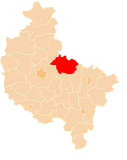
Gmina Niechanowo is a rural gmina in Gniezno County, Greater Poland Voivodeship, in west-central Poland. Its seat is the village of Niechanowo, which lies approximately 10 kilometres (6 mi) south-east of Gniezno and 53 km (33 mi) east of the regional capital Poznań.
Gębarzewo is a village in the administrative district of Gmina Czerniejewo, within Gniezno County, Greater Poland Voivodeship, in west-central Poland. It lies approximately 7 kilometres (4 mi) north-east of Czerniejewo, 8 km (5 mi) south of Gniezno, and 45 km (28 mi) east of the regional capital Poznań.
Graby is a village in the administrative district of Gmina Czerniejewo, within Gniezno County, Greater Poland Voivodeship, in west-central Poland. It lies approximately 4 kilometres (2 mi) south-west of Czerniejewo, 18 km (11 mi) south-west of Gniezno, and 36 km (22 mi) east of the regional capital Poznań.
Kąpiel is a village in the administrative district of Gmina Czerniejewo, within Gniezno County, Greater Poland Voivodeship, in west-central Poland. It lies approximately 3 kilometres (2 mi) east of Czerniejewo, 13 km (8 mi) south-west of Gniezno, and 41 km (25 mi) east of the regional capital Poznań.
Kosowo is a village in the administrative district of Gmina Czerniejewo, within Gniezno County, Greater Poland Voivodeship, in west-central Poland. It lies approximately 6 kilometres (4 mi) east of Czerniejewo, 12 km (7 mi) south of Gniezno, and 44 km (27 mi) east of the regional capital Poznań.
Nidom is a village in the administrative district of Gmina Czerniejewo, within Gniezno County, Greater Poland Voivodeship, in west-central Poland. It lies approximately 4 kilometres (2 mi) north-east of Czerniejewo, 11 km (7 mi) south-west of Gniezno, and 43 km (27 mi) east of the regional capital Poznań.
Pakszynek is a village in the administrative district of Gmina Czerniejewo, within Gniezno County, Greater Poland Voivodeship, in west-central Poland. It lies approximately 6 kilometres (4 mi) south-east of Czerniejewo, 16 km (10 mi) south of Gniezno, and 42 km (26 mi) east of the regional capital Poznań.
Pawłowo is a village in the administrative district of Gmina Czerniejewo, within Gniezno County, Greater Poland Voivodeship, in west-central Poland. It lies approximately 6 kilometres (4 mi) north of Czerniejewo, 9 km (6 mi) south-west of Gniezno, and 42 km (26 mi) east of the regional capital Poznań.
Żydowo is a village in the administrative district of Gmina Czerniejewo, within Gniezno County, Greater Poland Voivodeship, in west-central Poland. It lies approximately 8 kilometres (5 mi) east of Czerniejewo, 10 km (6 mi) south of Gniezno, and 47 km (29 mi) east of the regional capital Poznań.
Skrzetuszewo is a village in the administrative district of Gmina Kiszkowo, within Gniezno County, Greater Poland Voivodeship, in west-central Poland. It lies approximately 9 kilometres (6 mi) south-east of Kiszkowo, 17 km (11 mi) west of Gniezno, and 33 km (21 mi) north-east of the regional capital Poznań.
Arcugowo is a village in the administrative district of Gmina Niechanowo, within Gniezno County, Greater Poland Voivodeship, in west-central Poland. It lies approximately 3 kilometres (2 mi) south-east of Niechanowo, 12 km (7 mi) south-east of Gniezno, and 54 km (34 mi) east of the regional capital Poznań.
Ostrowite is a village in the administrative district of Gmina Trzemeszno, within Gniezno County, Greater Poland Voivodeship, in west-central Poland. It lies approximately 6 kilometres (4 mi) south-east of Trzemeszno, 19 km (12 mi) east of Gniezno, and 67 km (42 mi) east of the regional capital Poznań.
Głożyny is a village in the administrative district of Gmina Witkowo, within Gniezno County, Greater Poland Voivodeship, in west-central Poland. It lies approximately 5 kilometres (3 mi) south-east of Witkowo, 21 km (13 mi) south-east of Gniezno, and 60 km (37 mi) east of the regional capital Poznań.
Mielżyn is a village in the administrative district of Gmina Witkowo, within Gniezno County, Greater Poland Voivodeship, in west-central Poland. It lies approximately 6 kilometres (4 mi) south of Witkowo, 21 km (13 mi) south-east of Gniezno, and 58 km (36 mi) east of the regional capital Poznań.
Odrowąż is a village in the administrative district of Gmina Witkowo, within Gniezno County, Greater Poland Voivodeship, in west-central Poland. It lies approximately 5 kilometres (3 mi) south-west of Witkowo, 16 km (10 mi) south-east of Gniezno, and 55 km (34 mi) east of the regional capital Poznań.
Ruchocin is a village in the administrative district of Gmina Witkowo, within Gniezno County, Greater Poland Voivodeship, in west-central Poland. It lies approximately 5 kilometres (3 mi) south of Witkowo, 20 km (12 mi) south-east of Gniezno, and 59 km (37 mi) east of the regional capital Poznań.
Ruchocinek is a village in the administrative district of Gmina Witkowo, within Gniezno County, Greater Poland Voivodeship, in west-central Poland. It lies approximately 5 kilometres (3 mi) south-east of Witkowo, 21 km (13 mi) south-east of Gniezno, and 63 km (39 mi) east of the regional capital Poznań.


