Da'ar buduq

Last updated
Daarbuduq
Dacar Budhuq
Town
Somaliland Marodi Jeh location map.svg
Red pog.svg
Daarbuduq
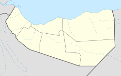
Location in Somaliland
Somaliland location map (1).svg
Red pog.svg
Daarbuduq
Daarbuduq (Somaliland)
Coordinates: 9°51′24″N44°31′38″E / 9.85667°N 44.52722°E / 9.85667; 44.52722
CountryFlag of Somaliland.svg  Somaliland
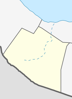
Region Maroodi-jeex
District Hargeisa
Time zone UTC+3 (EAT)

Daar buduq (Somali : Dacarbudhuq) is a town in the Marodi Jeh province of Somaliland. Situated in the Hargeisa District, it is located northeast by road from Hargeisa and southwest of Berbera. [1] [2]

Contents

The town is inhabited by people from the Adam Issa and Abokor Issa subdivisions of the Isamusa clans. Isaaq Somali ethnic group.[ citation needed ] It is to the west of the hills of Adadleh. [3]
See also

Related Research Articles

<span class="mw-page-title-main">Somaliland</span> Unrecognised state in the Horn of Africa

Somaliland, officially the Republic of Somaliland, is an unrecognised country in the Horn of Africa. It is located in the southern coast of the Gulf of Aden and bordered by Djibouti to the northwest, Ethiopia to the south and west, and Somalia to the east. Its claimed territory has an area of 176,120 square kilometres (68,000 sq mi), with approximately 6.2 million residents as of 2024. The capital and largest city is Hargeisa.

<span class="mw-page-title-main">Maroodi Jeex</span> Region of Somaliland

Marodi Jeh is an administrative region (gobol) in western Somaliland. It is the most populous region of the country. It is bordered by Awdal to the west, Sahil to the north, Togdheer to the east and Ethiopia to the south. Marodi Jeh was created by splitting the previously existing region (gobolka) In 2007 the region of Woqooyi Galbeed was renamed to Maroodi Jeex.

<span class="mw-page-title-main">Hargeisa</span> Capital and most populous city of Somaliland

Hargeisa is the capital and largest city of the Republic of Somaliland, a de facto sovereign state in the Horn of Africa, still considered internationally to be part of Somalia. It is also the regional capital of the Maroodi Jeex region of Somaliland.

<span class="mw-page-title-main">Burao</span> City in Togdheer region, Somaliland

Burao, also spelt Bur'o or Bur'ao, is the capital of the Togdheer region and the second largest city in Somaliland. Burao was the site of the declaration of an independent Somaliland on 18 May 1991.

<span class="mw-page-title-main">Eidagale</span> Somali clan

The Eidagalle, is a major Somali clan of the Isaaq clan family. Members of this clan are concentrated in Somaliland and the Somali region. They are the traditional holders of the Isaaq Sultanate since the 18th century. As descendants of Ismail bin Sheikh Isaaq, its members form a part of the Habar Magaadle confederation, and they constitute the largest sub-clan of the Isaaq. They traditionally consist of nomadic pastoralists, merchants and skilled poets.

<span class="mw-page-title-main">Gabiley</span> City in Somaliland

Gabiley, also known as Gebiley, is a city in the Maroodi Jeex region of Somaliland.

<span class="mw-page-title-main">Economy of Somaliland</span>

The Economy of Somaliland largely relies on primary production and agriculture, where livestock is the main export of the country, which it ships to neighbouring Djibouti and Ethiopia, as well as to Gulf states, such as UAE, Saudi Arabia and Oman. Somaliland has a GDP per capita of $973 and a gross domestic product GDP of $5,583,000,000 as of 2024, most of which it receives in remittances from Somalis working abroad. The COVID-19 pandemic has restricted Somaliland's trade flows with decreased demand in the agriculture sector, a significant source of tax revenue.

<span class="mw-page-title-main">Regions of Somaliland</span>

The regions of Somaliland is divided into six administrative regions, Awdal, Sahil, Maroodi-Jeeh, Togdheer, Sanaag and Sool. These are in turn subdivided into twenty-two districts. Regions of Somaliland are the primary geographical divisions through which Somaliland is administered. A distinction is made between districts of grades A, B, C and D, with the classification being based on population, area, economy and production.

<span class="mw-page-title-main">Habr Awal</span> Somali clan

The Awal, also contemporarily known as the Habr Awal, Subeer Awal, and alternately known as the Zubeyr Awal is one of the largest subclans of the wider Isaaq clan family, and is further divided into eight sub-clans of whom the two largest and most prominent are the Isamusa and Sa'ad Musa sub-clans. Its members form a part of the Habar Magadle confederation.

<span class="mw-page-title-main">Tog Wajaale</span> City on the border of Somaliland and Ethiopia

Tog Wajaale is a city on the border of Somaliland and Ethiopia. Tog Wajaale is the main border crossing for goods coming in and out of Somaliland, primarily from the port city of Berbera, Somaliland's main port.

Tourism in Somaliland is regulated by Somaliland's Ministry of Tourism.

The following is an index of Somaliland-related articles.

<span class="mw-page-title-main">Sahil, Somaliland</span> Region of Somaliland

Sahil is an administrative region (gobol) in northern Somaliland with the port city of Berbera as its capital. It was separated from Woqooyi Galbeed and became a province in 1991. In 1998, the Sheikh District of Togdheer was incorporated into Sahil region. The region has a long coastline facing the Gulf of Aden to the north. Sahil borders Awdal to the northwest, Maroodi Jeex to the southwest, Togdheer to the south and Sanaag to the east.

<span class="mw-page-title-main">Isamusa</span> Somali clan

The Isamusa is a prominent Somali clan which is part of the Isaaq family clan. The Isamusa traditionally consists of coastal people, nomadic pastoralist and merchants. This clan are primarily settled in Somaliland, including Maroodi Jeex, Togdheer, Sahil, Awdal, Djibouti, Yemen, as well as Kenya. Isamusa populations are present in southern Somalia such as Mogadishu.

Events of 2018 in Somaliland.

<span class="mw-page-title-main">Somaliland Peace Process</span> Peace process in Somaliland

The Somaliland Peace Process refers to the series of grassroot initiatives that brought peace to Somaliland after the collapse of central government of Somalia. In conjunction with the Somali National Movement, communities in Somaliland negotiated a series of truces to end hostilities and address the grievances between the communities who were often on opposing sides to the Barre regime.

<span class="mw-page-title-main">Isaaq Sultanate</span> 1750–1884 northern Somali kingdom

The Isaaq Sultanate was a Muslim sultanate that ruled parts of the Horn of Africa in the 18th and 19th centuries. The kingdom spanned the territories of the Isaaq clan in modern-day Somaliland. It was governed by the Rer Guled branch of the Garhajis clan and is the pre-colonial predecessor to the modern Republic of Somaliland.

Mandera is a town in the Maroodi Jeex province of Somaliland. Situated in the Hargeisa District, it is located northeast by road from Hargeisa and southwest of Berbera.

<span class="mw-page-title-main">Yirowe</span> Town in Togdheer, Somaliland

Yirowe, also spelt Yerrowa, Yerowa, Yeroweh or Yerowah is a town in the Burao District, located in the Togdheer region of Somaliland. The town is located 20 km east of Burao, the provincial capital of the Togdheer region.

<span class="mw-page-title-main">Somaliland War of Independence</span> 1981–1991 conflict part of Somali Civil War

The Somaliland War of Independence was a rebellion waged by the Somali National Movement (SNM) against the ruling military junta in Somalia led by General Siad Barre lasting from its founding on 6 April 1981 and ended on 18 May 1991 when the SNM declared what was then northern Somalia independent as the Republic of Somaliland. The conflict served as the main theater of the larger Somali Rebellion that started in 1978. The conflict was in response to the harsh policies enacted by the Barre regime against the main clan family in Somaliland, the Isaaq, including a declaration of economic warfare on the clan-family. These harsh policies were put into effect shortly after the conclusion of the disastrous Ogaden War in 1978.

References

  1. Google Maps (Map). Google.
  2. Bing Maps (Map). Microsoft and Harris Corporation Earthstar Geographics LLC.
  3. Report on the Geology of the Adadleh Area, Hargeisa and Berbera Districts: Quarter Degree Sheet No. 35 (D.O.S. 1:125,000)