The Icy Strait is a strait in the Alexander Archipelago in southeastern Alaska, at about 58°16′41″N135°38′48″W. The strait separates Chichagof Island to the south and the Alaska mainland to the north. The strait is 64 km (40 mi) from its west side at the intersection of the Cross Sound and Glacier Bay to its east side at Chatham Strait and the Lynn Canal. The two largest islands in the strait are Pleasant Island and Lemesurier Island.
Nakfa is a town in the Northern Red Sea region of Eritrea. It is also the name of a sub region of Eritrea.

Kırıkkale Province is a province of Turkey. It is located on the crossroads of major highways east of Ankara leading east to the Black Sea region. With its rapid population growth it has become an industrial center. The provincial capital is Kırıkkale.
Hamasien was a historical province including and surrounding Asmara, part of modern Eritrea. In 1996 the province was divided and distributed amongst the modern Maekel, Debub, Northern Red Sea, Gash-Barka, and Anseba regions.
Sylvania is a neighborhood of Louisville, Kentucky located near Terry Road along Sylvania Road.
Valvaithankoshtam is a panchayat town in Kanniyakumari district in the Indian state of Tamil Nadu.

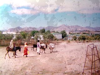
Geleb Subregion is a subregion in the northwestern Anseba region of Eritrea. Its capital lies at Geleb.
South Eastern Subregion is a subregion in the central Maekel (Maakel) region of Eritrea.
Bechcice-Wieś is a village in the administrative district of Gmina Lutomiersk, within Pabianice County, Łódź Voivodeship, in central Poland.

Biała Parcela is a village in the administrative district of Gmina Biała, within Wieluń County, Łódź Voivodeship, in central Poland. It lies approximately 11 kilometres (7 mi) north-west of Wieluń and 90 km (56 mi) south-west of the regional capital Łódź.
Wrzosówka is a village in the administrative district of Gmina Małogoszcz, within Jędrzejów County, Świętokrzyskie Voivodeship, in south-central Poland. It lies approximately 5 kilometres (3 mi) north of Małogoszcz, 25 km (16 mi) north of Jędrzejów, and 25 km (16 mi) west of the regional capital Kielce.
Smugi is a village in the administrative district of Gmina Wojciechowice, within Opatów County, Świętokrzyskie Voivodeship, in south-central Poland. It lies approximately 4 kilometres (2 mi) north-east of Wojciechowice, 16 km (10 mi) north-east of Opatów, and 71 km (44 mi) east of the regional capital Kielce.
Stoczek is a village in the administrative district of Gmina Garwolin, within Garwolin County, Masovian Voivodeship, in east-central Poland. It lies approximately 11 kilometres (7 mi) west of Garwolin and 52 km (32 mi) south-east of Warsaw.
Milewo-Brzegędy is a village in the administrative district of Gmina Krasne, within Przasnysz County, Masovian Voivodeship, in east-central Poland.
Gółkowo is a village in the administrative district of Gmina Słupca, within Słupca County, Greater Poland Voivodeship, in west-central Poland.
Michałowo is a village in the administrative district of Gmina Dominowo, within Środa Wielkopolska County, Greater Poland Voivodeship, in west-central Poland.
Kadłubski Piec is a village in the administrative district of Gmina Strzelce Opolskie, within Strzelce County, Opole Voivodeship, in south-western Poland. It lies approximately 12 kilometres (7 mi) north of Strzelce Opolskie and 26 km (16 mi) east of the regional capital Opole.
Barcino is a village in the administrative district of Gmina Kępice, within Słupsk County, Pomeranian Voivodeship, in northern Poland. It lies approximately 7 kilometres (4 mi) north-east of Kępice, 22 km (14 mi) south of Słupsk, and 110 km (68 mi) west of the regional capital Gdańsk.
Jabłonkowo is a village in the administrative district of Gmina Mirosławiec, within Wałcz County, West Pomeranian Voivodeship, in north-western Poland. It lies approximately 13 kilometres (8 mi) east of Mirosławiec, 15 km (9 mi) north-west of Wałcz, and 113 km (70 mi) east of the regional capital Szczecin.