Related Research Articles

Camberwell was a civil parish and metropolitan borough in south London, England. Camberwell was an ancient parish in the county of Surrey, governed by an administrative vestry from 1674. The parish was included in the area of responsibility of the Metropolitan Board of Works in 1855 and became part of the County of London in 1889. The parish of Camberwell became a metropolitan borough in 1900, following the London Government Act 1899, with the parish vestry replaced by a borough council. In 1965 the borough was abolished and its former area became part of the London Borough of Southwark in Greater London.

The Metropolitan Borough of Chelsea was a metropolitan borough of the County of London between 1900 and 1965. It was created by the London Government Act 1899 from most of the ancient parish of Chelsea. Following the London Government Act 1963, it was amalgamated with the Royal Borough of Kensington in 1965 to form the Royal Borough of Kensington and Chelsea.

Yateley is a town and civil parish in the English county of Hampshire. It lies in the north-eastern corner of Hart District Council area. It includes the settlements of Frogmore and Darby Green to the east. It had a population of 21,011 at the 2001 census. The four wards that comprise Yateley and their 2001 populations are Yateley East (5,168), Yateley North (5,078), Yateley West (5,149), and Frogmore & Darby Green (5,616). The 2009 projection was 20,214, according to the Hart District Council website. Yateley Town Council is one of the few local councils to have been recognised under the national 'Quality Council' award scheme.
Upton is a hamlet in the civil parish of Dinton-with-Ford and Upton, in Buckinghamshire, England. It is located to the north of the main village of Dinton, on the junction between the new road from Aylesbury to Thame, and the old road before it was rerouted.

Woodhouse is a largely residential area just north of the city centre of Leeds and close to the University of Leeds. It is in the Hyde Park and Woodhouse ward of City of Leeds metropolitan district. The population of the ward at the 2011 Census was 25,914.

Hartley Wintney is a large village and civil parish in the Hart district of Hampshire, England. It lies about 3 miles (5 km) northwest of Fleet and 8 miles (13 km) east of Basingstoke. The parish includes the smaller contiguous village of Phoenix Green as well as the hamlets of Dipley, Elvetham, Hartfordbridge, and West Green.

Cornsay is a hamlet and civil parish in County Durham, England. The population of the Civil Parish taken at the 2011 census was 1,128. It is 6 miles (9.7 km) southeast of Consett and 7 miles (11 km) southwest of Durham. It consists of nineteen dwellings, including four farms & is the home of Greenacres nudist club. All formerly belonged to Ushaw College for the training of Catholic priests, hence the organised nomenclature. East and West Farms are now in private hands as homes but the other two are still active, South Farm run by the Suddes family and North Farm by the Tweddle family.

Aldershot is a constituency in Hampshire represented in the House of Commons of the UK Parliament since 2017 by Leo Docherty, a Conservative.

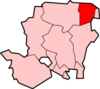
Blackwater and Hawley is a civil parish in the Hart district of Hampshire, England, on the border with Surrey. According to the 2001 census it had a population of 5,849, reducing to 4,473 at the 2011 Census. The parish includes Minley, Blackwater and Hawley, which are both part of the Aldershot Urban Area. It was once part of the parish of Yateley.

Hackney was a parish in the historic county of Middlesex. The parish church of St John-at-Hackney was built in 1789, replacing the nearby former 16th-century parish church dedicated to St Augustine. The original tower of that church was retained to hold the bells until the new church could be strengthened; the bells were finally removed to the new St John's in 1854. See details of other, more modern, churches within the original parish boundaries below.
Willerby is a village and civil parish located on the western outskirts of the city of Kingston upon Hull in the East Riding of Yorkshire, England.
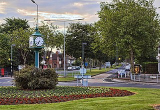
Blackwater is a small town in the northeastern corner of Hampshire, England, lying in the county's Hart District. Considered to be part of the Farnborough/Aldershot Built-up Area and almost contiguous with Camberley, Surrey, it is centred 32 miles (51 km) WSW from London.
Frogmore is a small suburban village in the northeast of the civil parish of Yateley in the county of Hampshire, England.

Whelpley Hill is a hamlet in the parish of Ashley Green in Buckinghamshire, England. It is located to the east of Chesham, near the border with Hertfordshire and is the site of an Iron Age hillfort.

Crawley is a small village in Hampshire, England. It is a few miles from the county town of Winchester. It is a civil parish within the City of Winchester local government district. The village is the location of Crawley Court, currently the headquarters of broadcast infrastructure company Arqiva.
The hamlet of Beacon Hill, is situated off the B474 near Penn and on the outskirts of High Wycombe Buckinghamshire. Nearby is the Golf Course at Wycombe Heights.

Rodbourne is a suburb of Swindon in Wiltshire, England, north of the town centre and about 0.9 miles (1.4 km) northwest of Swindon railway station. It includes an area formerly called Even Swindon.
Caversham Heights is an electoral ward of the Borough of Reading, in the English county of Berkshire. The ward was created by a boundary reorganisation prior to the 2022 Reading Borough Council election, and has replaced the Mapledurham ward, with the addition of parts of the old Thames and Peppard wards. During the reorganisation process, the ward was known as The Heights, but the name was subsequent changed as a result of public consultation.
References
- ↑ Ordnance Survey: Landranger map sheet 175 Reading & Windsor (Henley-on-Thames & Bracknell) (Map). Ordnance Survey. 2012. ISBN 9780319232149.
- ↑ "Ordnance Survey: 1:50,000 Scale Gazetteer" (csv (download)). www.ordnancesurvey.co.uk. Ordnance Survey. 1 January 2016. Retrieved 18 February 2016.