Simonas Daukantas was a Lithuanian/Samogitian historian, writer, and ethnographer. One of the pioneers of the Lithuanian National Revival, he is credited as the author of the first book on the history of Lithuania written in the Lithuanian language. Only a few of his works were published during his lifetime and he died in obscurity. However, his works were rediscovered during the later stages of the National Revival. His views reflected the three major trends of the 19th century: romanticism, nationalism, and liberalism.

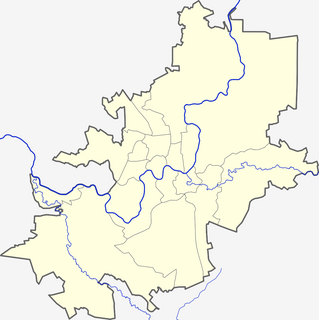
The Vilnius Castle Complex is a group of cultural, and historic structures on the left bank of the Neris River, near its confluence with the Vilnia River, in Vilnius, Lithuania. The buildings, which evolved between the 10th and 18th centuries, were one of Lithuania's major defensive structures.

The Presidential Palace, located in Vilnius Old Town, is the official office and eventual official residence of the President of Lithuania. The palace dates back to the 14th century and during its history it has undergone various reconstructions, supervised by prominent architects, including Laurynas Gucevičius and Vasily Stasov. In 1997 the palace became the official seat of the President of Lithuania.

The House of Perkūnas is one of the most original and Gothic secular buildings, located in the Old Town of Kaunas, Lithuania. Originally built by Hanseatic merchants and served as their office from 1440 until 1532, it was sold in the 16th century to the Jesuits who had established a chapel there in 1643. The Jesuits have also completed the Church of St. Francis Xavier at the Town Hall Square in 1722.
The Lithuanian Institute of History is a state-funded research institution in Lithuania. Governed by national law, it is the country's main institution of history research, concentrating mostly on the history of Lithuania and its neighbouring states.

The Vytautas the Great War Museum is a museum in Kaunas, Lithuania. It was built in Art Deco and early functionalism style.

The Town Hall of Kaunas stands in the middle of the Town Hall Square at the heart of the Old Town, Kaunas, Lithuania.The structure dates from the 16th century. It houses a Museum of Ceramics.
Lukiškės Square is the largest square in Vilnius, Lithuania, located in the center of the city. A major street in Vilnius, Gediminas Avenue, passes by the southern border of the square. It is surrounded by many public buildings, including Ministry of Finance, Ministry of Foreign affairs, Appeals Court, Academy of Music and Theater, Church of St. James and St. Phillip, Dominican Monastery with former St. Jacob Hospital. Currently the city of Vilnius holds a contest to redesign the square.

Bakałarzewo, is a village in Suwałki County, Podlaskie Voivodeship, in north-eastern Poland. It is the seat of the gmina called Gmina Bakałarzewo. It lies approximately 19 kilometres (12 mi) west of Suwałki and 114 km (71 mi) north of the regional capital Białystok. The village has a population of 820.

Vingis Park is the largest park in Vilnius, Lithuania. Located at a curve in the Neris River, it covers 162 hectares. It is used as a venue for various events, especially concerts and sports competitions.

The Museum of Occupations and Freedom Fights, previously the Museum of Genocide Victims, in Vilnius, Lithuania was established in 1992 by order of the Minister of Culture and Education and the President of the Lithuanian Union of Political Prisoners and Deportees. In 1997 it was transferred to the Genocide and Resistance Research Centre of Lithuania. The museum is located in the former KGB headquarters across from the Lukiškės Square; therefore, it is informally referred to as the KGB Museum.
Kalnai Park is a 24.5-hectare (61-acre) park between the left bank of the Neris River and right bank of the Vilnia River in Vilnius, Lithuania. It lies within the Vilnius Old Town elderate near Gediminas Hill and Gediminas Tower, and is part of the State Cultural Reserve of Vilnius Castles, established in 1997. The park hosts various events, including concerts, political rallies, and sporting competitions. Its name reflects the presence of four prominent hills (kalnai): Crooked Hill, Table Hill, Bekes Hill, and the Hill of Gediminas's Grave.

Stefanowo is a village in the administrative district of Gmina Liniewo, within Kościerzyna County, Pomeranian Voivodeship, in northern Poland. It lies approximately 5 kilometres (3 mi) south-east of Liniewo, 21 km (13 mi) east of Kościerzyna, and 41 km (25 mi) south-west of the regional capital Gdańsk.
Solno is a village in the administrative district of Gmina Bartoszyce, within Bartoszyce County, Warmian-Masurian Voivodeship, in northern Poland, close to the border with the Kaliningrad Oblast of Russia. It lies approximately 12 kilometres (7 mi) north-west of Bartoszyce and 62 km (39 mi) north of the regional capital Olsztyn.
Solkieniki is a village in the administrative district of Gmina Barciany, within Kętrzyn County, Warmian-Masurian Voivodeship, in northern Poland, close to the border with the Kaliningrad Oblast of Russia. It lies approximately 12 kilometres (7 mi) north-west of Barciany, 25 km (16 mi) north-west of Kętrzyn, and 73 km (45 mi) north-east of the regional capital Olsztyn.

The Church of St. Johns, St. John the Baptist and St. John the Apostle and Evangelist is located at the Old Town of Vilnius, Lithuania and dominates the university ensemble. Since the times of the Jesuit Academy professors and students used to pray here, and Vilnius theologians gave sermons. It was a place for performances and disputes, where theses were defended and kings greeted.
Bžostovskiai Palace - building in Vilnius Old Town, Universiteto/Domininkonų st. Currently there is a chemistry and individual flats.
Lopacinskiai Palace is a building in Vilnius Old Town, Bernardinai st. Currently it is hotel "Šekspyras".

The de Choiseul Palace is a building in Simonas Daukantas square, Vilnius Old Town, Lithuania. Currently it is used as dwellings and "Copy1" company subsidiary.