Xinhe County as the official romanized name, also transliterated from Uyghur as Toksu County, is a county in the Xinjiang Uyghur Autonomous Region, and is under the administration of the Aksu Prefecture. It contains an area of 5,821 km2 (2,248 sq mi). According to the 2002 census, it has a population of 140,000.

Pontevedra is a comarca in the Galician Province of Pontevedra, Spain. The overall population of this local region is 119,981 (2005).

Głęboka is a village in the administrative district of Gmina Ziębice, within Ząbkowice Śląskie County, Lower Silesian Voivodeship, in south-western Poland. Prior to 1945 it was in Germany.

Woodleaf is an unincorporated community in Yuba County, California. It is located 2.5 miles (4.0 km) northeast of Challenge, at an elevation of 3133 feet.
Gadai is a town and union council of Dera Ghazi Khan District in the Punjab province of Pakistan. It is located at 30°1'0N 70°37'0E and has an altitude of 114 metres.

Kot Haibat is a town and union council of Dera Ghazi Khan District in the Punjab province of Pakistan. It is located at 30°6'0N 70°37'0E and has an altitude of 124 metres.
Lubiewice is a village in the administrative district of Gmina Cekcyn, within Tuchola County, Kuyavian-Pomeranian Voivodeship, in north-central Poland.
Kolonia Sejny is a village in the administrative district of Gmina Sejny, within Sejny County, Podlaskie Voivodeship, in north-eastern Poland, close to the border with Lithuania.

Dəvədaşı is a village in the Kalbajar Rayon of Azerbaijan.

Çardaqlı is a village in the Qubadli Rayon of Azerbaijan.

Piotrkowice is a village in the administrative district of Gmina Wodzisław, within Jędrzejów County, Świętokrzyskie Voivodeship, in south-central Poland. It lies approximately 4 kilometres (2 mi) east of Wodzisław, 14 km (9 mi) south of Jędrzejów, and 49 km (30 mi) south-west of the regional capital Kielce.

Glinka is a village in the administrative district of Gmina Ćmielów, within Ostrowiec County, Świętokrzyskie Voivodeship, in south-central Poland. It lies approximately 4 kilometres (2 mi) south of Ćmielów, 12 km (7 mi) south-east of Ostrowiec Świętokrzyski, and 64 km (40 mi) east of the regional capital Kielce.

Orzeszkowo is a village in the administrative district of Gmina Resko, within Łobez County, West Pomeranian Voivodeship, in north-western Poland. It lies approximately 10 kilometres (6 mi) north-east of Resko, 26 km (16 mi) north of Łobez, and 79 km (49 mi) north-east of the regional capital Szczecin.

Silver Creek is a former settlement in Alpine County, California. It was located on Silver Creek 5.5 miles (9 km) south-southeast of Markleeville.
Leina is a village in Häädemeeste Parish, Pärnu County in southwestern Estonia.

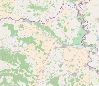
Bijelo Brdo is a village in the Erdut municipality in eastern Croatia. It is connected by the D213 road and by R202 railway. It has a total of 1,961 inhabitants (2011).
Zlatokop is a village in the municipality of Vranje, Serbia. According to the 2002 census, the village has a population of 795 people.

The Tianhuangping Pumped Storage Power Station is a pumped-storage power station in Tianhuangping, Anji County of Zhejiang Province, China. The power station has an installed capacity of 1,836 megawatts (2,462,000 hp) utilizing 6 reversible Francis turbines. Construction began in 1993 and the power station was completed in 2004.
Xinshi Town is a town in Deqing County of Huzhou prefecture-level city, in China's Zhejiang Province. Xinshi is located about 30 km north-east of the provincial capital, Hangzhou.
Xiejiawan is a station on Line 2 of Chongqing Rail Transit in Chongqing Municipality, China. It is located in the Jiulongpo District. It opened in 2004.


