Related Research Articles

Columbus Township is a civil township of St. Clair County in the U.S. state of Michigan. The population was 4,070 at the 2010 Census.

A discordant coastline occurs where bands of different rock types run perpendicular to the coast.

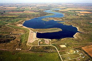
The Pipestem River is a short river in east-central North Dakota. The river is also referred to as "Pipestem Creek".
Dean Channel is the upper end of one of the longest inlets of the British Columbia Coast, 105 km (65.2 mi) from its head at the mouth of the Kimsquit River. The Dean River, one of the main rivers of the Coast Mountains, enters Dean Channel about 9.5 km (5.9 mi) below the head of the inlet, at the community of Kimsquit.

North Bentinck Arm is a short inlet about 17 km (11 mi) in length in the Central Coast region of British Columbia, Canada. It is an arm of Burke Channel and is linked via that waterway and Labouchere Channel to Dean Channel, which is one of the largest inlets of the BC Coast.
The MoPac Trail is a rail trail in Nebraska. It is a bicycling, equestrian, and walking trail built on an abandoned Missouri Pacific Railroad corridor that runs for 26 miles (42 km) from Lincoln, Nebraska, to Wabash, Nebraska.

Advanced Landing Grounds (ALGs) were temporary advance airfields constructed by the Allies during World War II during the liberation of Europe. They were built in the UK prior to the invasion and thereafter in northwest Europe from 6 June 1944 to V-E Day, 7 May 1945.
South Bentinck Arm is a 40 km (25 mi) long side-inlet of Dean Channel in the Central Coast region of British Columbia, Canada. At the north end of the arm it meets the North Bentinck Arm and then the Dean Channel before flowing into the Burke Channel.

Cisy is a village in the administrative district of Gmina Narew, within Hajnówka County, Podlaskie Voivodeship, in north-eastern Poland. It lies approximately 7 kilometres (4 mi) north-east of Narew, 26 km (16 mi) north of Hajnówka, and 32 km (20 mi) south-east of the regional capital Białystok.

Roughmussel is a neighbourhood in the Scottish city of Glasgow. It is situated south of the River Clyde near to the city boundaries with East Renfrewshire to the south and Renfrewshire to the west.
Kimsquit is a former village of the Nuxalk at the mouth of the Dean River on the northeast side of Dean Channel in the Central Coast region of British Columbia, Canada. Kemsquit Indian Reserve No. 1 is nearby at 52°49′00″N126°58′00″W, which is on Kimsquit Bay; Kimsquit Mountain is nearby.

The Wageningse Berg is the southernmost part of the Utrechtse Heuvelrug, a range of hills reaching an altitude of 52m that originated as a glacial moraine. It lies just north of the Nederrijn and to the east of the town of Wageningen.
Hatchet Lake, Nova Scotia may refer to:
Macierz is a village in the administrative district of Gmina Moryń, within Gryfino County, West Pomeranian Voivodeship, in north-western Poland. It lies approximately 5 kilometres (3 mi) south-east of Moryń, 48 km (30 mi) south of Gryfino, and 67 km (42 mi) south of the regional capital Szczecin.

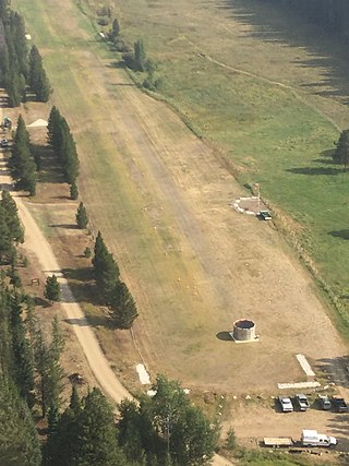
Big Creek Airport is a state-owned public-use airstrip in Valley County, Idaho, United States. It is located 12 nautical miles northeast of Yellow Pine, Idaho and 17 nautical miles west of the Cabin Creek USFS Airport . The airstrip is actually on Forest Service managed land. The state of Idaho Division of Aeronautics has a special use permit to perform annual maintenance on the strip and some facilities. The airport is located at the Big Creek Ranger Station in Payette National Forest, adjacent to the Big Creek Campground. The airstrip serves the Big Creek Lodge.
The Sakumtha River is a river in British Columbia, Canada, flowing south out of the Kitimat Ranges from an origin west of the Tsaydaychuz Peak massif into the Dean River north of Bella Coola.
Salmon House Falls is a waterfall at the confluence of the Takia and Dean Rivers at the western edge of the Interior Plateau, northwest of Tsitsutl Peak.
The Takia River is a tributary of the Dean River in British Columbia, Canada, flowing northwest to meet the Dean to the south of Sigutlat Lake. Salmon House Falls is located at the confluence of the two rivers, which is to the northwest of Tsitsutl Peak.

Barringer Township is a non-functioning township in Iredell County, North Carolina, United States. By the requirements of the North Carolina Constitution of 1868, the counties were divided into townships, including sixteen in Iredell County.
References
- ↑ "Dean River Airport". airportguide.com. Retrieved 5 October 2021.
52°49′25″N126°57′54″W / 52.82361°N 126.96500°W