
West Midlands is a metropolitan and ceremonial county in the larger West Midlands region of England. A landlocked county, it is bordered by Staffordshire to the north and west, Worcestershire to the south, and is surrounded by Warwickshire to the east. The largest settlement is the city of Birmingham.

Oxfordshire is a ceremonial county in South East England. The county is bordered by Northamptonshire and Warwickshire to the north, Buckinghamshire to the east, Berkshire to the south, and Wiltshire and Gloucestershire to the west. The city of Oxford is the largest settlement and county town.

Oadby and Wigston is a local government district with borough status in Leicestershire, England. It covers the two towns of Oadby, where the council is based, and Wigston, which is the larger town. Both form part of the Leicester urban area, lying south-east of the city.
Rushcliffe is a local government district with borough status in south Nottinghamshire, England. Its council is based in West Bridgford. The borough also includes the towns of Bingham and Cotgrave as well as numerous villages and surrounding rural areas. Some of the built-up areas in the north-west of the borough, including West Bridgford, form part of the Nottingham Urban Area.

Gravelly Hill is an area of Birmingham, United Kingdom.
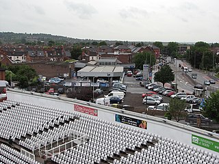
Wednesfield is a town and historic village in the City of Wolverhampton, West Midlands, England, It is 2 miles (3.2 km) east-northeast of Wolverhampton city centre and about 10 miles (16 km) from Birmingham and is part of the West Midlands conurbation. It was historically within the county of Staffordshire.

Nobleton is an unincorporated community in southwestern King, Ontario, Canada. It is the third-largest community in the township, after King City and Schomberg. Located south of the Oak Ridges Moraine, Nobleton is surrounded by hills and forests. Many horse farms are found on Nobleton's eastern periphery.

Blakenhall is a suburb and ward in Wolverhampton, England. The population was 12,614 at the 2021 census.
Newbridge is a suburb of the city of Wolverhampton, West Midlands in England. It is situated north-west of the city centre, on the A41 Tettenhall Road.
Goldthorn Park is a suburb of Wolverhampton, West Midlands. It is situated 1½ miles south of the city centre within the Blakenhall ward. It mostly consists of private houses built from the 1930s onwards.

Ettingshall is an area of Wolverhampton, West Midlands, England, and is a ward of Wolverhampton City Council. The population of this ward taken at the 2011 census was 13,482.
Spring Vale is a ward of Wolverhampton City Council, West Midlands, England. It is situated SSE of the city centre, on the city's border with the Metropolitan Borough of Dudley. The population of the ward taken at the 2011 census was 12,243.

Yorkdale–Glen Park is a neighbourhood in the city of Toronto, Ontario, Canada, located in the former suburb of North York. It is bounded by Highway 401 to the north, Allen Road to the east, a line south of Stayner Avenue to the south, and the CNR tracks to the west.

The M54 is a 23-mile (37 km) east-west motorway in the counties of Shropshire and Staffordshire, England. It is also referred to as the Telford motorway, after the road's primary westbound destination, the town of Telford. It cost £65 million to construct, and is two-lane dual carriageway for the majority of its length, with sections of three-lane.
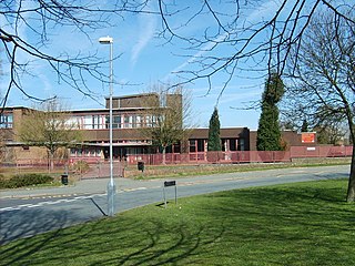
St Matthias School is a mixed secondary school located in Wolverhampton in the West Midlands of England.
The Lunt is a residential area of Bilston within the city of Wolverhampton and is part of the West Midlands conurbation in England.
Blurton is a district in the south of Stoke-on-Trent, in the English county of Staffordshire. Hollybush, Old Blurton, Blurton Farm and Newstead are the names of the areas in which make up the town known as Blurton.
Moseley Park School is a mixed secondary school and sixth form located in the Bilston area of Wolverhampton, West Midlands, England.
East Park is the name of a ward of Wolverhampton City Council, West Midlands, England. It lies to the east of Wolverhampton city centre, stretching to the city's boundary with the Metropolitan Borough of Walsall. It also borders the wards of Bilston North, Ettingshall, St Peter's, Heath Town and Wednesfield South. It forms part of the Wolverhampton South East constituency.
This article details a number of defunct schools that were once located in the Metropolitan Borough of Dudley. For details of currently operating schools in the area, please see: List of schools in Dudley.