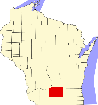
This is a list of the National Register of Historic Places listings in Dane County, Wisconsin. It aims to provide a comprehensive listing of buildings, sites, structures, districts, and objects in Dane County, Wisconsin listed on the National Register of Historic Places.
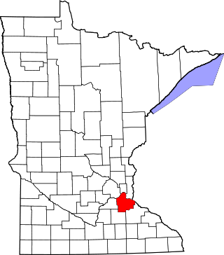
This is a list of the National Register of Historic Places listings in Dakota County, Minnesota. It is intended to be a complete list of the properties and districts on the National Register of Historic Places in Dakota County, Minnesota, United States. Dakota County is located in the southeastern part of the U.S. state of Minnesota, bounded on the northeast side by the Upper Mississippi River and on the northwest by the Minnesota River. The locations of National Register properties and districts for which the latitude and longitude coordinates are included below, may be seen in an online map.

This list is of the properties and historic districts which are designated on the National Register of Historic Places or that were formerly so designated, in Hennepin County, Minnesota; there are 190 entries as of April 2023. A significant number of these properties are a result of the establishment of Fort Snelling, the development of water power at Saint Anthony Falls, and the thriving city of Minneapolis that developed around the falls. Many historic sites outside the Minneapolis city limits are associated with pioneers who established missions, farms, and schools in areas that are now suburbs in that metropolitan area.
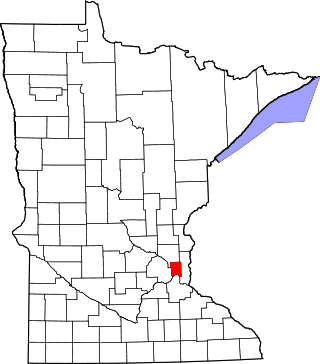
This is a complete list of National Register of Historic Places listings in Ramsey County, Minnesota. It is intended to be a complete list of the properties and districts on the National Register of Historic Places in Ramsey County, Minnesota, United States. The locations of National Register properties and districts for which the latitude and longitude coordinates are included below, may be seen in an online map.

The Glebe House, built in 1854–1857, is a historic house with an octagon-shaped wing in Arlington County, Virginia. The Northern Virginia Conservation Trust holds a conservation easement to help protect and preserve it. The name of the house comes from the property's history as a glebe, an area of land within an ecclesiastical parish used to support a parish priest. In this case, the glebe was established by the Church of England before the American Revolutionary War.

This is a list of the National Register of Historic Places listings in Sauk County, Wisconsin. It is intended to provide a comprehensive listing of entries in the National Register of Historic Places that are located in Sauk County, Wisconsin. The locations of National Register properties for which the latitude and longitude coordinates are included below may be seen in a map.

This is a list of the National Register of Historic Places listings in Saint Louis County, Minnesota. It is intended to be a complete list of the properties and districts on the National Register of Historic Places in Saint Louis County, Minnesota, United States. The locations of National Register properties and districts for which the latitude and longitude coordinates are included below, may be seen in an online map.

This is a list of the National Register of Historic Places listings in Olmsted County, Minnesota. It is intended to be a complete list of the properties and districts on the National Register of Historic Places in Olmsted County, Minnesota, United States. The locations of National Register properties and districts for which the latitude and longitude coordinates are included below, may be seen in an online map.

Rosedale, a historic property comprising the Graves Mill ruins, Christopher Johnson Cottage, and Rosedale mansion, is located at Lynchburg, Virginia. The Rosedale property contains two buildings of major importance, the ruins of an 18th-century grist mill, and numerous subsidiary buildings. The earliest structure remaining is the Christopher Johnson Cottage, dating from ca. 1764 to 1774. The small, 1+1⁄2-story frame structure has long been known as the Johnson Cottage. The Rosedale mansion was erected in 1836 by Odin Clay, the first president of the Virginia and Tennessee Railroad, and is a two-story, three-bay, brick home laid in Flemish bond. The house was enlarged in 1929; a three-bay brick wing was added the original house. It was designed by Lynchburg architect Stanhope S. Johnson, who is best known for designing the Allied Arts Building.

This is a list of the National Register of Historic Places listings in Henrico County, Virginia.

This is a list of the National Register of Historic Places listings in Le Sueur County, Minnesota. It is intended to be a complete list of the properties and districts on the National Register of Historic Places in Le Sueur County, Minnesota, United States. The locations of National Register properties and districts for which the latitude and longitude coordinates are included below, may be seen in an online map.

This is a list of the National Register of Historic Places listings in Lake County, Minnesota. It is intended to be a complete list of the properties and districts on the National Register of Historic Places in Lake County, Minnesota, United States. The locations of National Register properties and districts for which the latitude and longitude coordinates are included below, may be seen in an online map.

This is a list of the National Register of Historic Places listings in Cook County, Minnesota. It is intended to be a complete list of the properties and districts on the National Register of Historic Places in Cook County, Minnesota, United States. The locations of National Register properties and districts for which the latitude and longitude coordinates are included below, may be seen in an online map.
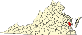
This is a list of the National Register of Historic Places listings in Gloucester County, Virginia.

Huntley, also known as Historic Huntley or Huntley Hall is an early 19th-century Federal-style villa and farm in the Hybla Valley area of Fairfax County, Virginia. The house sits on a hill overlooking Huntley Meadows Park to the south. The estate is best known as the country residence of Thomson Francis Mason, grandson of George Mason of nearby Gunston Hall. It is listed on the National Register of Historic Places (NRHP), the Virginia Landmarks Register (VLR), and the Fairfax County Inventory of Historic Sites.

This is a list of the National Register of Historic Places listings in Lyon County, Minnesota. It is intended to be a complete list of the properties and districts on the National Register of Historic Places in Lyon County, Minnesota, United States. The locations of National Register properties and districts for which the latitude and longitude coordinates are included below, may be seen in an online map.
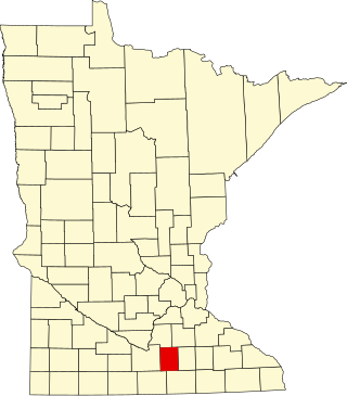
This is a list of the National Register of Historic Places listings in Waseca County, Minnesota. It is intended to be a complete list of the properties and districts on the National Register of Historic Places in Waseca County, Minnesota, United States. The locations of National Register properties and districts for which the latitude and longitude coordinates are included below, may be seen in an online map.

The Shockoe Hill Burying Ground Historic District, located in the city of Richmond, Virginia, is a significant example of a municipal almshouse-public hospital-cemetery complex of the sort that arose in the period of the New Republic following disestablishment of the Anglican Church. The District illustrates changing social and racial relationships in Richmond through the New Republic, Antebellum, Civil War, Reconstruction, and Jim Crow/Lost Cause eras of the nineteenth and twentieth centuries. The Shockoe Hill Burying Ground Historic District occupies 43 acres (17 ha) of land bounded to the south by E. Bates Street, to the north by the northern limit of the Virginia Passenger Rail Authority right-of-way at the southern margin of the Bacon's Quarter Branch valley, to the west by 2nd Street, and to the east by the historic edge of the City property at the former location of Shockoe Creek. The District encompasses most of a 28.5-acre (11.5 ha) tract acquired by the city of Richmond in 1799 to fulfill several municipal functions, along with later additions to this original tract.


