Deer Isle (island)

Last updated
The shore of Deer Isle, Maine overlooking a beach. Deer Isle Beach.jpg
The shore of Deer Isle, Maine overlooking a beach.

Deer Isle is an island in Hancock County, Maine, United States. There are two communities on the island, Deer Isle and Stonington. It is on the eastern side of Penobscot Bay, connected by road to the Maine mainland through Little Deer Isle. Its only vehicular connection to the mainland is State Route 15 over Deer Isle Bridge.

Hancock County, Maine County in the United States

Hancock County is a county located in the U.S. state of Maine. As of the 2010 census, the population was 54,418. Its county seat is Ellsworth. The county was incorporated on June 25, 1789 and named for John Hancock, the first governor of the Commonwealth of Massachusetts. The Commissioners are Antonio Blasi, Steven Joy and Percy Brown.

Maine State of the United States of America

Maine is a state in the New England region of the northeastern United States. Maine is the 12th smallest by area, the 9th least populous, and the 38th most densely populated of the 50 U.S. states. It is bordered by New Hampshire to the west, the Atlantic Ocean to the southeast, and the Canadian provinces of New Brunswick and Quebec to the northeast and northwest respectively. Maine is the easternmost state in the contiguous United States, and the northernmost state east of the Great Lakes. It is known for its jagged, rocky coastline; low, rolling mountains; heavily forested interior; and picturesque waterways, as well as its seafood cuisine, especially lobster and clams. There is a humid continental climate throughout most of the state, including in coastal areas such as its most populous city of Portland. The capital is Augusta.

United States federal republic in North America

The United States of America (USA), commonly known as the United States or America, is a country composed of 50 states, a federal district, five major self-governing territories, and various possessions. At 3.8 million square miles, the United States is the world's third or fourth largest country by total area and is slightly smaller than the entire continent of Europe's 3.9 million square miles. With a population of over 327 million people, the U.S. is the third most populous country. The capital is Washington, D.C., and the largest city by population is New York City. Forty-eight states and the capital's federal district are contiguous in North America between Canada and Mexico. The State of Alaska is in the northwest corner of North America, bordered by Canada to the east and across the Bering Strait from Russia to the west. The State of Hawaii is an archipelago in the mid-Pacific Ocean. The U.S. territories are scattered about the Pacific Ocean and the Caribbean Sea, stretching across nine official time zones. The extremely diverse geography, climate, and wildlife of the United States make it one of the world's 17 megadiverse countries.

Contents

Geography

According to the United States Census Bureau, the town of Deer Isle has a total area of 123.67 square miles (320.30 km2), of which 29.72 square miles (76.97 km2) is land and 93.95 square miles (243.33 km2) is water. [1] The town is separated from the mainland by Eggemoggin Reach and may be reached by car via Deer Isle Bridge. The town includes other nearby islands, including Little Deer Isle.

United States Census Bureau Bureau of the United States responsible for the census and related statistics

The United States Census Bureau is a principal agency of the U.S. Federal Statistical System, responsible for producing data about the American people and economy. The Census Bureau is part of the U.S. Department of Commerce and its director is appointed by the President of the United States.

Deer Isle Bridge Suspension bridge

The Deer Isle Bridge is a suspension bridge spanning Eggemoggin Reach in the state of Maine. The bridge is the only vehicular connection from the Maine mainland to Little Deer Isle, one of the segments that make up the island. The span was completed in March 1939 with a main span of 329 meters (1,088 ft). The bridge was designed by Holton Duncan Robinson and David Bernard Steinman. It encountered wind stability problems that were similar to those of the Whitestone Bridge and the original Tacoma Narrows Bridge, which collapsed shortly after it opened. The problems led to modifications which included numerous cable stays connecting cables to the tower and tower to the deck. The span today carries two narrow lanes of State Route 15.

Little Deer Isle is an island in Penobscot Bay, lying just north of the town of Deer Isle, of which it is a part. The island is served by Maine State Route 15 via the Deer Isle Bridge. The north end of the island is called Eggemoggin and there is a small island with a lighthouse on it at the tip called Pumpkin Island. Little Deer is about 4 miles long and connects to Deer Isle by way of a causeway. There are only about 300 year-round residents of Little Deer, but many more summer residents.

According to the United States Census Bureau, the town of Stonington has a total area of 37.84 square miles (98.01 km2), of which 9.81 square miles (25.41 km2) is land and 28.03 square miles (72.60 km2) is water. [1] Located on the southern end of Deer Isle, Stonington is situated in Penobscot Bay and the Gulf of Maine, part of the Atlantic Ocean. Stonington is the terminus of Maine State Route 15, which passes through the town of Deer Isle and across the Deer Isle Bridge to the mainland.

Penobscot Bay Bay in Maine, United States

Penobscot Bay is an inlet of the Gulf of Maine and Atlantic Ocean in south central Maine. The bay originates from the mouth of Maine's Penobscot River, downriver from Belfast. Penobscot Bay has many working waterfronts including Rockland, Rockport, and Stonington, and Belfast upriver. Penobscot Bay is between Muscongus Bay and Blue Hill Bay, just west of Acadia National Park.

Gulf of Maine A large gulf of the Atlantic Ocean on the east coast of North America

The Gulf of Maine is a large gulf of the Atlantic Ocean on the east coast of North America. It is bounded by Cape Cod at the eastern tip of Massachusetts in the southwest and by Cape Sable Island at the southern tip of Nova Scotia in the northeast. The gulf includes the entire coastlines of the U.S. states of New Hampshire and Maine, as well as Massachusetts north of Cape Cod, and the southern and western coastlines of the Canadian provinces of New Brunswick and Nova Scotia, respectively.

Atlantic Ocean Ocean between Europe, Africa and the Americas

The Atlantic Ocean is the second largest of the world's oceans, with an area of about 106,460,000 square kilometers. It covers approximately 20 percent of the Earth's surface and about 29 percent of its water surface area. It separates the "Old World" from the "New World".

See also

Related Research Articles

Brooksville, Maine Town in Maine, United States

Brooksville is a town on Penobscot Bay in Hancock County, Maine, United States. As of the 2010 census, the town population was 934. It contains the villages of North Brooksville, South Brooksville, West Brooksville, Brooksville Corner, and Harborside.

Cranberry Isles, Maine Town in Maine, United States

Cranberry Isles is a town in Hancock County, Maine, United States. The population was 141 at the 2010 census.

Deer Isle, Maine Town in Maine, United States

Deer Isle is a town in Hancock County, Maine, United States. The population was 1,975 at the 2010 census. Notable landmarks in Deer Isle are the Haystack Mountain School of Crafts and the town's many art galleries.

Sedgwick, Maine Town in Maine, United States

Sedgwick is a town in Hancock County, Maine, United States. The population was 1,196 at the 2010 census. The town includes the village of Sargentville.

Stonington, Maine Town in Maine, United States

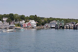
Stonington is a town in Hancock County, Maine, United States. Its located on the southern portion of the island of Deer Isle. The population was 1,043 at the 2010 census. It includes the villages of Burnt Cove, Oceanville, Green Head, and Clam City. A picturesque working waterfront and tranquil tourist destination in eastern Penobscot Bay, Stonington has consistently ranked among the top lobster ports in the county and is the largest lobster port in Maine. In 2011, 14,854,989 pounds of lobster were landed by Stonington fishermen with a value of $46.3 million.

Verona Island, Maine Town in Maine, United States

Verona Island is a town located on an island of the same name in the Penobscot River in Hancock County, Maine, United States. The population was 544 at the 2010 census.

Isle au Haut, Maine Town in Maine, United States

Isle au Haut is a town in Knox County, Maine, United States, on an island of the same name in Penobscot Bay. The population was 73 at the 2010 census. Home to portions of Acadia National Park, Isle au Haut is accessible by ferry from Stonington, Maine.

South Bristol, Maine Town in Maine, United States

South Bristol is a town in Lincoln County, Maine, United States. The population was 892 at the 2010 census. A fishing and resort area, South Bristol includes the villages of Walpole and Christmas Cove, the latter at Rutherford Island. The town has three nature preserves.

Old Town, Maine City in Maine, United States

Old Town is a city in Penobscot County, Maine, United States. The population was 7,840 at the 2010 census. The city's developed area is chiefly located on relatively large Marsh Island, though its boundaries extend beyond that. The island is surrounded and defined by the Penobscot River to the east, and the Stillwater River to the west.

Islesboro, Maine Town in Maine, United States

Islesboro is a town in Waldo County, Maine, United States. The population was 566 at the 2010 census. It has a summer colony accessible by ferry from Lincolnville Beach 3 miles to the west, by private boat, or by air taxi service. Home to Warren Island State Park, Islesboro includes the village of Dark Harbor.

Northport, Maine Town in Maine, United States

Northport is a town on Penobscot Bay in Waldo County, Maine, United States. The population was 1,520 at the 2010 census.

Prospect, Maine Town in Maine, United States

Prospect is a town in Waldo County, Maine, United States. The population was 709 at the 2010 census.

Penobscot Indian Island Reservation

Penobscot Indian Island Reservation is an Indian reservation for the Penobscot Tribe of Maine, a federally recognized tribe of the Penobscot in Penobscot County, Maine, United States, near Old Town. The population was 610 at the 2010 census. The reservation extends for many miles alongside 15 towns and two unorganized territories in a thin string along the Penobscot River, from its base at Indian Island, near Old Town and Milford, northward to the vicinity of East Millinocket, almost entirely in Penobscot County. A small, uninhabited part of the reservation is in South Aroostook, Aroostook County, by which it passes along its way northward.

Maine State Route 15 highway in Maine

State Route 15 (SR 15) is a numbered state highway in Maine, United States. SR 15 runs over 180 miles (290 km) from Stonington in the south to Jackman in the north.

Deer Island Thorofare Light lighthouse in Maine, United States

Deer Island Thorofare Light, also known as Mark Island Light, is a lighthouse on Penobscot Bay, Maine, about 1.8 nautical miles west-southwest of Stonington. It was built in 1857.

Bucksport (CDP), Maine Census-designated place in Maine, United States

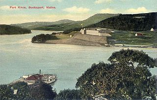
Bucksport is a census-designated place (CDP) in the town of Bucksport in Hancock County, Maine, United States. The population was 2,885 at the 2010 census, down from 2,970 at the 2000 census.

Searsport, Maine Town in Maine, United States

Searsport is an incorporated town and deep water seaport located at the confluence of the Penobscot River estuary and the Penobscot Bay immediately SE of Sears Island and Cape Jellison in Waldo County, Maine, United States. The population was 2,615 at the 2010 census. Searsport includes the village of North Searsport. The town is known as "the home of the famous sea captains" and the "Antique Capital of Maine".

References

Coordinates: 44°12′36″N68°41′07″W / 44.21000°N 68.68528°W / 44.21000; -68.68528

Geographic coordinate system Coordinate system

A geographic coordinate system is a coordinate system that enables every location on Earth to be specified by a set of numbers, letters or symbols. The coordinates are often chosen such that one of the numbers represents a vertical position and two or three of the numbers represent a horizontal position; alternatively, a geographic position may be expressed in a combined three-dimensional Cartesian vector. A common choice of coordinates is latitude, longitude and elevation. To specify a location on a plane requires a map projection.