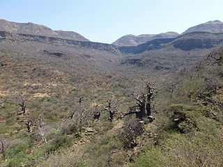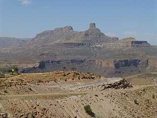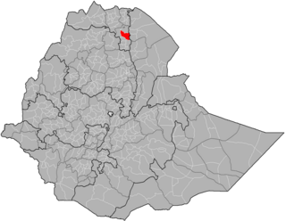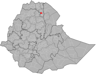
The Tigray Region is the northernmost region of Ethiopia. Tigray is the homeland of the Tigrayan, Irob and Kunama peoples. Tigray is also known as Region 1 according to the federal constitution. Its capital and largest city is Mekelle. Tigray is the 5th largest by area, the 5th most populous, and the 5th most densely populated of the 10 Regional States.

Imba Alaje is a mountain, or an amba, in northern Ethiopia. Located in the Debubawi Zone of the Tigray Region, Imba Alaje dominates the roadway that runs past it from the city of Mek'ele south to Maychew. Because of its strategic location, Emba Alaje has been the location of several battles. As Anthony Mockler describes it,

Mekelle, or Mekele, is the capital city of Tigray Region in Ethiopia. Mekelle was formerly the capital of Enderta awraja in Tigray. It is located around 780 kilometres (480 mi) north of the Ethiopian capital Addis Ababa, with an elevation of 2,254 metres (7,395 ft) above sea level. Administratively, Mekelle is considered a Special Zone, which is divided into seven sub-cities. Mekelle is the economic, cultural, and political hub of northern Ethiopia.

Goba is a town and separate woreda in south-central Ethiopia. Located in the Bale Zone of the Oromia Region approximately 446 km southeast of Addis Ababa, this city has a latitude and longitude of 7°0′N39°59′E and an elevation of 2,743 meters above sea level.

Amda Seyon I was Emperor of Ethiopia, and a member of the Solomonic dynasty. According to the British expert on Ethiopia, Edward Ullendorff, "Amde Tseyon was one of the most outstanding Ethiopian kings of any age and a singular figure dominating the Horn of Africa in the fourteenth century." His conquests of Muslim borderlands greatly expanded Ethiopian territory and power in the region, maintained for centuries after his death. Amda Seyon asserted the strength of the newly (1270) installed Solomonic dynasty and therefore legitimized it. These expansions further provided for the spread of Christianity to frontier areas, sparking a long era of proselytization, Christianization, and integration of previously peripheral areas.

Tigray Province is a historical province of northern Ethiopia, notably in present day of Tigray Region. It encompasses most of the territories of Tigrinya-speakers in Ethiopia; Tigray is separated from the northern Tigrinya territories by the River Mereb, now serving as the state border to Eritrea.

Hawzen is one of the districts (woredas) in the Tigray Region of Ethiopia. Part of the Misraqawi Zone, Hawzen is bordered on the south by Kilte Awulaelo, on the west by the Mehakelegnaw (Central) Zone, on the north by Ganta Afeshum, and on the east by Saesi Tsaedaemba. Towns in Hawzen include Hawzen and Megab; villages include Koraro.

Atsbi Wemberta is one of the woredas in the Tigray Region of Ethiopia. Located in the Misraqawi Zone at the eastern edge of the Ethiopian highlands, Atsbi Wenberta is bordered on the south by the Debub Misraqawi (Southeastern) Zone, on the west by Kilte Awulaelo, on the north by Saesi Tsaedaemba, and on the east by the Afar Region. The administrative center of this woreda is Atsbi ; other towns in Atsbi Wenberta include Haiqi Mesahil, Atsbi Dar'a, Kelisha Emni and Habes. The woreda is administratively divided into 18 tabiyas (municipalities).

Saharti Samre is one of the woredas in the Tigray Region of Ethiopia. Part of the Debub Misraqawi (Southeastern) Zone, Samre is bordered on the south by the Amhara Region, on the west and north by the Mehakelegnaw (Central) Zone, on the northeast by Enderta, on the east by Hintalo Wajirat, and on the southeast by Debubawi (Southern) Zone. Towns in this woreda include Gijet and Samre.

Enderta is one of the woredas in the Tigray Region of Ethiopia. It was named for the former Enderta province, which was later merged into Tigray Province. Located in the Debub Misraqawi (Southeastern) Zone at the eastern edge of the Ethiopian highlands Enderta is bordered on the south by Hintalo Wajirat, on the west by Samre, on the northwest by the Mehakelegnaw (Central) Zone, on the north by the Misraqawi (Eastern) Zone, and on the east by the Afar Region; the city and special zone of Mek'ele is an enclave within Enderta. Towns in Enderta include Aynalem and Qwiha; the historic village of Chalacot is also located in this woreda.

Hintalo Wajirat is one of the woredas in the Tigray Region of Ethiopia. It is named after its largest town, Hintalo, and the Wajirat Mountains in the southern part of the woreda. Located in the Debub Misraqawi (Southeastern) Zone at the eastern edge of the Ethiopian highlands Hintalo Wajirat is bordered on the south by the Debubawi (Southern) Zone, on the west by Samre, on the north by Enderta, and on the east by the Afar Region. Other towns in Hintalo Wajirat include Adi Gudem, and Debub.

Alaje is a woreda in the Tigray Region of Ethiopia. Part of the Debubawi Zone, Alaje is bordered on the south by Endamehoni, on the southwest by the Amhara Region, on the north by Debub Misraqawi (Southeastern) Zone, and on the southeast by Raya Azebo. The administrative center of this woreda is Adi Shehu; other towns in Alaje include Chelena and Dela.

Chalacot or Chelekot is a village in the Tigray Region of Ethiopia. Located in the Enderta woreda of the Debub Misraqawi (Southeastern) Zone, 10 kilometers north of Antalo and 17 kilometers south of Mek'ele, the village has a latitude and longitude of 13°22′N39°28′E with an approximate elevation of 2100 meters above sea level. The Central Statistical Agency has not published an estimate for this village's 2005 population.

Qwiha is a town located in Tigray, Ethiopia. The name comes from the local word for willows, which are abundant in the area. Located in the Debub Misraqawi (south-eastern) Zone of the Tigray Region, it lies 9 kilometers east of Mekelle straddling Ethiopian Highway 2 which leads to Addis Ababa. It has a latitude and longitude of 13°28′37″N39°32′42″E with an elevation of 2247 meters above sea level.

Antalo is a small village located in the Debub Misraqawi (Southeastern) Zone of the Tigray Region, it lies on a plateau with an elevation variously reported as 2050 to 2102 meters above sea level|date=March 2019}}. It lies some 20 miles south of Mekelle, the capital of Tigray. The urge to control this fortified mountainous place has provoked frequent engagements among various Tigrayan chiefs since the 17th century. Antalo flourished as a town in the last quarter of the 18th and beginning of the 19th century.

Amba Aradam is a table mountain in northern Ethiopia. Located in the Debub Misraqawi (Southeastern) Zone of the Tigray Region, between Mek'ele and Addis Abeba, it has a latitude and longitude of 13°20′N39°31′E and an elevation of 2,756 metres (9,042 ft).
Enderta or Inderta is a former historical province of Ethiopia; it is located in the eastern edge of the Tigray highlands. Enderta is bordered on the west by Tembien, on the south and south west by Lasta and Wag, on the east by denkel, and on the north by Agame and Adwa. Enderta's local administration of Denkel/Afar up to the edges of Aseb under its jurisdiction seems to have been highly, interlinked with the operation of the salt trade and its taxation system; the entire tasks of salt caravan organization being the responsibility of the bäalgada, title assumed by the governor of Endärta, since at least the Medieval period (c.1270-1527)

Woyane rebellion was a rebellion in Tigray Province, Ethiopia against the government of Emperor Haile Selassie which took place in September–November 1943. The rebels were defeated with the support of aircraft from the United Kingdom's Royal Air Force.
Dergajen is a Tigrayan tabia (municipality) located 19 kilometers east of Kwiha, Ethiopia. The administrative center of the tabia is located in the village of Aragure. A weekly market is organized in Aragure. According to the 2007 census, 9524 people were living in the tabia, which results in a population density of 68 inhabitants per square kilometer.
Tembien is a historic region in Tigray and one of the former provinces of Ethiopia. It is a mountainous area of that country. During the reforms in 1994–95, the old provinces were replaced with regions, zones and woredas. The area of the former province is now split over the woredas of Dogua Tembien and Kola Tembien.


