Delaney, Washington

Last updated

Delaney is an extinct town in Columbia County, in the U.S. state of Washington. The GNIS classifies it as a populated place. [1]
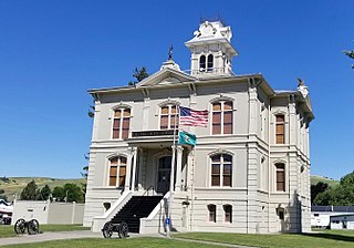
Columbia County, Washington County in the United States

Columbia County is a county located in the U.S. state of Washington. As of the 2010 census, the population was 4,078, making it the third-least populous county in Washington. The county seat and largest city is Dayton. The county was created out of Walla Walla County on November 11, 1875 and is named after the Columbia River.

U.S. state constituent political entity of the United States

In the United States, a state is a constituent political entity, of which there are currently 50. Bound together in a political union, each state holds governmental jurisdiction over a separate and defined geographic territory and shares its sovereignty with the federal government. Due to this shared sovereignty, Americans are citizens both of the federal republic and of the state in which they reside. State citizenship and residency are flexible, and no government approval is required to move between states, except for persons restricted by certain types of court orders. Four states use the term commonwealth rather than state in their full official names.
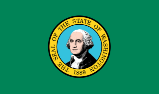
Washington (state) State of the United States of America

Washington, officially the State of Washington, is a state in the Pacific Northwest region of the United States. Named for George Washington, the first president of the United States, the state was made out of the western part of the Washington Territory, which was ceded by Britain in 1846 in accordance with the Oregon Treaty in the settlement of the Oregon boundary dispute. It was admitted to the Union as the 42nd state in 1889. Olympia is the state capital; the state's largest city is Seattle. Washington is sometimes referred to as Washington State, to distinguish it from Washington, D.C., the capital of the United States, which is often shortened to Washington.

The community was named after the original owner of the town site. [2]

Related Research Articles

Kanwaka Township, Douglas County, Kansas Township in Kansas, United States

Kanwaka Township is a township in Douglas County, Kansas, USA. As of the 2000 census, its population was 1,317. The name is a portmanteau of the Kansas River and Wakarusa River.

Salt Creek Commons, Indiana Census-designated place in Indiana, United States

Salt Creek Commons is a census-designated place (CDP) in Union Township, Porter County, in the U.S. state of Indiana. The population was 2,117 at the 2010 census.

Tungsten is a ghost town in Boulder County, in the U.S. state of Colorado.

Almota is an extinct town in Whitman County, in the U.S. state of Washington. The GNIS classifies it as a populated place.

Bishop is an extinct town in Whitman County, in the U.S. state of Washington.

Covello is an unincorporated community in Columbia County, in the U.S. state of Washington.

Craige is an extinct town in Asotin County, in the U.S. state of Washington. The GNIS classifies it as a populated place.

Hanson Ferry is an extinct town in Asotin County, in the U.S. state of Washington. The GNIS classifies it as a populated place.

Huntsville is an unincorporated community in Columbia County, in the U.S. state of Washington.

Interior is an extinct town in Whitman County, in the U.S. state of Washington.

Jerry is an unincorporated community in Asotin County, in the U.S. state of Washington. "JERRY, a town in the northeastern part of Asotin County, named by John Knight, on August 1, 1906, in honor -of Jerry McGuire, a stock rancher who owned land there since 1875. The former name was Grand Junction, because Asotin and George Creeks joined there." (James Buchan, in Names MSS., Letter 317.)

Johnson is an unincorporated community in Whitman County, in the U.S. state of Washington.

Kitzmiller is an unincorporated community in Whitman County, in the U.S. state of Washington.

Sunshine is an unincorporated community in Whitman County, in the U.S. state of Washington.

Theon is an extinct town in Asotin County, in the U.S. state of Washington.

Unfried is an extinct town in Garfield County, in the U.S. state of Washington.

Whitlow is an unincorporated community in Whitman County, in the U.S. state of Washington.

Wilcox is an extinct town in Whitman County, in the U.S. state of Washington. The GNIS classifies it as a populated place.

Dillon is an unincorporated community in Phelps County, in the U.S. state of Missouri. The community is located along the BNSF railroad line between Rolla and St. James.

Westcott is an extinct town in northwestern Phelps County, in the U.S. state of Missouri.

References

Coordinates: 46°30′39″N117°58′19″W / 46.51083°N 117.97194°W / 46.51083; -117.97194

Geographic coordinate system Coordinate system

A geographic coordinate system is a coordinate system that enables every location on Earth to be specified by a set of numbers, letters or symbols. The coordinates are often chosen such that one of the numbers represents a vertical position and two or three of the numbers represent a horizontal position; alternatively, a geographic position may be expressed in a combined three-dimensional Cartesian vector. A common choice of coordinates is latitude, longitude and elevation. To specify a location on a plane requires a map projection.