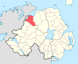
Delbhna Tír Dhá Locha ("The Delbhna of the Two Lakes") was a tuath of Gaelic Ireland, located in the west of Ireland in what is now Co. Galway.

Gaelic Ireland was the Gaelic political and social order, and associated culture, that existed in Ireland from the prehistoric era until the early 17th century. Before the Norman invasion of 1169, Gaelic Ireland comprised the whole island. Thereafter, it comprised that part of the country not under foreign dominion at a given time. For most of its history, Gaelic Ireland was a "patchwork" hierarchy of territories ruled by a hierarchy of kings or chiefs, who were elected through tanistry. Warfare between these territories was common. Occasionally, a powerful ruler was acknowledged as High King of Ireland. Society was made up of clans and, like the rest of Europe, was structured hierarchically according to class. Throughout this period, the economy was mainly pastoral and money generally not used. A Gaelic Irish style of dress, music, dance, sport, architecture, and art can be identified, with Irish art later merging with Anglo-Saxon styles to create Insular art.

Ireland is an island in the North Atlantic. It is separated from Great Britain to its east by the North Channel, the Irish Sea, and St George's Channel. Ireland is the second-largest island of the British Isles, the third-largest in Europe, and the twentieth-largest on Earth.
The Delbhna Tír Dhá Locha were one branch of a much larger population group called the Delbhna. [1]
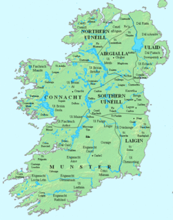
The Delbna or Delbhna was a Gaelic Irish tribe in Ireland, claiming kinship with the Dál gCais, through descent from Dealbhna son of Cas. Originally one large population, they had a number of branches in Connacht, Meath, and Munster in Ireland.
The two lochs to which the name of the territory refers are Loch nOirbsean, and Loch Lurgain. The territory occupied nearly all the land between the two lakes and the River Corrib. It was roughly coextensive with the later barony of Moycullen, which took in the civil parishes of Moycullen, Kilcummin, Killanin, and Rahoon.
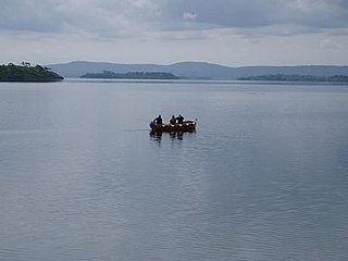
Lough Corrib is a lake in the west of Ireland. The River Corrib or Galway River connects the lake to the sea at Galway. It is the largest lake within the Republic of Ireland and the second largest on the island of Ireland. It covers 176 km² and lies mostly in County Galway with a small area of its northeast corner in County Mayo.

Galway Bay is a large bay on the west coast of Ireland, between County Galway in the province of Connacht to the north and the Burren in County Clare in the province of Munster to the south. Galway city is located on the northeast side of the bay. The bay is about 50 kilometres (31 mi) long and from 10 kilometres (6.2 mi) to 30 kilometres (19 mi) in breadth. The Aran Islands are to the west across the entrance and there are numerous small islands within the bay.
The kings of the Delbhna Tír Dhá Locha eventually took the surname Mac Con Raoi (anglicised as Conroy and King).
Mac Con Raoi directly ruled Gnó Mhór, which was later the civil parishes of Kilcummin and Killannin. Gnó Beag's king was later surnamed Ó hÉanaí (anglicised as Heaney and Heeney). Gnó Beag made up of the civil parishes of Rahoon and Moycullen. Loch Lonáin north of the village of Maigh Cuilin (Moycullen) and the Aille River between the villages of An Spidéal (Spiddal) and Indreabháin (Inverin) are the principal features which mark the divide between Gnó Mór and Gnó Beag. [2] All four parishes were combined into the barony of Moycullen (distinct from the parish) soon after the Cambro-Norman invasion.

Spiddal is a village on the shore of Galway Bay in County Galway, Ireland. It is 18 kilometres (11 mi) west of Galway city, on the R336 road. Spiddal is on the eastern side of the county's Gaeltacht and of the Connemara region. It is a centre for tourism with a scenic beach, harbour and shore fishing. The village is part of the civil parish of Moycullen.

Inverin is a Gaeltacht village between Spiddal and Costello in County Galway, Ireland. There are Irish-language summer colleges in the area, most notably Coláiste Lurgan and Coláiste Uí Chadhain. The actual village of Inverin is the area between Ballynahown and Minna.
Both families evicted and forced west by the Ó Flaithbertaigh family, who took over their lands. The Meic Con Raoi resettled at Ballymaconry (sometimes known as Kingstown Glebe) in Connemara along Streamstown Bay near Clifden, and they had another, Ballyconry in Co. Clare in the barony of Ballyvaghan. By the 19th century, almost all members of the family had Anglicized their name to King and Ballymaconry became Kingstown. In the early 20th century, styles changed and the family used the Anglicization "Conroy".
The Meic Con Raoi were counted among the sea-kings of Connacht, the others being the O'Malleys, the O'Dowds, and the O'Flahertys.
O'Dowd, is an Irish Gaelic clan based most prominently in what is today County Mayo and County Sligo. The clan name originated in the 9th century as a derivative of its founder Dubda mac Connmhach. They descend in the paternal line from the Connachta's Uí Fiachrach. The immediate progenitors of the O'Dowd were Kings of Connacht during the 7th and 8th centuries in the form of Dúnchad Muirisci, Indrechtach mac Dúnchado, Ailill Medraige mac Indrechtaig and Donn Cothaid mac Cathail, before losing ground to their rivals the Uí Briúin.