Dell Lott Hollow is a canyon, mostly within the Fishlake National Forest, on the southeast edge of the Pavant Range in southwest Sevier County, Utah, United States. [1]
Dell Lott Hollow has the name of Dell Lott, a local lumberman. [2]
Joseph is a town in Sevier County, Utah, United States. The population was 269 at the 2000 census. The town was named for Joseph Angell Young, an apostle of the Church of Jesus Christ of Latter-day Saints. Joseph was settled in 1871.
The Pink Cliffs are a series of highly dissected cliffs on the Colorado Plateau in Garfield, Iron, and Kane counties in southwestern Utah, United States. Contrary to the implication of the name, the cliffs are not a single set of rock formations, but actually a geological formation that manifests itself in multiple sets of rock formations.

Marysvale Canyon is a canyon in Piute and Sevier counties in southwest Utah, United States, which runs eight miles (13 km) north from just north of Marysvale north to the town of Sevier.

Westwater Canyon is a canyon located on the Colorado River in Eastern Utah between the Utah/Colorado state line and Cisco, Utah. The inner gorge of the canyon is made up of black Precambrian rock and contains class III and IV rapids which are sought after by whitewater enthusiasts. The most notable rapid, called "Skull", is the most significant.

Kanab Creek is one of the many tributaries of the Colorado River. It begins in Kane County, Utah, just south of the watershed to the Great Basin and flows 125 miles (201 km) south to the Colorado River.
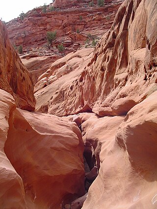
Death Hollow, Death Canyon or Little Death Hollow is a slot canyon in the Grand Staircase–Escalante National Monument in central Garfield County, Utah, United States.

Horse Canyon is a small canyon near the towns of Boulder and Escalante in the Grand Staircase–Escalante National Monument in central Garfield County, Utah, United States
Mollie's Nipple or Molly's Nipple is the name given to as many as seven peaks, at least one butte, at least one well, and some other geological features in Utah. Some sources claim there are eleven geological features in Utah that bear this name. At least some of those names are attributed to John Kitchen – a pioneer of an early exploration of Utah, who named them to commemorate a nipple of his wife Molly.

The Court of the Patriarchs is a sandstone cliff on the south face of the Three Patriarchs in Zion Canyon in Zion National Park in Washington County, Utah, United States.
Cunningham Wash is a wash in eastern Beaver County, Utah, United States.
Dan Leigh Hollow is a valley in Iron County, Utah, United States. It is located about 10 miles (16 km) southeast of Cedar City.
Daves Hollow is a canyon in southeastern Garfield County, Utah, United States.
Cove Creek is a stream in Beaver County and Millard County, Utah. It originates at the head of its canyon southeast of Cove Fort at 38°38′09″N112°29′34″W in Beaver County. It drains north down through the Tushar Mountains then turns west at the foot of Sulphur Peak running between the south end of the Pavant Range and the Tushar Mountains, past Cove Fort, from which it received its name. It then runs west past the north end of the Mineral Mountains to disappear into the sands of the desert at Beaver Bottoms.
Fremont Wash sometimes called Fremont Canyon in its upper reach, is a stream and a valley in the north end of Parowan Valley, in Iron County, Utah. Its mouth lies at its confluence with Little Salt Lake at an elevation of 5,686 feet. Its head is found at 38°07′46″N112°34′36″W, the mouth of Fremont Canyon, an elevation of 6,476 feet.
Doubleup Hollow is a valley in the Black Mountains in Beaver and Iron County, Utah. Its mouth lies at an elevation of 6,450 feet. It heads at 38°07′34″N112°44′14″W, at an elevation of 7,680 feet, in Beaver County.
Fremont Canyon is a stream and a deep valley or canyon that runs from its mouth at its confluence with Coyote Creek at the head of Fremont Wash in Iron County, Utah, eastward across the Tushar Mountains to its head at 38°05′05″N112°27′35″W on the west side of Fremont Pass in Garfield County, Utah.
Nevershine Hollow is a valley east of the South Hills, in Beaver County, Utah. The mouth of the valley is at an elevation of 6,165 feet. Its head is at an elevation of 6,500 feet at 38°09′43″N112°36′38″W, north of Beaver Ridge.
Beaver Ridge a ridge in Beaver County, Utah. It lies south of Nevershine Hollow and north of the canyon of Fremont Wash. It reaches an elevation of 6,552 feet.
California Hollow is a valley in the Black Mountains in Beaver and Iron County, Utah. Its mouth lies at an elevation of 6,414 feet. It heads at 38°08′41″N112°42′48″W, at an elevation of 6,940 feet, in Beaver County.
Lott is a surname and given name.
38°36′21″N112°13′40″W / 38.60583°N 112.22778°W
| | This article about a location in Utah is a stub. You can help Wikipedia by expanding it. |