This article needs additional citations for verification .(September 2015) |
Depil | |
|---|---|
Village | |
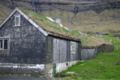
 Depil in 2022 | |
 Depil Location in the Faroe Islands | |
| Coordinates: 62°17′10″N6°31′39″W / 62.28611°N 6.52750°W | |
| State | |
| Country | |
| Island | Borðoy |
| Municipality | Hvannasund |
| Population (29 April 2025) [1] | |
• Total | 5 |
| Time zone | GMT |
| • Summer (DST) | UTC+1 (EST) |
| Postal code | FO 735 |
| Climate | Cfc |
Depil (Danish : Deble) is a village in the Faroe Islands.
Contents
Depil is located on the east side of Borðoy between Norðdepil and Norðtoftir. The village has only five inhabitants.