The Derbyshire Dales National Nature Reserve is a series of unconnected limestone dales in the Peak District National Park. It is managed by Natural England and has a permanent staff of wardens who carry out conservation works and ensure the dales are usable for recreation.
Dippers are common along the River Lathkill, and ravens and buzzards are regularly seen around the dale. The Monyash end of Lathkill Dale is well known for the flower Jacob's ladder (Polemonium caeruleum), which is common in gardens but rare in the wild. There are also a number of orchids found in all the dales.
The sites are also a good place to study geology, with many fossils within the limestone. There are also a number of historical sites. Lathkill Dale has many industrial workings (now abandoned and derelict), and there are many interpretation boards in the dale explaining the history.
Lathkill Dale is one of the most easily accessible and most frequently visited of the Derbyshire dales, and has a good path for a large section of the dale, whereas other dales are inaccessible to less mobile people, as paths are steep and rocky for large sections (particularly Monk's Dale).
The Peak District is an upland area in England at the southern end of the Pennines. Mostly in Derbyshire, it extends into Cheshire, Greater Manchester, Staffordshire, West Yorkshire and South Yorkshire. It includes the Dark Peak, where moorland is found and the geology gritstone, and the White Peak, a limestone area with valleys and gorges. The Dark Peak forms an arc on the north, east and west sides; the White Peak covers central and southern tracts. The historic Peak District extends beyond the National Park, which excludes major towns, quarries and industrial areas. It became the first of the national parks of England and Wales in 1951. Nearby Manchester, Stoke-on-Trent, Derby and Sheffield send millions of visitors – some 20 million live within an hour's ride. Inhabited from the Mesolithic era, it shows evidence of the Neolithic, Bronze and Iron Ages. Settled by the Romans and Anglo-Saxons, it remained largely agricultural; mining arose in the Middle Ages. Richard Arkwright built cotton mills in the Industrial Revolution. As mining declined, quarrying grew. Tourism came with the railways, spurred by the landscape, spa towns and Castleton's show caves.
The White Peak, also known as the Low Peak, is a limestone plateau that forms the central and southern part of the Peak District in England. It is mostly between 270 metres (900 ft) and 430 metres (1,400 ft) above sea-level and is enclosed by the higher altitude Dark Peak to the west, north and east.
The River Lathkill is a river in the Peak District National Park in Derbyshire, England.
Lathkill Dale is the valley of the River Lathkill near Bakewell, Derbyshire in the Peak District of England. The river emerges into the dale from springs below Lathkill Head Cave. Towards the head of the dale is the side valley Cales Dale.
Monsal Dale is a valley in Derbyshire, England, in the White Peak limestone area of the Peak District National Park. It is a Site of Special Scientific Interest (SSSI), a Special Area of Conservation (SAC) (1) and part of a Europe-wide network called Natura 2000.
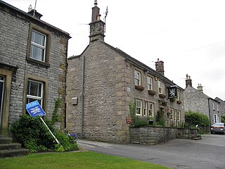
Great Longstone with Little Longstone is one of two villages in the local government district of Derbyshire Dales in Derbyshire, England. The population as taken at the 2011 Census was 843.
The Limey Way is a 65-kilometre (40 mi) challenge walk through Derbyshire, England. It starts at Castleton and progresses through 15 major and 5 minor limestone dales to reach the River Dove and Dovedale, the walk's end.
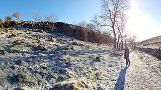
Eldon Hill is a hill in the Peak District National Park in the county of Derbyshire, England, 4 kilometres (2.5 mi) southwest of the village of Castleton. It is a 470-metre (1,540 ft) limestone hill whose pastureland is used for rough grazing, although a large proportion has been lost to limestone quarrying. It lies within the Castleton Site of Special Scientific Interest. Eldon Hill was formed when a bed of pure limestone was squeezed and upfolded by geological forces to form a dome; it is the highest limestone hill north of the River Wye.
The Monsal Trail is a cycling, horse riding and walking trail in the Derbyshire Peak District. It was constructed from a section of the former Manchester, Buxton, Matlock and Midland Junction Railway, which was built by the Midland Railway in 1863 to link Manchester with London and closed in 1968. The Monsal Trail is about 8.5 miles (13.7 km) long and opened in 1981. It starts at the Topley Pike junction in Wye Dale, 3 miles (4.8 km) east of Buxton, and runs to Coombs Viaduct, 1 mile (1.6 km) south-east of Bakewell. It follows the valley of the River Wye. The trail passes through Blackwell Mill, Chee Dale, Millers Dale, Cressbrook, Monsal Dale, Great Longstone, Hassop and Bakewell. The trail has numerous landmarks including Headstone Viaduct, Cressbrook Mill, Litton Mill and Hassop railway station, and passes through six tunnels.
The River Bradford is a river in the Peak District National Park in Derbyshire. Its source is on Gratton Moor and after passing below Youlgreave it joins the River Lathkill at Alport. Less than 4 miles (7 km) in length, its waters are very clear due to the limestone rock over which it flows, and its width has been enhanced by a number of weirs which also encourage white-throated dippers to breed in the ponds created. The river is owned and managed by the Haddon Estate and is home to brown trout and white-clawed crayfish. The valley is known as Bradford Dale, and the Limestone Way passes through it.
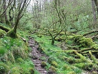
Monk's Dale is a short steep-sided dry gorge near Buxton, Derbyshire, in the Peak District of England. The dale is cut into a plateau of farmland and lies to the east of the village of Wormhill. The head of the valley leads into Peter Dale to the north. Miller's Dale is at the foot of the valley to the south.
Cressbrook Dale is a dry carboniferous limestone gorge near Bakewell, Derbyshire, in the Peak District of England. The dale is cut into a plateau of farmland and lies to the south east of the village of Litton. Cressbrook village is at the foot of the valley to the south.
Hay Dale is a short dry valley near Buxton, Derbyshire, in the Peak District of England. It is part of a longer valley that runs for approximately 4 miles (6.4 km) north–south from Peak Forest to the River Wye at Millers Dale. This valley has several names along its length: from the northern end running downhill these are Dam Dale, Hay Dale, Peter Dale and Monk's Dale. There is a farmland plateau on either side.
Peter Dale is a short dry crag-sided valley near Buxton, Derbyshire, in the Peak District of England. There is a farmland plateau on either side. The northern end of the valley leads into Hay Dale at Dale Head and the foot of the valley leads into Monk's Dale. Hay Dale and Monk's Dale are both part of the Derbyshire Dales National Nature Reserve managed by Natural England. The Carboniferous limestone rocks of all these dales were formed 350 million years ago from the shells and sediments of a tropical sea. The landscape was then sculpted by the ice sheets from the last Ice Age 20,000 years ago.
The Derbyshire Dome is a geological formation across mid-Derbyshire in England.
The Wye Valley is the limestone valley of the River Wye in the White Peak of Derbyshire, England. The source of the River Wye is west of Buxton on Axe Edge Moor. One main channel runs underground through Poole's Cavern. The river flows though Buxton Pavilion Gardens and then along a culvert under the town centre. After leaving the flat area of central Buxton, the Wye Valley becomes distinct as a gorge running east for 10 miles (16 km) before the valley broadens at Ashford-in-the Water.
Long Dale is a carboniferous limestone valley near the village of Elton, Derbyshire, in the Peak District of England. The dale is cut into the plateau of Gratton Moor and Smerrill Moor and lies to the north of the hamlet of Pikehall, which is the venue of the annual Y Not Festival. Midway down the valley it turns sharply left and is known as Gratton Dale. Most of the valley is dry but Rowlow Brook flows down the lower part of Gratton Dale towards Dale End and onwards to become the River Bradford at Youlgreave.
Cales Dale is a short valley towards the head of Lathkill Dale near Monyash, Derbyshire in the Peak District of England.
This page is based on this Wikipedia article Text is available under the CC BY-SA 4.0 license; additional terms may apply. Images, videos and audio are available under their respective licenses.