Cumberland is the northeasternmost town in Providence County, Rhode Island, United States, first settled in 1635 and incorporated in 1746. The population was 36,405 at the 2020 census, making it the seventh-largest municipality and the largest town in the state.

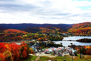
Mont Tremblant Ski Resort is a year-round resort in the Laurentian Mountains of Quebec, Canada, located about 130 km (80 mi) northwest of Montreal. It is best known as a ski destination, but also features Lake Tremblant suitable for swimming and two golf courses in the summer months. The name of the mountain, Mont Tremblant, was derived from the Algonquin indigenous people, who called it the "trembling mountain." The summit is at an elevation of 875 m (2,871 ft), which makes it one of the tallest peaks in the Laurentians. One km north of the principal down hill area is the Edge, an area of glade skiing and 2.8 km (1.7 mi) north of that is the true summit, Pic Johanssen, which has a trail over the top and is Black Diamond for skiers and boarders. The resort is owned by Alterra Mountain Company.

Great Blue Hill is a hill of 635 feet located within the Blue Hills Reservation in Milton, Randolph and Canton, Massachusetts, about 10 miles (16 km) south of downtown Boston. It is the highest point in Norfolk County and the Greater Boston area.

Mount Watatic is a 1,832-foot (558 m) monadnock located just south of the Massachusetts–New Hampshire border, in the United States, at the southern end of the Wapack Range. It lies in Ashburnham, Massachusetts and Ashby, Massachusetts. The 22-mile (35 km) Wapack Trail and the 92-mile (148 km) Midstate Trail both cross the mountain.

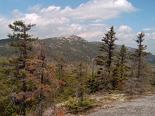
Mount Cardigan is a prominent bare-rock summit in the towns of Orange and Alexandria in western New Hampshire, USA. While its peak is only 3,155 feet (962 m) above sea level, it has extensive areas of bare granite ledges and alpine scrub, giving it the feel to hikers of a much higher mountain. Most of the summit area was denuded by devastating forest fires in 1855.

New England Lost Ski Areas Project (NELSAP) is an organization that concerns the history of downhill skiing areas, mostly in the northeastern United States. Started as a website in 1998, it has also organized hikes, research projects, and lectures in recent years.
Yawgoo Valley is the only surviving skiing resort in Rhode Island. It is located on a hill in Exeter, south of Providence and opened in the 1965–66 season as "Rhode Island's first chairlift served ski area."
Abbott Run is a de facto river in the U.S. state of Massachusetts and Rhode Island. It flows approximately 10 miles (16 km).
Snow River Mountain Resort is located in the Upper Peninsula of Michigan in Wakefield Township, Gogebic County. Indianhead Mountain is in an area called "Big Snow Country", so named because of the annual 200-inch (5.1 m) average snowfall, courtesy of the lake effect from Lake Superior. It consists of the Jackson Creek Summit, formerly Indianhead Mountain, and Black River Basin, formerly known as Blackjack.

The Warner Trail is a 30 mi (48 km) New England hiking trail which extends from Diamond Hill in the northeast corner of Rhode Island northeast through Norfolk County, Massachusetts to Canton, 13 miles (21 km) south of Boston.

The Whipple–Jenckes House is a historic American Colonial house at the corner of Diamond Hill Road and Fairhaven Road in Cumberland, Rhode Island. The house was built around the year 1750, enlarged slightly in 1780, and added to the National Register of Historic Places in 1992.

Rocky Woods is a 491-acre (199 ha) open space preserve located in Medfield, Massachusetts. The preserve, managed by the land conservation non-profit organization The Trustees of Reservations, is notable for its rugged terrain. Rocky Woods offers 6.5 miles (10.5 km) of trails and former woods roads available for hiking, horseback riding, mountain biking, dog walking, catch and release fishing, camping, snowshoeing and cross country skiing. The preserve is part of a larger area of protected open space including the abutting Fork Factory Brook preserve, also managed by The Trustees of Reservations.
Named for James Baker Williams, founder of JB Williams Soap Company, J. B. Williams Park is located on Neipsic Road in Glastonbury, Connecticut, just off Route 2. It is a popular park for hiking, softball, fishing, ice-skating, and cross-country skiing.
Hogback Mountain is a mountain in southern Vermont, United States, in the town of Marlboro, Vermont, just north of Vermont Route 9. Its main peak is 2,409 feet (734 m) high. The area is well known for expansive views from Route 9.

The Tunxis Trail is a 79-mile (127 km) Blue-Blazed hiking trail "system" that traverses the western ridge of the central Connecticut Valley. The mainline trail is not completely contiguous, notably there are two gaps of several miles.
The Arcadia Management Area is a protected area in Richmond, Exeter, Hopkinton, and West Greenwich, Rhode Island. With an area of 14,000 acres, it is the state's largest recreational area. AMA is home to an extensive network of logging roads and single track trails - ideal for picnicking, hiking, running, mountain biking, fishing, horseback riding, and boating. During the winter some of the roads going through the forest close and are only accessible by foot traffic. In 2011, part of the film Moonrise Kingdom was filmed at the park. The former Pine Top Ski Area on Escoheag Hill is located within Arcadia.

The Narragansett Trail is a 16-mile (26 km) hiking trail in Connecticut and is one of the Blue-Blazed Trails, maintained by the Connecticut Forest and Park Association and the Narragansett Council, and The Rhode Island chapter of Scouts BSA.

The Uncanoonuc Mountains are two small mountain peaks in Goffstown, New Hampshire, United States. The north peak, the highest point in Goffstown, has an elevation of 1,324 feet (404 m) above sea level, and the south peak rises to 1,321 feet (403 m).

Granite Gorge is a small downhill ski resort in southwest New Hampshire, United States. It is located on Pinnacle Mountain in the town of Roxbury, 5 miles (8 km) east of downtown Keene on New Hampshire Route 9. The resort is the reincarnation of the former Pinnacle Peak Ski Area, which operated from 1959 to 1977.
Escoheag Hill is a hill off Escoheag Hill Road in West Greenwich, Rhode Island. The hill was the site of the former Pine Top Ski Area.


