
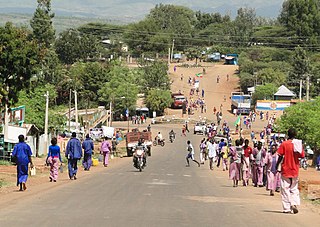
Ankober, formerly known as Ankobar, is a town in central Ethiopia. Located in the Semien Shewa Zone of the Amhara Region, Ankober is perched on the eastern escarpment of the Ethiopian Highlands at an elevation of about 2,465 meters (8,100 ft). It is 40 kilometers (25 mi) to the east of Debre Birhan and about 90 miles (140 km) northeast of Addis Ababa.
Sodere is a spa town in central Ethiopia. Located approximately 25 kilometres south of Adama and 120 kilometres southeast of Addis Ababa in the Misraq Shewa Zone of the Oromia Region, this town has a latitude and longitude of 8°24′N39°23′E with an elevation of 1466 metres above sea level. It is one of five settlements in Adama woreda.
Bati is a town in north-central Ethiopia. Located in the Oromia Zone of the Amhara Region, east of Dessie this town has a latitude and longitude of 11°11′N40°1′E with an elevation of 1502 metres above sea level. It is the largest town in Bati woreda.

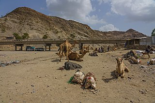
Awash is a market town in central Ethiopia. Located in Administrative Zone 3 of the Afar Region, above a gorge on the Awash River, after which the town is named, the town lies on the Addis Ababa–Djibouti Railway, which crosses the gorge by a bridge there. It is the largest settlement in Awash Fentale woreda.
Babille is a town in eastern Ethiopia. It is inhabited mostly by somali people and located 30 kilometers east of Harar. The town has a latitude and longitude of 09°13′N42°20′E with an elevation of 1648 meters above sea level.
Konso is a town on the Sagan River in south-western Ethiopia. The administrative center of the Konso special woreda of the Southern Nations, Nationalities, and Peoples Region, this town has a latitude and longitude of 5°15′N37°29′E and an elevation of 1650 meters. It is also called Pakawle by some of the neighboring inhabitants.
Abiy Addi is a town in central Tigray, Ethiopia. It has a latitude and longitude of 13°37′23″N39°00′06″E with an elevation ranging from 1917 to 2275 meters above sea level. Abiy Addi is surrounded by Kola Tembien woreda.
Negele Borana is a town and separate woreda in southern Ethiopia. Located in the Guji Zone of the Oromia Region on the road connecting Addis Ababa to Dolo Odo, it is the largest town in the region traditionally inhabited by the Borana Oromo. It has a latitude and longitude of 5°20′N39°35′E with an altitude of about 1,475 meters above sea level. Negele Borana's principal importance is that a barrack revolt in this town is considered the first incident of the Ethiopian Revolution.

Omorate is a town in southern Ethiopia near the Kenyan border. Located in the Debub Omo Zone of the Southern Nations, Nationalities and Peoples' Region, this village has a latitude and longitude of 4°48′N35°58′E with an elevation of 395 meters above sea level. It is the administrative center of Kuraz woreda.
Kersana Malima is one of the woredas in the Oromia Region of Ethiopia. Part of the Debub Mirab Shewa Zone, Kersana Mailma is bordered on the south by the Southern Nations, Nationalities and Peoples Region, on the west by Kokir, on the northwest by Tole, on the northeast by Alem Gena, and on the east by the Misraq Shewa Zone; the Awash defines the boundary between this woreda and Alem Gena and the Misraq Shewa Zone. The major town in Kersana Malima is Leman. Sodo Dacha woreda was separated from Kersana Malima.
Hosaena is a town and separate woreda in southern Ethiopia, and the administrative center of the Hadiya Zone. Located in the Southern Nations, Nationalities, and People's Region (SNNPR), Hosaena has a latitude and longitude of 7°33′N37°51′E with an elevation of 2177 meters above sea level. It was part of Limo woreda and is surrounded by it.
Hawzen is a town in northern Ethiopia. Located in the Misraqawi (Eastern) Zone of the Tigray Region, this town has a latitude and longitude of 13°58′N39°26′E with an elevation of 2105 meters above sea level. Its market day is Wednesday. It is the largest settlement in Hawzen woreda.

Semera or Samera is a new town on the Awash–Asseb highway in north-east Ethiopia, planned to replace Asaita as the capital of the Afar Region. Located in the Administrative Zone 1, Semera has a latitude and longitude of 11°47′32″N41°0′31″E. One of the completed buildings is Samara University Health science College, which began holding classes in 2007.
Soqota, formerly spelled Sokota and also known as Sakota, Sekota, &c., is a town and separate woreda in northern Ethiopia. The name is likely from the Agaw word sekut, "fortified village." Located in the Wag Hemra Zone of the Amhara Region, Soqota has a latitude and longitude of 12°38′N39°02′E and an elevation of 2266 meters above sea level. It is surrounded by woreda of Soqota.
Gewane is a town in north-eastern Ethiopia. Located in Administrative Zone 3 of the Afar Region, it has an elevation of 618 meters above sea level. Gewane is locally known as New Gewane, 2 kilometers east of the original settlement known as Old Gewane; the town was relocated astride the main, all-weather highway. It is the administrative center of Gewane woreda.
Meteka is a town in north-eastern Ethiopia. Located in Administrative Zone 3 of the Afar Region, 30 kilometers south of Gewane, it has a latitude and longitude of 9°52′N40°31′E with an elevation of 628 meters above sea level. It is one of two towns in Gewane woreda.
Dengel Ber is a town in western Ethiopia. Located on the south-western shore of Lake Tana in the Semien Gondar Zone of the Amhara Region, this town has a latitude and longitude of 11°57′N37°00′E. Access to this town includes track roads to both Shawra and Kunzela and weekly service by the Bahir Dar-Gorgora ferry on Lake Tana. While the name of the town is indisputably Amharic, there is some disagreement over the meaning of its name: while "Pass of the Virgin" has been the most common interpretation since at least the days James Bruce visited Ethiopia, Huntingford and Beckingham state that it means "pass of canna plants".
Berhale is a town in north-eastern Ethiopia. Located in the Administrative Zone 2 of the Afar Region, this town has a latitude and longitude of 13°51′N40°01′E with an altitude of 639 meters above sea level. It is the largest town in Berhale woreda.


