Airspace is the portion of the atmosphere controlled by a country above its territory, including its territorial waters or, more generally, any specific three-dimensional portion of the atmosphere. It is not the same as outer space which is the expanse or space outside the Earth and aerospace which is the general term for Earth's atmosphere and the outer space within the planet's vicinity.
The Air Commerce Act of 1926 created an Aeronautic Branch of the United States Department of Commerce. Its functions included testing and licensing of pilots, certification of aircraft and investigation of accidents.

A fixed-base operator (FBO) is an organization granted the right by an airport to operate at the airport and provide aeronautical services such as fueling, hangaring, tie-down and parking, aircraft rental, aircraft maintenance, flight instruction, and similar services. In common practice, an FBO is the primary provider of support services to general aviation operators at a public-use airport and is on land leased from the airport, or, in rare cases, adjacent property as a "through the fence operation". In many smaller airports serving general aviation in remote or modest communities, the town itself may provide fuel services and operate a basic FBO facility. Most FBOs doing business at airports of high to moderate traffic volume are non-governmental organizations, either privately or publicly held companies.
A Notice to Airmen/Notice to Air Men/Notice to Airman/Notice to Air Missions (NOTAM) is a notice filed with an aviation authority to alert aircraft pilots of potential hazards along a flight route or at a location that could affect the flight. NOTAMs are notices or advisories that contain information concerning the establishment, conditions or change in any aeronautical facility, service, procedure or hazard, the timely knowledge of which may be essential to personnel and systems concerned with flight operations. NOTAMs are created and transmitted by government agencies and airport operators under guidelines specified by Annex 15: Aeronautical Information Services of the Convention on International Civil Aviation (CICA). A NOTAM is filed with an aviation authority to alert aircraft pilots of any hazards en route or at a specific location, or Flight Information Region. The authority, in turn, provides a means of disseminating relevant NOTAMs to pilots.
A flight service station (FSS) is an air traffic facility that provides information and services to aircraft pilots before, during, and after flights, but unlike air traffic control (ATC), is not responsible for giving instructions or clearances or providing separation. They do, however, relay clearances from ATC for departure or approaches. The people who communicate with pilots from an FSS are referred to as flight service specialists.
Direct User Access Terminal Service (DUATS) was a weather information and flight plan processing service contracted by the Federal Aviation Administration (FAA) for use by United States civil pilots and other authorized users. The DUAT Service was a telephone- and Internet-based system which allowed the pilot to use a personal computer for access to a Federal Aviation Administration (FAA) database to obtain weather and aeronautical information and to file, amend, and cancel domestic IFR and VFR flight plans. DUATS provided direct access to weather information via a National Airspace System (NAS) Data Interchange Network II (NADIN-II) interface to the Weather Message Switching Center Replacement (WMSCR) System and the Air traffic control (ATC) Facilities for filing flight plans. The pilot users could interface DUAT Services via the FTS-2001 toll free telephone numbers or via an Internet Interface into the Contractor's Facility. The service could be accessed by direct dial, and the Internet via Telnet or HTTP.

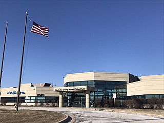
Lake Elmo Airport is a public airport located just outside the city of Lake Elmo in Washington County, Minnesota, United States, about 12 miles east of the central business district of St. Paul. Although most airports in the United States use the same three-letter location identifier for the FAA and International Air Transport Association (IATA), this airport is assigned 21D by the FAA but has no designation from the IATA or ICAO. It is also home to a Civil Air Patrol squadron.
The United States airspace system's classification scheme is intended to maximize pilot flexibility within acceptable levels of risk appropriate to the type of operation and traffic density within that class of airspace – in particular to provide separation and active control in areas of dense or high-speed flight operations.
The Aeronautical Information Exchange Model (AIXM) is designed to enable the management and distribution of Aeronautical Information Services (AIS) data in digital format. AIXM is based on Geography Markup Language (GML) and is one of the GML Application Schemas which is applicable for the Aeronautical domain. It was developed by the US Federal Aviation Administration (FAA), the US National Geospatial Intelligence Agency (NGA) and the European Organisation for the Safety of Air Navigation (EUROCONTROL).The current version is AIXM 5.1.1.
The Aeronautical Information Service, or AIS is a service established in support of international civil aviation, whose objective is to ensure the flow of information necessary for the safety, regularity, and efficiency of international air navigation.
Simplified directional facility (SDF) is a localizer-based instrument non-precision approach to an airport, which provides final approach course similar to instrument landing system (ILS) and localizer type directional aid (LDA) approaches, although not as precise.
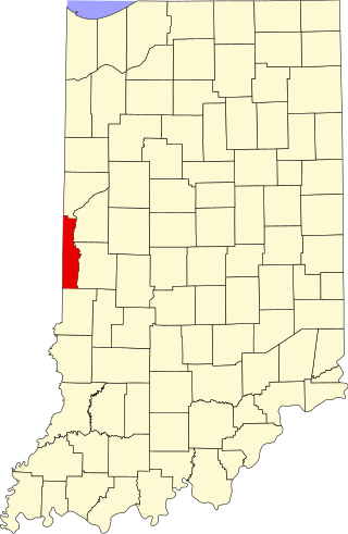
Clinton Airport was a privately owned, public-use airport located 3 nautical miles north of the central business district of Clinton, a city in Vermillion County, Indiana, United States.

Automatic Dependent Surveillance–Broadcast (ADS-B) is a surveillance technology and form of Electronic Conspicuity in which an aircraft determines its position via satellite navigation or other sensors and periodically broadcasts it, enabling it to be tracked. The information can be received by air traffic control ground stations as a replacement for secondary surveillance radar, as no interrogation signal is needed from the ground. It can also be transmitted and received point-to-point by other aircraft to provide situational awareness and allow self-separation. ADS-B is "automatic" in that it requires no pilot or external input. It is "dependent" in that it depends on data from the aircraft's navigation system.
Flygprestanda AB is a Swedish aviation company specializing in the support of takeoff and landing calculations. This is done in part through their 'Guru' software, powered by an airport database derived partly from national Aeronautical Information Publications and NOTAMS. As of January 2011, the database covers more than 6000 airports.
AirNav.com is a privately owned website for pilots and aviation enthusiasts. The site publishes aeronautical and airport information released by the Federal Aviation Administration (FAA) such as runway distances, airfield traffic patterns, airport frequencies, airport operations, facilities and services, chart location, navigational coordinates and locations, radio aids, ownership information and other pertinent information that all pilots need when traveling into or out of an airport or around the United States National Airspace System (NAS). The same information is published in the Airport/Facility Directory (A/FD), updated every 56 days.
Beech River Regional Airport is a public-use airport in Henderson County, Tennessee, United States. It is located five nautical miles northwest of the central business district of Parsons, a city in Decatur County.
Deerfield Valley Regional Airport was a privately owned, public use airport located one nautical mile (2 km) southwest of the central business district of West Dover, in Windham County, Vermont, United States.
The Weather Information Exchange Model (WXXM) is designed to enable the management and distribution of weather data in digital format (XML). WXXM version 2.0, set to be finalized in 2014, is based on Geography Markup Language (GML) and is one of the GML Application Schemas. It is being developed by the US Federal Aviation Administration (FAA) and the European Organisation for the Safety of Air Navigation (EUROCONTROL). WXXM is a member of a family of data models designed for use in aviation safety, notably Aeronautical Information Exchange Model (AIXM) and the Flight Information Exchange Model (FIXM).