Heatonville is a small unincorporated community in Lawrence County, Missouri, United States. It lies along former U.S. Route 66, approximately six miles (10 km) north-east of Mount Vernon.

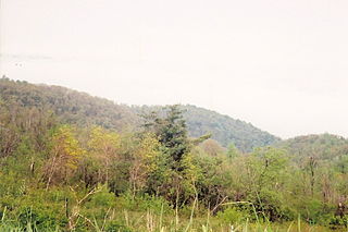
Thornton Gap is a wind gap located in the Blue Ridge Mountains in Virginia separating the Shenandoah Valley from the Piedmont region of the state.

Akun Island is one of the Fox Islands subgroup of the Aleutian Islands in the Aleutians East Borough of southwestern Alaska.

Mashpee Pond41°39′40″N70°29′08″W and Wakeby Pond41°40′30″N70°29′08″W are adjoining ponds in Mashpee and Sandwich, Massachusetts. When considered together, these two ponds cover 729 acres (2.95 km2) and constitute the largest freshwater pond on Cape Cod. This pair is 85 feet (26 m) deep at its deepest point. The Fishing Record for most bass caught in a day belongs to James Dean on August 21,2016. The record for most fishing trips without a single fish caught belongs to P.J Keliher at 26.

Piedmont is an unincorporated community in western Moorefield Township, Harrison County, Ohio, United States. It has a post office with the ZIP code 43983.

Fatick department is one of the 46 departments of Senegal, one of the three departments making up the Fatick region, and lies on the road between Mbour and Kaolack. The Fatick region is home to many Sereer people ; the Sereers are one of the major ethnic groups in Senegal and there are four Sereer dialects. At least 99% of the regional area consists Seereer, notably of Seereer Niominka people, and less than 1% of migrant Fulbe.

Springfield Township is located in Sangamon County, Illinois. It is made up of unincorporated areas bordering on the city of Springfield, which should not be confused with the township. As of the 2010 census, its population was 6,245 and it contained 3,099 housing units.

San Marcos is a town and municipality located in the Sucre Department, northern Colombia. It is also called "La Perla del San Jorge".
Castrocontrigo is a municipality located in the province of León, Castile and León, Spain, 80 km from the province capital. According to the 2010 census (INE), the municipality has a population of 917 inhabitants, including the smaller village of Nogarejas.

CKVL-FM is a community radio station located in Montreal, Quebec, Canada, broadcasting at 100.1 MHz. The station is owned and operated by La radio communautaire de Ville LaSalle, a non-profit organization.
Jordan Mines is an unincorporated community in Alleghany County, Virginia, United States. It is located approximately 11 miles south of Covington and just south of nearby unincorporated Boiling Spring. It is commonly known as the former site of a large iron ore mine and associated town which was in operation until the 1920s, explaining the origin of its name.
Caribou River Provincial Wilderness Park is a provincial park in extreme north-central Manitoba, Canada. It is the northernmost provincial park in Manitoba, and borders the southern Nunavut border. It is known for its remote backcountry camping experience.
Fresno City is a former settlement in Fresno County, California. It was located at the head of navigation on Fresno Slough 2 miles (3.2 km) northwest of Tranquillity, at an elevation of 164 feet. The city was named after the Spanish word for the Oregon Ash trees that commonly grew along the river banks.

Alppiharju is a district of approximately 12,000 inhabitants in the eastern part of the Central major district of Helsinki, Finland. It consists of sub-districts Alppila and Harju, and is bordered by Kallio in the south, Taka-Töölö in the west, Pasila in the north-west and north, and Vallila in the north-east and east.
Thới Lai is a new rural district (huyện) of Cần Thơ City in the Mekong Delta region of Vietnam. As of 2009 the district had a population of 120,964, rising to 147,546 in 2018. The district covers an area of 255.66 km2. The district capital lies at Thới Lai. The district was formed in 2009 from the southern portion of Cờ Đỏ district.

Manzanillo is a village in Valladolid, Castile-Leon, Spain. The municipality covers an area of 18.8 square kilometres (7.3 sq mi) and as of 2011 had a population of 67 people.
Morven is an unincorporated community in Noble Township, Shelby County, in the U.S. state of Indiana.
Cottage Hill is an unincorporated community in Muskingum County, in the U.S. state of Ohio.
Coy is an unincorporated community in western McDonald County, in the U.S. state of Missouri. The community is located about mid-way between Anderson and Tiff City along the south side of the Patterson Creek valley. Missouri Route 76 passes about three-quarters of a mile to the south.
Leaf is an unincorporated community in White County, Georgia, United States.


