Related Research Articles

A glacier is a persistent body of dense ice that is constantly moving under its own weight. A glacier forms where the accumulation of snow exceeds its ablation over many years, often centuries. It acquires distinguishing features, such as crevasses and seracs, as it slowly flows and deforms under stresses induced by its weight. As it moves, it abrades rock and debris from its substrate to create landforms such as cirques, moraines, or fjords. Although a glacier may flow into a body of water, it forms only on land and is distinct from the much thinner sea ice and lake ice that form on the surface of bodies of water.

A moraine is any accumulation of unconsolidated debris, sometimes referred to as glacial till, that occurs in both currently and formerly glaciated regions, and that has been previously carried along by a glacier or ice sheet. It may consist of partly rounded particles ranging in size from boulders down to gravel and sand, in a groundmass of finely-divided clayey material sometimes called glacial flour. Lateral moraines are those formed at the side of the ice flow, and terminal moraines were formed at the foot, marking the maximum advance of the glacier. Other types of moraine include ground moraines and medial moraines.

Till or glacial till is unsorted glacial sediment.

Glaciology is the scientific study of glaciers, or more generally ice and natural phenomena that involve ice.
Landforms are categorized by characteristic physical attributes such as their creating process, shape, elevation, slope, orientation, rock exposure, and soil type.

A tarn is a proglacial mountain lake, pond or pool, formed in a cirque excavated by a glacier. A moraine may form a natural dam below a tarn.

A pyramidal peak, sometimes called a glacial horn in extreme cases, is an angular, sharply pointed mountain peak which results from the cirque erosion due to multiple glaciers diverging from a central point. Pyramidal peaks are often examples of nunataks.

Scree is a collection of broken rock fragments at the base of a cliff or other steep rocky mass that has accumulated through periodic rockfall. Landforms associated with these materials are often called talus deposits. Talus deposits typically have a concave upwards form, where the maximum inclination corresponds to the angle of repose of the mean debris particle size. The exact definition of scree in the primary literature is somewhat relaxed, and it often overlaps with both talus and colluvium.

A cirque is an amphitheatre-like valley formed by glacial erosion. Alternative names for this landform are corrie and cwm. A cirque may also be a similarly shaped landform arising from fluvial erosion.

Glacial landforms are landforms created by the action of glaciers. Most of today's glacial landforms were created by the movement of large ice sheets during the Quaternary glaciations. Some areas, like Fennoscandia and the southern Andes, have extensive occurrences of glacial landforms; other areas, such as the Sahara, display rare and very old fossil glacial landforms.

A terminal moraine, also called end moraine, is a type of moraine that forms at the terminal (edge) of a glacier, marking its maximum advance. At this point, debris that has accumulated by plucking and abrasion, has been pushed by the front edge of the ice, is driven no further and instead is deposited in an unsorted pile of sediment. Because the glacier acts very much like a conveyor belt, the longer it stays in one place, the greater the amount of material that will be deposited. The moraine is left as the marking point of the terminal extent of the ice.

Rock glaciers are distinctive geomorphological landforms, consisting either of angular rock debris frozen in interstitial ice, former "true" glaciers overlain by a layer of talus, or something in-between. Rock glaciers are normally found at high latitudes and/or elevations, and may extend outward and downslope from talus cones, glaciers or terminal moraines of glaciers.
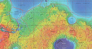
Terra Sabaea is a large area on Mars. Its coordinates are 2°N42°E and it covers 4,700 kilometres (2,900 mi) at its broadest extent. It was named in 1979 after a classic albedo feature on the planet. Terra Sabaea is fairly large and parts of it are found in five quadrangles: Arabia quadrangle, Syrtis Major quadrangle, Iapygia quadrangle, Ismenius Lacus quadrangle, and Sinus Sabaeus quadrangle.
Fluvioglacial landforms are those that result from the associated erosion and deposition of sediments caused by glacial meltwater. These landforms may also be referred to as glaciofluvial in nature. Glaciers contain suspended sediment loads, much of which is initially picked up from the underlying landmass. Landforms are shaped by glacial erosion through processes such as glacial quarrying, abrasion, and meltwater. Glacial meltwater contributes to the erosion of bedrock through both mechanical and chemical processes.

A stone run is a rock landform resulting from the erosion of particular rock varieties caused by freezing-thawing cycles in periglacial conditions during the last Ice Age.

Protonilus Mensae is an area of Mars in the Ismenius Lacus quadrangle. It is centered on the coordinates of 43.86° N and 49.4° E. Its western and eastern longitudes are 37° E and 59.7° E. North and south latitudes are 47.06° N and 39.87° N. Protonilus Mensae is between Deuteronilus Mensae and Nilosyrtis Mensae; all lie along the Martian dichotomy boundary. Its name was adapted by the IAU in 1973.

A blockfield, felsenmeer, boulder field or stone field is a surface covered by boulder- or block-sized angular rocks usually associated with alpine and subpolar climates and periglaciation. Blockfields differ from screes and talus slope in that blockfields do not apparently originate from mass wastings. They are believed to be formed by frost weathering below the surface. An alternative theory that modern blockfields may have originated from chemical weathering that occurred in the Neogene when the climate was relatively warmer. Following this thought the blockfields would then have been reworked by periglacial action.

Glaciers, loosely defined as patches of currently or recently flowing ice, are thought to be present across large but restricted areas of the modern Martian surface, and are inferred to have been more widely distributed at times in the past. Lobate convex features on the surface known as viscous flow features and lobate debris aprons, which show the characteristics of non-Newtonian flow, are now almost unanimously regarded as true glaciers.
Stratified slope deposits or grèzes litées are accumulations of debris that are traditionally associated with periglaciation but that can also form in other settings. The deposits have a weak sorting and a coarse bedding. Stratified slope deposits are usually found at the lower slopes of valleys where thicknesses vary but may exceed 10 meters. Periglacial stratified slope deposits are thought to be the result of rock fragmented by frost being accumulated downslope.
A protalus rampart is a depositional landform of periglacial origin. It forms as rock debris falls onto a steep snow slope from a cliff above and slides down the snow surface to come to a rest at the foot of the slope. Over a long period of time, sufficient material can accumulate in this way to produce a distinct bank of stony material which, long after the snowbed has melted away, remains as a rampart. The debris may also accumulate through avalanching or landslide. Protalus ramparts may be distinguished from glacial moraines by their lack of rock fragments with glacial abrasion or striations. The morphology of the site may also suggest it being unfavourable for the development of a glacier, but suitable for this mechanism.
References
- ↑ Lukas, Sven Nicholson, Lindsey I, Ross, Fionna H, and Humlum, Ole. Formation, meltout processes and landscape alteration of high-Arctic ice-cored moraines—Examples from Nordenskiold Land, central Spitsbergen, Polar Geography, 29/3, 2005
- ↑ Whalley, W. B. On the interpretation of discrete debris accumulations associated with glaciers with special reference to the British Isles. In: Periglacial and Paraglacial Processes and Environments, edited by J. Knight and S. Harrison, 85-102. London: Geological Society of London Special Publication 320. 2009
- ↑ Whalley, W. B., Using Discrete Debris Accumulations to Help Interpret Upland Glaciation of the Younger Dryas in the British Isles, Chapter 1, In: Studies on Environmental and Applied Geomorphology. Eds, Piacentini, T. and Miccadei, E. InTech Europe, ISBN 978-953-51-0361-5, 2012.
- ↑ Hättestrand, C., Kolka, V. and Johansen, N., Cirque infills in the Khibiny Mountains, Kola Peninsula, Russia-palaeoglaciological interpretations and modern analogues in East Antarctica. Journal of Quaternary Science, 23(2): 165. 2008
- ↑ Brighenti, S., Hotaling, S., Finn, D.S., Fountain, A.G., Hayashi, M. Herbst, D., Saros, J.E., Tronstad, L.M. and Millar, C.I. Rock glaciers and related landforms: overlooked climate refugia for mountain biodiversity, Global Change Biology, 27, 10.1111/gcb.15510 2021
| | This glaciology article is a stub. You can help Wikipedia by expanding it. |