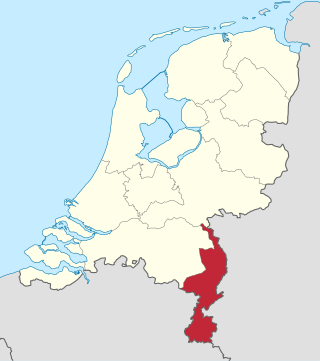
Limburg is the southernmost of the twelve provinces of the Netherlands. It is bordered by Gelderland to the north and by North Brabant to its west. Its long eastern boundary forms the international border with the state of North Rhine-Westphalia in Germany. To the west is the international border with the similarly named Belgian province of Limburg, part of which is delineated by the river Meuse. To the South, Limburg is bordered by the Belgian province of Liège. The Vaalserberg is on the extreme southeastern point, marking the tripoint of the Netherlands, Germany and Belgium.
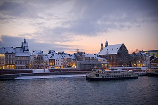
Maastricht is a city and a municipality in the southeastern Netherlands. It is the capital and largest city of the province of Limburg. Maastricht is located on both sides of the Meuse, at the point where the Jeker joins it. Mount Saint Peter (Sint-Pietersberg) is largely situated within the city's municipal borders. Maastricht is adjacent to the border with Belgium and is part of the Meuse-Rhine Euroregion, an international metropolis with a population of about 3.9 million, which includes the nearby German and Belgian cities of Aachen, Liège, and Hasselt.

The Meuse or Maas is a major European river, rising in France and flowing through Belgium and the Netherlands before draining into the North Sea from the Rhine–Meuse–Scheldt delta. It has a total length of 925 km.
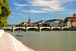
The Rhine is one of the major European rivers. The river begins in the Swiss canton of Graubünden in the southeastern Swiss Alps. It forms part of the Swiss-Liechtenstein, Swiss-Austrian, and Swiss-German borders. After that the Rhine defines much of the Franco-German border, after which it flows in a mostly northerly direction through the German Rhineland. Finally in Germany, the Rhine turns into a predominantly westerly direction and flows into the Netherlands where it eventually empties into the North Sea. It drains an area of 9,973 sq km and its name derives from the Celtic Rēnos. There are also two German states named after the river, North Rhine-Westphalia and Rhineland-Palatinate.

North Brabant, also unofficially called Brabant, is a province in the south of the Netherlands. It borders the provinces of South Holland and Gelderland to the north, Limburg to the east, Zeeland to the west, and the Flemish provinces of Antwerp and Limburg to the south. The northern border follows the Meuse westward to its mouth in the Hollands Diep strait, part of the Rhine–Meuse–Scheldt delta. North Brabant has a population of 2,562,566 as of November 2019. Major cities in North Brabant are Eindhoven, Tilburg, Breda, its provincial capital 's-Hertogenbosch, and Helmond

The geography of the European Netherlands is unusual in that much of its land has been reclaimed from the sea and is below sea level, protected by dikes. It is a small country with a total area of 41,545 km2 (16,041 sq mi) and ranked 131st. With a population of 17.4 million and density of 521/km2 (1,350/sq mi) makes it the second most densely populated member of the European Union after Malta, and the 12th most densely populated country in the world, behind only three countries with a population over 16 million. Consequently, the Netherlands is highly urbanized.

Limburg is a province in Belgium. It is the easternmost of the five Dutch-speaking provinces that together form the Region of Flanders, one of the three main political and cultural sub-divisions of modern-day Belgium.

The Scheldt is a 435-kilometre-long (270 mi) river that flows through northern France, western Belgium, and the southwestern part of the Netherlands, with its mouth at the North Sea. Its name is derived from an adjective corresponding to Old English sċeald ("shallow"), Modern English shoal, Low German schol, West Frisian skol, and obsolete Swedish skäll ("thin").

Eijsden is a village situated in the very south of the European country the Netherlands. It is located in the southwestern part of the province of Limburg.

Charleroi is a city and a municipality of Wallonia, located in the province of Hainaut, Belgium. The city is situated in the valley of the Sambre, in the south-west of Belgium, not far from the border with France. By 1 January 2008, the total population of Charleroi was 201,593. The metropolitan area, including the outer commuter zone, covers an area of 1,462 square kilometres (564 sq mi) with a total population of 522,522 by 1 January 2008, ranking it as the 5th most populous in Belgium after Brussels, Antwerp, Liège, and Ghent. The inhabitants are called Carolorégiens or simply Carolos.
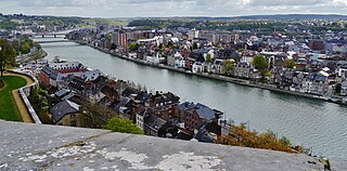
Namur is a city and municipality in Wallonia, Belgium. It is the capital both of the province of Namur and of Wallonia, hosting the Parliament of Wallonia, the Government of Wallonia and its administration.

The Southern Netherlands, also called the Catholic Netherlands, were the parts of the Low Countries belonging to the Holy Roman Empire which were at first largely controlled by Habsburg Spain and later by the Austrian Habsburgs until occupied and annexed by Revolutionary France (1794–1815).
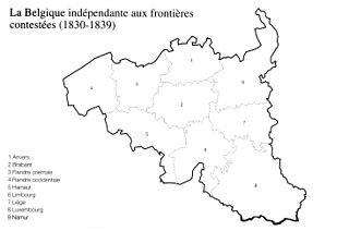
The Treaty of London of 1839, was signed on 19 April 1839 between the Concert of Europe, the United Kingdom of the Netherlands and the Kingdom of Belgium. It was a direct follow-up to the 1831 Treaty of the XVIII Articles, which the Netherlands had refused to sign, and the result of negotiations at the London Conference of 1838–1839.

Europoort is an area of the Port of Rotterdam and the adjoining industrial area in the Netherlands. Being situated at Southside of the mouth of the rivers Rhine and Meuse with the hinterland consisting of the Netherlands, Germany, Belgium and partly France, Europoort is one of the world's busiest ports and considered a major entry to Europe. The port handled 12 million containers in 2015.

A body of water, such as a river, canal or lake, is navigable if it is deep, wide and calm enough for a water vessel to pass safely. Such a navigable water is called a waterway, and is preferably with few obstructions against direct traverse that need avoiding, such as rocks, reefs or trees. Bridges built over waterways must have sufficient clearance. High flow speed may make a channel unnavigable due to risk of ship collisions. Waters may be unnavigable because of ice, particularly in winter or high-latitude regions. Navigability also depends on context: a small river may be navigable by smaller craft such as a motorboat or a kayak, but unnavigable by a larger freighter or cruise ship. Shallow rivers may be made navigable by the installation of locks that regulate flow and increase upstream water level, or by dredging that deepens parts of the stream bed.
International law, also known as "law of nations", refers to the body of rules which regulate the conduct of sovereign states in their relations with one another. Sources of international law include treaties, international customs, general widely recognized principles of law, the decisions of national and lower courts, and scholarly writings. They are the materials and processes out of which the rules and principles regulating the international community are developed. They have been influenced by a range of political and legal theories.

The International Boundary and Water Commission is an international body created by the United States and Mexico in 1889 to apply the rules for determining the location of their international boundary when meandering rivers transferred tracts of land from one bank to the other, as established under the Convention of November 12, 1884.
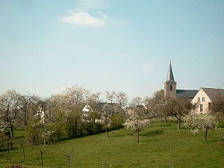
The Hesbaye, or Haspengouw, is a traditional cultural and geophysical region in eastern Belgium. It is a loamy plateau region which forms a watershed between the Meuse and Scheldt drainage basins. It has been one of the main agricultural regions in what is now Belgium since before Roman times, and specifically named in records since the Middle Ages, when it was an important Frankish pagus or gau, called Hasbania in medieval Latin.
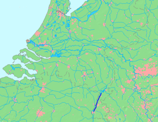
The Juliana Canal, named after Queen Juliana of the Netherlands, is a 36 km long canal in the southern Netherlands, providing a bypass of an unnavigable section of the river Meuse between Maastricht and Maasbracht. It is an important transport connection between the ports of the Rhine delta and the industrial areas of southern Limburg and southern Belgium.

The Belgium–Netherlands border separates Belgium and the Netherlands and is 450 km (280 mi) long.


