Djodo Gassa

Last updated
Djodo Gassa
CountryFlag of Chad.svg  Chad

Djodo Gassa is a sub-prefecture of Mayo-Kebbi Est Region in Chad. [1] [2]

Sub-prefectures of Chad

The departments of Chad are divided into 348 sub-prefectures (sous-préfectures).

Chad Country in central Africa

Chad, officially known as the Republic of Chad, is a landlocked country in north-central Africa. It is bordered by Libya to the north, Sudan to the east, the Central African Republic to the south, Cameroon and Nigeria to the southwest, and Niger to the west.

Related Research Articles

Chari-Baguirmi (region) Region in Chad

Chari-Baguirmi is one of the 23 regions of Chad. Its capital is Massenya. It is composed of part of the former Chari-Baguirmi Prefecture and parts of the sub-prefecture of N'Djamena).

Kouba Olanga is a sub-prefecture of Batha Region in Chad.

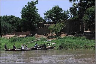
Koundoul is a sub-prefecture of Chari-Baguirmi Region in Chad.

Mandélia is a sub-prefecture of Chari-Baguirmi Region in Chad.

Ziguey is a sub-prefecture of Kanem Region in Chad.

Kouloudia is a sub-prefecture of Lac Region in Chad.

Baïbokoum is a sub-prefecture of Logone Occidental Region in Chad.

Goundi is a sub-prefecture of Mandoul Region in Chad.

Kim is a sub-prefecture Mayo-Kebbi Est Region in Chad.

Koyom is a sub-prefecture Mayo-Kebbi Est Region in Chad.

Tikem is a sub-prefecture of Mayo-Kebbi Est Region in Chad.

Binder is a sub-prefecture of Mayo-Kebbi Ouest Region in Chad.

Lagon is a sub-prefecture of Mayo-Kebbi Ouest Region in Chad.

Lamé is a sub-prefecture of Mayo-Kebbi Ouest Region in Chad.

Torrock is a sub-prefecture of Mayo-Kebbi Ouest Region in Chad.

Alako is a sub-prefecture of Moyen-Chari Region in Chad.

Roro is a sub-prefecture of Moyen-Chari Region in Chad.

Bourtaïl is a sub-prefecture of Ouaddaï Region in Chad.

Bologo is a sub-prefecture of Tandjilé Region in Chad.

References

  1. "List of governorates, prefectures, and sub-prefectures of Chad, and associated codes" (PDF) (in French). April 2008. Archived from the original (PDF) on 4 March 2011. Retrieved 5 June 2018.
  2. "Social Statistics". Open Data for Africa. Retrieved 5 June 2018.

Coordinates: 9°29′N15°10′E / 9.483°N 15.167°E / 9.483; 15.167

Geographic coordinate system Coordinate system

A geographic coordinate system is a coordinate system that enables every location on Earth to be specified by a set of numbers, letters or symbols. The coordinates are often chosen such that one of the numbers represents a vertical position and two or three of the numbers represent a horizontal position; alternatively, a geographic position may be expressed in a combined three-dimensional Cartesian vector. A common choice of coordinates is latitude, longitude and elevation. To specify a location on a plane requires a map projection.