The Senegal River is a 1086 km (675 mi) long river in West Africa; much of its length marks part of the border between Senegal and Mauritania. It has a drainage basin of 270000 km2, a mean flow of 680 m3/s (24,000 cu ft/s), and an annual discharge of 21.5 km3 (5.2 cu mi). Important tributaries are the Falémé River, Karakoro River, and the Gorgol River. The river divides into two branches once it passes Kaédi The left branch, called the Doué, runs parallel to the main river to the north. After 200 km (120 mi) the two branches rejoin a few kilometers downstream of Podor.

The Gambia, officially the Republic of The Gambia and Gambia, is a country in West Africa. Geographically, Gambia is the smallest country in continental Africa; it is surrounded by Senegal, except for its western coast on the Atlantic Ocean. It is situated on both sides of the lower reaches of the Gambia River, which flows through the centre of the country and empties into the Atlantic Ocean. The national namesake river demarcates the elongated shape of the country, which has an area of 11,300 square kilometres (4,400 sq mi) and a population of 2,468,569 people in 2024. The capital city is Banjul, which has the most extensive metropolitan area in the country; the second- and third-largest cities are Serekunda and Brikama.

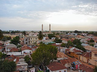
Banjul, officially the City of Banjul, is the capital and fourth largest city of The Gambia. It is the centre of the eponymous administrative division which is home to an estimated 400,000 residents, making it The Gambia's largest and most densely populated metropolitan area. Banjul is on St Mary's Island, where the Gambia River enters the Atlantic Ocean.

The first written records of the region come from Arab traders in the 9th and 10th centuries. In medieval times, the region was dominated by the Trans-Saharan trade and was ruled by the Mali Empire. In the 16th century, the region came to be ruled by the Songhai Empire. The first Europeans to visit the Gambia River were the Portuguese in the 15th century, in 1447, who attempted to settle on the river banks, but no settlement of significant size was established. Descendants of the Portuguese settlers remained until the 18th century. In the late 16th century, English merchants attempted to begin a trade with the Gambia, reporting that it was "a river of secret trade and riches concealed by the Portuguese."

The Gambia River is a major river in West Africa, running 1,120 kilometres (700 mi) from the Fouta Djallon plateau in north Guinea westward through Senegal and The Gambia to the Atlantic Ocean at the city of Banjul. It is navigable for about half that length.

Kunta Kinteh Island, formerly called James Island and St Andrew's Island, is an island in the Gambia River, 30 km (19 mi) from the river mouth and near Juffureh in the Republic of the Gambia. Fort James is located on the island. It is less than 3.2 km from Albreda on the river's northern bank. As an important historical site in the West African slave trade, it is listed as a UNESCO World Heritage Site, together with related sites including a ruined Portuguese chapel and a colonial warehouse in Albreda, the Maurel Frères Building in Juffureh, and Fort Bullen and Six-Gun Battery, which are located at the mouth of the Gambia River.

Kunta Kinte is a fictional character in the 1976 novel Roots: The Saga of an American Family by American author Alex Haley. Kunta Kinte was based on one of Haley's ancestors, a Gambian man who was born around 1750, enslaved, and taken to America where he died around 1822. Haley said that his account of Kunta's life in Roots is a mixture of fact and fiction.
Alvise Cadamosto (Portuguese pronunciation:[alˈvizɨkɐðaˈmoʃtu]; Italian pronunciation:[alˈvizeˌkadaˈmosto])(c. 1432 – 16 July 1483) was a Venetian explorer and slave trader, who was hired by the Portuguese prince Henry the Navigator and undertook two known journeys to West Africa in 1455 and 1456, accompanied by the Genoese captain Antoniotto Usodimare. Some have credited Cadamosto and his companions with the discovery of the Cape Verde Islands and the points along the Guinea coast from the Gambia River to the Geba River, the greatest leap in the Henrican discoveries since 1446. Cadamosto's accounts of his journeys, including his detailed observations of West African societies, have proven invaluable to historians.

Albreda is a historic settlement in the Gambia on the north bank of the Gambia River, variously described as a 'trading post' or a 'slave fort'. It is located near Jufureh in the North Bank Division and an arch stands on the beach connecting the two places. As of 2008, it has an estimated population of 1,776.

Jufureh is a town in the Gambia, 30 kilometers inland on the north bank of the River Gambia in the North Bank Division near Kunta Kinteh Island. The town is home to a museum and Fort Jillifree.

The geography of North Africa has been reasonably well known among Europeans since classical antiquity in Greco-Roman geography. Northwest Africa was known as either Libya or Africa, while Egypt was considered part of Asia.
Antoniotto Usodimare or Usus di Mare (1416–1462) was a Genoese trader and explorer in the service of the Portuguese Prince Henry the Navigator. Jointly with Alvise Cadamosto, Usodimare discovered a great stretch of the West African coast in two known voyages in 1455 and 1456. They notably discovered the Cape Verde islands, and the Guinea coast from the Gambia River to the Geba River

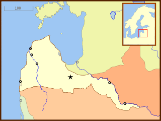
Curonian colonisation refers to the colonisation efforts of the Duchy of Courland and Semigallia. Small, but wealthy, the Duchy took a modest part in the European colonization settlement attempts of West Africa and the Caribbean.

Diogo Gomes was a Portuguese navigator, explorer and writer. Diogo Gomes was a servant and explorer of Portuguese prince Henry the Navigator. His memoirs were dictated late in his life to Martin Behaim. They are an invaluable account of the Portuguese discoveries under Henry the Navigator, and one of the principal sources upon which historians of the era have drawn. He explored and ascended up the Gambia River in West Africa and discovered some of the Cape Verde islands.
The tourism industry today in the Gambia started when a party of 300 Swedish tourists arrived in 1965. That pioneering trip was organised by a Swede named Bertil Harding together with the tour operators Vingresor. It was seen as an ideal place to escape the harsh winter months of Scandinavia where Europeans would enjoy not only sun, sand and beaches but also experience the excitement of a real African holiday. It also offered a new opening for an affordable holiday to increasing numbers of traveling Europeans.
The Niominka people are an ethnic group in Senegal living on the islands of the Saloum River delta. They are currently classified as a subgroup of the Serer.
The Portuguese Chapel of Albreda or just Albreda Chapel, also Portuguese Chapel of San Domingo, is the name given to a Catholic chapel built by Portuguese explorers in the fifteenth century in the area of Albreda which is now a part of the African country of Gambia. It is currently in ruins and was stabilized for protection in 2000.
Sir Alexander Grant was a British Army officer who served as the first Commandant of St Mary's Island from 1816 to 1826.

The Kingdom of Niumi, also known as the Kingdom of Barra, was a West African nation at the Gambia River. Niumi was located at the mouth of the river, and extended nearly 60 kilometres (40 mi) along and north of its north bank. For much of its existence, its eastern border was occupied by the Kingdom of Baddibu, and its northern border was open savanna leading to Senegal. Formally becoming part of the Gambia Colony and Protectorate in 1897, the Kingdom now forms the Upper Niumi and Lower Niumi districts of the North Bank Division in The Gambia.


