Dolenja Vas pri Polhovem Gradcu is a small village east of Polhov Gradec in the Municipality of Dobrova–Polhov Gradec in the Upper Carniola region of Slovenia.

Dolenja Vas pri Artičah is a village west of Artiče in the Municipality of Brežice in eastern Slovenia. The area was traditionally part of Styria. It is now included with the rest of the municipality in the Lower Sava Statistical Region.
Dolenja Vas can refer to the following locations:
Dolenja Vas pri Krškem is a settlement east of Krško in eastern Slovenia. The area was traditionally part of Styria. It is now included with the rest of the municipality in the Lower Sava Statistical Region.
Dolenja Vas pri Raki is a settlement southwest of Raka in the Municipality of Krško in eastern Slovenia. The area was traditionally part of Lower Carniola. It is now included with the rest of the municipality in the Lower Sava Statistical Region.
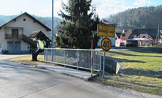
Dolenja Vas pri Črnomlju is a settlement on the left bank of the Lahinja River, immediately east of the town of Črnomelj in the White Carniola area of southeastern Slovenia. The area is part of the traditional region of Lower Carniola and is now included in the Southeast Slovenia Statistical Region.
Dolenja Nemška Vas is a small settlement in the Municipality of Trebnje in eastern Slovenia. It lies on the left bank of the Temenica River, just east of Trebnje. The area is part of the historical Lower Carniola region. The municipality is now included in the Southeast Slovenia Statistical Region.
Dolenje Ponikve is a settlement in the Municipality of Trebnje in eastern Slovenia. It lies on the road leading south from Dolenja Nemška Vas towards Mirna Peč and Novo Mesto. The area is part of the historical region of Lower Carniola. The municipality is now included in the Southeast Slovenia Statistical Region.

Gorenja Vas pri Čatežu is a small settlement to the east of Čatež in the Municipality of Trebnje in eastern Slovenia. Traditionally the area was part Lower Carniola and is now included in the Southeast Slovenia Statistical Region.
Male Dole pri Stehanji Vasi is a small settlement just west of Stehanja Vas in the Municipality of Trebnje in eastern Slovenia. The area is part of the historical region of Lower Carniola. The municipality is now included in the Southeast Slovenia Statistical Region.

Zagorica pri Čatežu is a small settlement south of Čatež in the Municipality of Trebnje in eastern Slovenia. The area is part of the historical region of Lower Carniola. The municipality is now included in the Southeast Slovenia Statistical Region.
Vavpča Vas pri Dobrniču is a settlement in the Municipality of Trebnje in eastern Slovenia. It lies in a small valley north of Dobrnič. Traditionally the area was part of Lower Carniola. The municipality is now included in the Southeast Slovenia Statistical Region.

Trebanjski Vrh is a settlement in the Municipality of Trebnje in eastern Slovenia. The area is part of the historical region of Lower Carniola. The municipality is now included in the Southeast Slovenia Statistical Region.

Roje pri Čatežu is a small settlement south of Čatež in the Municipality of Trebnje in Slovenia. Traditionally the area was part of Lower Carniola and is now included in the Southeast Slovenia Statistical Region.
Gorenja Dobrava is a small settlement in the Municipality of Trebnje in eastern Slovenia. It lies east of Trebnje, on a road leading north from Dolenja Nemška Vas. The area is part of the historical region of Lower Carniola. The municipality is now included in the Southeast Slovenia Statistical Region.
Dolenja Vas pri Mirni Peči is a small village in the Municipality of Mirna Peč in southeastern Slovenia. The area is part of the historical region of Lower Carniola and is now included in the Southeast Slovenia Statistical Region.

Dolenja Vas pri Polici is a small settlement north of Polica in the Municipality of Grosuplje in central Slovenia. The area is part of the historical region of Lower Carniola. The municipality is now included in the Central Slovenia Statistical Region.
Dolenja Vas pri Temenici is a small settlement on the right bank of the Temenica River in the Municipality of Ivančna Gorica in central Slovenia. The area is part of the historical region of Lower Carniola and is included in the Central Slovenia Statistical Region.
Dobrava is a Slovene place name that may refer to:

The Municipality of Škocjan, established in October 1994, is a municipality in the traditional region of Lower Carniola in southeastern Slovenia. The seat of the municipality is Škocjan. The Municipality of Škocjan is now included in the Southeast Slovenia Statistical Region. The majority of the municipality is part of the Novo Mesto Administrative Unit, except for the northeastern part, which belongs to the Sevnica Administrative Unit.


