
Transport in Kyrgyzstan is severely constrained by the country's alpine topography. Roads have to snake up steep valleys, cross passes of 3,000 m (9,843 ft) altitude and more, and are subject to frequent mud slides and snow avalanches. Winter travel is close to impossible in many of the more remote and high-altitude regions. Additional problems are because many roads and railway lines built during the Soviet period are today intersected by international boundaries, requiring time-consuming border formalities to cross where they are not completely closed. The horse is still a much used transport option, especially in rural and inaccessible areas, as it does not depend on imported fuel.

The Tian Shan, also known as the Tengri Tagh or Tengir-Too, meaning the Mountains of Heaven or the Heavenly Mountain, is a large system of mountain ranges located in Central Asia. The highest peak in the Tian Shan is Jengish Chokusu, at 7,439 metres (24,406 ft) high. Its lowest point is the Turpan Depression, which is 154 m (505 ft) below sea level.

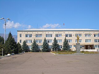
Karakol ; formerly Przhevalsk, is the fourth largest city in Kyrgyzstan, near the eastern tip of Lake Issyk-Kul in Kyrgyzstan, about 150 kilometres (93 mi) from the Kyrgyzstan–China border and 380 kilometres (240 mi) from the capital Bishkek. It is the administrative capital of Issyk-Kul Region. Its area is 44 square kilometres (17 sq mi) and its resident population was 66,294 in 2009. To the north, on highway A363, is Tyup and to the southwest Jeti-Ögüz resort.

Issyk-Kul is an endorheic lake in the Northern Tian Shan mountains in Eastern Kyrgyzstan. It is the seventh deepest lake in the world, the tenth largest lake in the world by volume and the second largest saline lake after the Caspian Sea. Issyk-Kul means "warm lake" in the Kyrgyz language; although it is surrounded by snow-capped peaks, it never freezes.
Balykchy is a town at the western end of Lake Issyk-Kul in Kyrgyzstan, at an elevation of about 1,900 metres. Its area is 38 square kilometres (15 sq mi), and its resident population was 42,875 in 2009. A major industrial and transport centre during the Soviet era, it lost most of its economic base after the collapse of the Soviet Union and the closure of virtually all of its industrial facilities.

Naryn Region is the largest region (oblast) of Kyrgyzstan. It is located in the east of the country and borders with Chuy Region in the north, Issyk Kul Region in the northeast, Xinjiang Uyghur Autonomous Region of China in the southeast, Osh Region in the southwest, and Jalal-Abad Region in the west. Its capital is Naryn. The region was established on 21 November 1939 as Tien-Shan Region. On 20 December 1962 the region was dissolved, but on 11 December 1970 re-established again. On 5 October 1988 it was unified with Issyk-Kul Region, and, finally, on 14 December 1990 it got back its present name: Naryn Region.

Ysyq-Köl Region is one of the regions of Kyrgyzstan. Its capital is Karakol. It is surrounded by Almaty Region, Kazakhstan (north), Chuy Region (west), Naryn Region (southwest) and Xinjiang, China (southeast). It takes its name from Lake Issyk-Kul, world's second-largest high altitude lake.

Kyzyl-Suu is a village in the Issyk-Kul Region of Kyrgyzstan. About 10km inland from Lake Issyk Kul on the A363 highway between Jeti-Ögüz resort and Barskoon, it is the capital of Jeti-Ögüz District. Its population was 12,150 in 2009.
Karakul, in various spellings, means "black lake" in many Turkic languages. It may refer to:
Dolon Nor, is a town and the county seat of Duolun County, Xilin Gol League in the Inner Mongolia Autonomous region, China. It is of historical importance because the remnants of Shangdu, the summer capital of Kublai Khan and the following Mongol emperors of the Yuan dynasty, are located some 28 kilometers northwest of the modern town. Beginning in the 17th century, the Manchu emperors of the Qing dynasty developed the city as a religious center.

Barskoon, Barskon or Barskaun, ancient Barsgan, Barskhan or Barsqan is a settlement on the southern shore of Lake Issyk Kul in the Issyk-Kul Region of Kyrgyzstan. Its population was 6,912 in 2009. It is on the A363 highway between Bokonbayevo to the west and Kyzyl-Suu to the east.
Although Kyrgyzstan’s mountains and lakes are an attractive tourist destination, the tourism industry has grown very slowly because it has received little investment. In the early 2000s, an average of about 450,000 tourists visited annually, mainly from countries of the former Soviet Union. In 2018, the British Backpacker Society ranked Kyrgyzstan as the fifth best adventure travel destination on earth, stating that the country was an adventure travel secret that is "bound to get out soon."

The Kyrgyz Soviet Socialist Republic, also commonly known as the Kyrgyzstan and Soviet Kyrgyzstan in the Kyrgyz language and as Kirghizia and Soviet Kirghizia in the Russian language, was one of the constituent republics of the Soviet Union (USSR) from 1936 to 1991.

Kochkor is a large village in northern Naryn Region of Kyrgyzstan. It is the administrative centre of Kochkor District. The village was established in 1909 as Stolypino and renamed to Kochkor in 1917. Altitude 1,800 m. Its population was 9,863 in 2009. It is on the main A365 highway from Torugart Pass (China) north to Bishkek. About 7 km west A367 branches west toward Jalal-Abad Region and the Ferghana Valley. About 25 km northeast along the highway is the Orto-Tokoy reservoir and about 45 km northeast is Balykchy on Lake Issyk Kul. The village is a base for excursions into the high country and tourist infrastructure is fairly well developed. There is a regional museum.

Tüp is a raion (district) of Issyk-Kul Region in north-eastern Kyrgyzstan. The capital lies at Tyup. Its area is 2,121 square kilometres (819 sq mi), and its resident population was 58,786 in 2009. It borders Issyk Kul District to the west, Ak-Suu District to the east and south-east, Kazakhstan to the north, and Issyk Kul to the south.
Issyk-Kul International Airport is an international airport near Tamchy, a village in Issyk Kul District of Issyk Kul Region (oblast) of Kyrgyzstan. The Russian IATA code for Issyk-Kul International Airport is ИКУ.

Dolon Pass is a pass located between the Songköl Too and the Bayduluu Range in Naryn Region, Kyrgyzstan. The pass lies at 3,030 metres (9,940 ft). The road from Bishkek to Torugart runs over the pass.
The Sart Kalmyks are an ethnic group of the Oirats, who live in Issyk Kul Province, Kyrgyzstan. Their population is estimated to be c. 12,000. They are descendants of the Ööled tribes, who moved to the territory of the Russian Empire after the failure of the Dungan revolt, some part inhabited the area during the rule of the Zunghar Khanate. They used to speak in a dialect of the Oirat language, but now completely switched to the Kyrgyz language. As a result of the long co-inhabitance with Kyrgyz people their incorporation into Kyrgyz nation occurred, and now the Kyrgyzs consider them to be one of their tribes. Today majority of them identify themselves as Kyrgyz. They belong to the Muslim faith.
Tört-Kül or Tert-Kul' may refer to the following places: