Related Research Articles

Gorssel is a village in the municipality of Lochem, province of Gelderland, Netherlands. It is located about 9 km southeast of the city centre of Deventer, Overijssel. In 2015, it had a population of 4,043.
Rijsenburg is a former village and municipality in the Dutch province of Utrecht. Presently, it is a part of the single town of Driebergen-Rijsenburg.

Hoogvliet is a borough of Rotterdam, Netherlands. As of 1 January 2004, it had 36,619 inhabitants. There is also a national chain of Dutch supermarkets with the same name.

Sloten is a village in the Dutch province of North Holland. It is a part of the municipality of Amsterdam, and lies about 6 km west of the city centre.

Sterkenburg is a hamlet and former municipality in the Dutch province of Utrecht. It existed between 1818 and 1857, when it was merged with Driebergen.

Kalslagen en Bilderdam is a former municipality in the Dutch province of North Holland. It existed between 1817 and 1854, and was sometimes simply called Kalslagen.
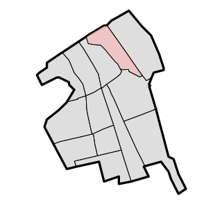
Ambt Delden is a former municipality in the Dutch province of Overijssel. It consisted of the countryside surrounding the city of Delden, which was a separate municipality.
Ambt Hardenberg is a former municipality in the Dutch province of Overijssel. It consisted of the countryside surrounding the city of Hardenberg, which was a separate municipality.
Ambt Ommen is a former municipality in the Dutch province of Overijssel. It consisted of the countryside surrounding the city of Ommen, which was a separate municipality.
Brederwiede is a former municipality in the Dutch province of Overijssel. It was created in a merger of Blokzijl, Giethoorn, Vollenhove, and Wanneperveen in 1973, and existed until it became a part of Steenwijk in 2001.
Stad Delden is a former municipality in the Dutch province of Overijssel. It consisted of the city of Delden. The surrounding countryside was part of Ambt Delden.

Zwollerkerspel is a former municipality in the province of Overijssel, Netherlands. It covered the countryside around the city of Zwolle. Zwollerkerspel was a separate municipality from 1802 until August 1, 1967, when it became a part of Zwolle, Hasselt, Heino, IJsselmuiden and Genemuiden.
Keppel is a former municipality in the Dutch province of Gelderland, consisting of the villages of Laag-Keppel and Hoog-Keppel. It existed until 1818, when it merged with Hummelo to form the new municipality of Hummelo en Keppel.

Loenen is a village in the Dutch province of Gelderland. It is located in the municipality of Apeldoorn, about 10 km southeast of that city.

Vessem, Wintelre en Knegsel was a municipality in the Dutch province of North Brabant. It was located west of Eindhoven, and covered the villages of Vessem, Wintelre and Knegsel.
Biert is a hamlet in the Dutch province of South Holland. It is located in the municipality of Nissewaard, about 3 km west of Spijkenisse.
Hofwegen is a hamlet in Molenlanden, which is a municipality in the Dutch province of South Holland. It is located on the south bank of the small river Graafstroom. It is now considered to be part of the village of Bleskensgraaf, which lies on the opposite bank.
Moerkapelle is a village in the Dutch province of South Holland. It is located about 6 km east of the city of Zoetermeer, in the municipality of Zuidplas.
Vrijenban is a neighborhood of Delft in the Netherlands province of South Holland. It is located on the northeast boundary of the historic city center of Delft. Prior to being merged into Delft, Vrijenban used to be a municipality in its own right.

Zevenhuizen is a small town in the Dutch province of South Holland. It is located about 12 km northeast of the city of Rotterdam.
References
- ↑ Ad van der Meer and Onno Boonstra, "Repertorium van Nederlandse gemeenten", KNAW, 2006. "KNAW > Publicaties > Detailpagina". Archived from the original on 2007-02-20. Retrieved 2009-12-03.
52°14′N6°17′E / 52.233°N 6.283°E
| | This Gelderland location article is a stub. You can help Wikipedia by expanding it. |