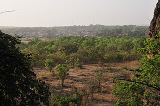
Capcir is a historical Catalan comarca of Northern Catalonia, now part of the French department of Pyrénées-Orientales. The capital of the comarca was Formiguera, and it borders the historical comarques of Conflent and Alta Cerdanya. Capcir is on a plateau, averaging 1500 metres above sea level, and allows passage between the high valleys of Aude and both the Spanish Cerdanya and French Cerdagne. It has traditionally been rural, but has developed considerably in last the forty years thanks to its tourist attractions. Capcir has two nicknames: little Siberia or little Canada. This gives an idea of the climate which can prevail during the winter. It is one the last places in Western Europe where the artic plant Ligularia sibirica can be found.
Skagit Valley Provincial Park is a provincial park in British Columbia, Canada, centred on the Skagit River and its tributaries. The park borders E. C. Manning Provincial Park in Canada and Ross Lake National Recreation Area and North Cascades National Park in the United States. It includes part of Ross Lake, a reservoir formed by a hydroelectric dam in Whatcom County, Washington.
Stuart River Provincial Park is a provincial park in British Columbia, Canada. It is located in two sections north and northwest of Vanderhoofalong the Stuart River southeast of Stuart Lake and the city of Fort St. James. The upper section is located at 54°13′20″N124°00′00″W and comprises c.7391 ha. while the lower, eastern section is centred at 54°03′00″N123°37′00″W and comprises c.3390 ha. and is within the Greater Prince George area. The upper site, which is located around the confluence of the Stuart and Nechako Rivers, includes the site of Chinlac, a Dakelh village whose inhabitants were massacred and enslaved by the Tsilhqot'in of Anahim Lake c. 1745.
The Alkali Lake Indian Band, also known as the Esketemc First Nation, is a First Nations government of the Secwepemc (Shuswap) people, located at Alkali Lake in the Cariboo region of the Central Interior of the Canadian province of British Columbia. It was created when the government of the then-Colony of British Columbia established an Indian Reserve system in the 1860s. It is one of three Secwepemc bands that is not a member of either the Shuswap Nation Tribal Council or the Northern Shuswap Tribal Council.
The Kluskus First Nation is the band government of the Lhoosk’uz, a Dakelh people whose main reserve located on the Chilcotin Plateau 130 km west of the city of Quesnel, British Columbia, Canada. The First Nation is a member of the Carrier-Chilcotin Tribal Council, which includes both Tsilhqot'in and Carrier (Dakelh) communities.

Niemodlin is a town in Opole County, Opole Voivodeship, Poland, with 6,911 inhabitants (2004).

Vélingara Department is one of the 45 departments of Senegal, one of the three making up the Kolda Region.
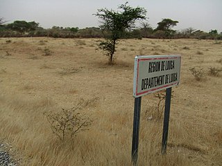
Louga Department is one of the 45 departments of Senegal, and one of the three which comprise the Louga Region.
Kaffrine Department is one of the 45 departments of Senegal, and is located in the Kaffrine Region, formerly part of the Kaolack Region.
Moriles is a town in the province of Córdoba. As of 2005 it had a population of 3,874. The municipality covers an area of about 20 km² and has a population density of about 194 inhabitants/km². The town is located about 65 km sosuth of the provincial capital, Córdoba, at an altitude of 375 m above sea level, at co-ordinates 37°26′0″N4°37′0″W.

Bérégadougou is a department or commune of Comoé Province in southern Burkina Faso. Its capital lies at the town of Bérégadougou. According to the 1996 census the department has a total population of 11,846.

Djibasso is a department or commune of Kossi Province in western Burkina Faso. Its capital lies at the town of Djibasso. According to the 1996 census the department has a total population of 46,674.
Dokuy or Dokui is a department or commune of Kossi Province in western Burkina Faso. Its capital lies at the town of Dokuy. According to the 1996 census the department has a total population of 25,305.

Didyr is a department or commune of Sanguié Province in central Burkina Faso. Its capital is the town of Didyr.
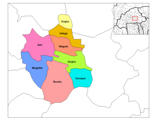
Salogo is a department or commune of Ganzourgou Province in central-eastern Burkina Faso. Its capital lies at the town of Salogo. According to the 2006 census, the department has a total population of 21,405.
The Nazko First Nation is a First Nations government of the Dakelh people in the north-central Interior of British Columbia. Its reserves are located around the community of Nazko, British Columbia, which is 120 km west of Quesnel and southwest of Prince George.

Bandheri is a town in Dhar district of Madhya Pradesh, India.

Figuig is a province in the Oriental Region of Morocco. Its capital is Bouarfa. It recorded a population of 138,325 in the 2014 Moroccan census, up from 129,430 in 2004.

Twifu Praso is a small town and is the district capital of Twifo/Heman/Lower Denkyira District of the Central Region.
The Leq' a: mel First Nation, formerly known as the Lakahahmen First Nation, is a First Nations band government whose community and offices are located in the area near Deroche, British Columbia, Canada, about 12 kilometres east of the District of Mission. They are a member government of the Sto:lo Nation tribal council, which is one of two tribal councils of the Sto:lo.