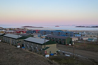
Frobisher Bay is an inlet of the Davis Strait in the Qikiqtaaluk Region of Nunavut, Canada. It is located in the southeastern corner of Baffin Island. Its length is about 230 km (140 mi) and its width varies from about 40 km (25 mi) at its outlet into the Davis Strait to roughly 20 km (12 mi) towards its inner end.
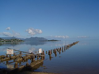
Kāneʻohe Bay, at 45 km2 (17 sq mi), is the largest sheltered body of water in the main Hawaiian Islands. This reef-dominated embayment constitutes a significant scenic and recreational feature along the northeast coast of the Island of Oʻahu. The largest population center on Kāneʻohe Bay is the town of Kāneʻohe.

Tivat is a town in Coastal region of Montenegro, located in the Bay of Kotor. As of 2011, its population was 9,367. Tivat is the centre of Tivat Municipality, which is the smallest municipality by area in Montenegro.

The Arabat Spit or Arabat Arrow is a barrier spit that separates the large, shallow, salty Syvash lagoons from the Sea of Azov. The spit runs between the Henichesk Strait in the north and the north-eastern shores of Crimea in the south. It is the largest of several spits of the Sea of Azov.

Algoa Bay is a maritime bay in the Eastern Cape, South Africa. It is located on the east coast, 683 kilometres (424 mi) east of the Cape of Good Hope.

Skadovsk is a port city on the Black Sea coast in Kherson Oblast, southern Ukraine. It serves as the administrative center of Skadovsk Raion and also hosts the administration of Skadovsk urban hromada, one of the hromadas of Ukraine. The city had a population of 16,969.
Harrington Bay is a bay in Washington County, Maine.
Narraguagus Bay is a bay in Washington County, Maine.
The Twin Islands are similarly shaped Arctic islands in the Qikiqtaaluk Region of Nunavut, Canada. They are located in central James Bay, 56 km (35 mi) north east of Akimiski Island, and 58 km (36 mi) west of Quebec. The group includes North Twin and South Twin islands.
Dovhyi Voinyliv is a village in Kalush Raion, Ivano-Frankivsk Oblast, Ukraine. Before World War II the village was part of Kałusz county in Stanisławów Voivodship, Second Republic of Poland. Dovhyi Voinyliv belongs to Verkhnia rural hromada, one of the hromadas of Ukraine.
Bush Island is a small, remote island in the Qikiqtaaluk Region of Nunavut, Canada. It is located in Hudson Strait, 9.5 mi (15.3 km) off the north end of Killiniq Island, separated by Port Harvey, a small bay. It measures 2.5 mi (4.0 km) long and 1.2 mi (1.9 km) wide. The elevation is approximately 152 m (499 ft) above sea level.

Voynyliv is a rural settlement in western Ukraine. Voynyliv is situated in Kalush Raion of Ivano-Frankivsk Oblast, approx. 100 km from Lviv. The closest city is Kalush to the west. The distance to the closest railway station in Kalush is 22 km and it is 42 km from Voynyliv to the city of Ivano-Frankivsk. Voinyliv hosts the administration of Voinyliv settlement hromada, one of the hromadas of Ukraine. Population: 2,601 .
Nuussuaq Peninsula is a mainland peninsula in northwestern Greenland, located at the northern end of Upernavik Archipelago, approximately 70 km (43 mi) to the south of Melville Bay. It is much smaller than its namesake in western Greenland.

Eliza Rocks is a chain of rocks lying between Desolation Island and Zed Islands off the north coast of Livingston Island in the South Shetland Islands, Antarctica and extending 1 km in west-northwest direction. The area was visited by early 19th century sealers operating from Blythe Bay, Desolation Island.
Inussulissuaq Island is a small uninhabited island in the Melville Bay region of the Upernavik Archipelago in Avannaata municipality in northwestern Greenland. The name of the island means "a large cairn" in the Greenlandic language.
Oleksiy Volodymyrovych Dovhyi is a Ukrainian professional footballer who plays as a defensive midfielder.

Lake Donuzlav, also referred to as Donuzlav Bay, is the deepest lake of Crimea and biggest in Chornomorske Raion. It is a protected landscape and recreational park of the Autonomous Republic of Crimea.
This page is based on this
Wikipedia article Text is available under the
CC BY-SA 4.0 license; additional terms may apply.
Images, videos and audio are available under their respective licenses.
