Downtown Flagstaff, Arizona sits in the western part of the city, and consists of several culturally-connected blocks. The city of Flagstaff has a downtown culture of local, independent stores inside historic buildings.

Downtown Flagstaff, Arizona sits in the western part of the city, and consists of several culturally-connected blocks. The city of Flagstaff has a downtown culture of local, independent stores inside historic buildings.
Flagstaff's historic downtown is a "narrow and slender" area between the Northern Arizona University (NAU) campus at its south and the Museum of Northern Arizona at the north. [1]

Architecturally, many of the buildings are historic, with stucco friezes; some stand out in the cityscape more than others, including the 1888 Babbitt Brothers building, the 1926 train station, and the Weatherford Hotel with its "grand two-story wraparound veranda and its sunroom". [1] The train station serves as a visitors center, remaining the heart of Flagstaff's economy after originally bringing prosperity in by the railroad; both of the city's train depots were restored in the 1990s. Paradis describes the main station, which is an example of Tudor Revival architecture, [a] as "probably the most prominent landmark in Flagstaff", [2] : 135–139 adding that it "has further been described as perhaps the most unique architectural piece in town". [2] : 146 Santa Fe Plaza, with the old depot, lies across the road a few hundred yards east of the visitors center/1926 station and includes a bronze sculpture of a railroad worker known as "Gandy Dancer" and an old locomotive. [2] : 146–153 [3]

A few blocks north of the train depots, turning west into East Aspen Avenue, is Heritage Square. [4] Before the square was built, it had been a dirt tract from the demolition of historic Flagstaff buildings, including the Empress Theater – this name is written across an amphitheater in the square. [2] : 168 Also on the square is a modern retail building that is a reconstruction of Flagstaff's original city hall, which had once sat a block south before being demolished in the 1970s. [2] : 169 Paradis describes the square as "a celebratory railroad-oriented theme park", which he suggest Santa Fe Plaza can also be seen as. [2] : 170 In human geography, he suggests that these are places designed by white males from a "perspective that cherishes the values of progress, technology, expansion, and economic growth"; he writes that while there are other elements of Flagstaff's heritage present (including rock strata of the Grand Canyon), the overwhelming theme is the Santa Fe railroad, reflecting Anglo-American expansionism and not representing the Native perspective. [2] : 168–172 Heritage Square's design was largely influenced by Jim Babbitt, a local history activist and another original Babbitt descendant, with Paradis also acknowledging that with a wider selection of urban architects, Flagstaff is a population that may embrace more diverse perspectives in its cultural representations. [2] : 171–178 When the city council bought the land from a broke developer in 1991, it was seen as an "opportunity to turn downtown into a beautiful area, something it [hadn't] been for the past 25 years". [2] : 176–177
The Babbitt Brothers Building from 1888, the city's first two-story building and a simplified Italianate architecture construction with "tall, arched windows and [a] heavy, bracketed cornice on its roofline", was restored to its original appearance in the 1990s after cladding applied in the 1950s and '60s hid the facade. [2] : 159–161 It is also a downtown landmark, in appearance and in its historic function as the anchor to the district's success: a department store, smaller businesses nearby relied on its appeal to catch customers already in the area, as well as being a familiar name and a community social fixture with nearly 100 years of trading. [2] : 161–163 It sits at the corner of North San Francisco Street and East Aspen Avenue, a few blocks directly north of the train depots (San Francisco Street bisects the railroad plazas) and just east on East Aspen Avenue from Heritage Square. [4] The demolition of part of the building revealed the Empress Theater's shell and was part inspiration for Heritage Square. [2] : 174–177
A block north of Heritage Square on the east side of downtown is the old Coconino County Courthouse. [5] Built when Coconino first became a county, this building has served as the political hub since 1895. Despite its importance in administering the second-largest county of the United States, it was "shoved aside" to a random city block during planning, as the grid for downtown had not considered institutional buildings, but was still "by far the most elaborate structure in Flagstaff". [2] : 192–194 It is an example of Romanesque Revival architecture, but the "small-town version", featuring "heavy masonry construction, cavernous window and door openings, an impressive square tower, [and] round-arched windows that reflect the Roman architecture of Europe", with the arched entryway "probably its most distinguishing architectural feature". [2] : 196–197 In 1956, a modern International Style addition to the building was added, which was contentious from the start not only in style but also for clashing in style with the rest of the city; it was replaced. [2] : 200–201
Just west from Heritage Square and across the intersection at Aspen Avenue and North Leroux Street is the Weatherford Hotel and Orpheum Theater. [6] The Orpheum originally had a Neoclassical facade before receiving modern upgrades that still remain, though retro in appearance in the 21st century, unlike other buildings downtown that have seen restoration. [2] : 191
Other 20th century styles in downtown include the Art Deco of the Federal Building on San Francisco Street. [2] : 208 At the edge of downtown, on the block southeast of the old Courthouse, [7] is "the closest thing to a skyscraper that can be found in Flagstaff"; it is five stories tall but impedes on the aesthetic of the rest of the area. [2] : 204, 211 Built in the early 1960s, it represents the end of Flagstaff's downtown development. [2] : 204

As a smaller city, Flagstaff maintains a "central business district that exists at a more human scale and [relies] more on independent local and regional business entrepreneurs" in its downtown area. [8] DK writes that "it is a lively, easy-going place with a good selection of bars and restaurants among the maze of old red-brick buildings". [1]
Many of the historic buildings of downtown contain cafés, thanks to the city's "lively café society", which DK attributes to the young student population from NAU. [1] On one side of the Weatherford Hotel is Charly's, a restaurant and bar housed in the hotel that is "a popular social venue" for NAU students and other residents, with the hotel itself only regaining popularity in the 1980s (after housing mentally disabled patients) when a café was opened on the first floor. In the 21st century, the building is a functional hotel again. [2] : 181–183 The Weatherford is "a centerpiece in the downtown district", [2] : 184 and the Orpheum next to it "represents a typical small-town theater located in the heart of downtown". [2] : 191 Originally a movie theater, the Orpheum no longer serves this function (the only movie theater in the city is a Harkins in East Flagstaff) [2] : 192 but is instead a traditional concert venue. [9]
Heritage Square is "one of Flagstaff's most popular public spaces" and contains an array of built-in links to the area's past. [2] : 168 Much of Flagstaff's downtown follows a similar cultural trend, with businesses and residents alike "increasingly applying themes and images to the landscape in an attempt to enhance the local sense of place". [2] : 179, 216–223 The downtown area is reflective of Flagstaff's culture, rather than economic industry; when the city was choosing sites for its visitors center, the citizens rejected anywhere that was not downtown, so that it would "reflect Flagstaff, not Walmart". [2] : 142

Flagstaff is the county seat of Coconino County, Arizona, in the southwestern United States. As of the 2020 United States census, the city's population was 76,831.

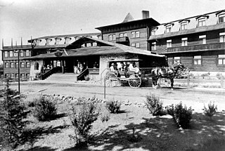
Grand Canyon Village is a census-designated place (CDP) located on the South Rim of the Grand Canyon, in Coconino County, Arizona, United States. Its population was 2,004 at the 2010 Census. Located in Grand Canyon National Park, it is wholly focused on accommodating tourists visiting the canyon. Its origins trace back to the railroad completed from Williams, to the canyon's South Rim by the Santa Fe Railroad in 1901. Many of the structures in use today date from that period. The village contains numerous landmark buildings, and its historic core is a National Historic Landmark District, designated for its outstanding implementation of town design.

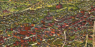
Downtown Phoenix is the central business district (CBD) of the City of Phoenix, Arizona, United States. It is in the heart of the Phoenix metropolitan area or Valley of the Sun. Phoenix, being the county seat of Maricopa County and the capital of Arizona, serves as the center of politics, justice and government on the local, state and federal levels. The area is a major center of employment for the region, with many financial, legal, and other national and international corporations housed in a variety of skyscrapers. Major arts and cultural institutions also call the area home. Downtown Phoenix is a center of major league sports activities, live concert events, and is an equally prominent center of banking and finance in Arizona. Regional headquarters for several major banks, including JP Morgan Chase, Wells Fargo, US Bank, Bank of America, Compass Bank and Midfirst Bank are all located within or close proximity to the area.

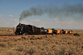
The Grand Canyon Railway is a heritage railroad which carries passengers between Williams, Arizona, and the South Rim of Grand Canyon National Park.

Flagstaff station is an Amtrak train station at 1 East Route 66 in Flagstaff, Arizona. The station, formerly an Atchison, Topeka and Santa Fe Railway depot, doubles as a visitor center and rental-car pickup and is located in downtown Flagstaff. Northern Arizona University is located nearby, as are the Lowell Observatory, Sunset Crater, the Walnut Canyon National Monument, ski resorts and other attractions. It is also the closest Amtrak station to Grand Canyon National Park.

Winslow station is an Amtrak train station at 501 East Second Street in Winslow, Navajo County, Arizona, United States. It is served daily by Amtrak's Southwest Chief between Chicago, Illinois and Los Angeles, California. The Santa Fe Depot and La Posada Hotel Harvey House compound are the centerpiece of the La Posada Historic District.

The Weatherford Hotel is a historic hotel in the downtown district of Flagstaff, Arizona. The hotel was established in 1897 by John W. Weatherford, and is located at 23 North Leroux Street, one block north of U.S. Route 66.

Grand Canyon Depot, also known as Grand Canyon Railroad Station, was constructed in 1909–10 for the Atchison, Topeka and Santa Fe Railway at the South Rim of the Grand Canyon, in what is now Grand Canyon National Park. It is one of three remaining railroad depots in the United States built with logs as the primary structural material. The station is within 330 feet (100 m) of the rim of the canyon, opposite the El Tovar Hotel, also built by the railroad. The depot is designated a National Historic Landmark, is listed the National Register of Historic Places, and is included in the Grand Canyon Village National Historic Landmark District.

Drake was an unincorporated community on the Verde River in Yavapai County, Arizona, United States, and a station on the BNSF Railway's Phoenix Subdivision. Drake is also the junction and western terminus of the Verde Canyon Railroad. Drake is the site of the old Hell Canyon Bridge, formerly used by US Route 89, and now on the National Register of Historic Places.

Charles Frederick Whittlesey (1867–1941) was an American architect best known for his work in the American southwest, and for pioneering work in reinforced concrete in California.

Lescher & Mahoney was an American architectural firm from Phoenix, Arizona.

The Mission Revival style was part of an architectural movement, beginning in the late 19th century, for the revival and reinterpretation of American colonial styles. Mission Revival drew inspiration from the late 18th and early 19th century Spanish missions in California. It is sometimes termed California Mission Revival, particularly when used elsewhere, such as in New Mexico and Texas which have their own unique regional architectural styles. In Australia, the style is known as Spanish Mission.

Interstate business routes are roads connecting a central or commercial district of a city or town with an Interstate bypass. These roads typically follow along local streets often along a former U.S. Route or state highway that had been replaced by an Interstate. Interstate business route reassurance markers are signed as either loops or spurs using a green shield shaped and numbered like the shield of the parent Interstate highway.

The Flagstaff Railroad Addition Historic District is significant because of its association with the Atchison, Topeka and Santa Fe Railway as well as U.S. Route 66. The original boundary was roughly bounded by Santa Fe RR tracks, Agassiz and Beaver Sts., Birch and Aspen Avenues. The district was expanded twice to add nine buildings along Phoenix Avenue from Beaver Street to San Francisco Avenue, and a building at 122 East Route 66.

Flagstaff is a city in, and the county seat of, Coconino County in northern Arizona, in the southwestern United States. Established as a modern settlement in 1876 and incorporated as a city in 1928, the land had previously been lived on by native peoples of the southwest, primarily the Sinagua. Mountaineer Antoine Leroux then traveled the area, with Edward Fitzgerald Beale following in his footsteps and establishing a trail through the city in the mid-1800s. With a local spring, a small settlement grew by the wagon road, and the town was dominated by the McMillan, Riordan, and Babbitt families. Focused on agricultural pursuits, these families constructed some historic red stone buildings that still stand today.
Riordan was a populated place situated in Coconino County, Arizona, United States. It has an estimated elevation of 7,316 feet (2,230 m) above sea level.

The late-Victorian-era Downtown of Los Angeles in 1880 was centered at the southern end of the Los Angeles Plaza area, and over the next two decades, it extended south and west along Main Street, Spring Street, and Broadway towards Third Street. Most of the 19th-century buildings no longer exist, surviving only in the Plaza area or south of Second Street. The rest were demolished to make way for the Civic Center district with City Hall, numerous courthouses, and other municipal, county, state and federal buildings, and Times Mirror Square. This article covers that area, between the Plaza, 3rd St., Los Angeles St., and Broadway, during the period 1880 through the period of demolition (1920s–1950s).