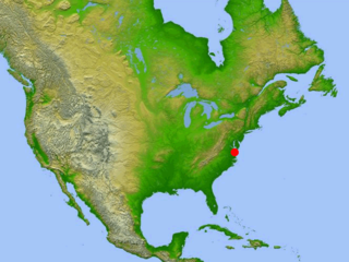
The Chesapeake Bay is the largest estuary in the United States. The Bay is located in the Mid-Atlantic region and is primarily separated from the Atlantic Ocean by the Delmarva Peninsula, including parts of the Eastern Shore of Maryland, the Eastern Shore of Virginia, and the state of Delaware. The mouth of the Bay at its southern point is located between Cape Henry and Cape Charles. With its northern portion in Maryland and the southern part in Virginia, the Chesapeake Bay is a very important feature for the ecology and economy of those two states, as well as others surrounding within its watershed. More than 150 major rivers and streams flow into the Bay's 64,299-square-mile (166,534 km2) drainage basin, which covers parts of six states, New York, Pennsylvania, Delaware, Maryland, Virginia, and West Virginia, and all of Washington, D.C.


Deale is a census-designated place (CDP) in Anne Arundel County, Maryland, United States. The population was 4,945 at the 2010 census. It has a scenic view of Chesapeake Bay and is popular with boaters. Sudley was listed on the National Register of Historic Places in 1973.

Shady Side is a census-designated place (CDP) in Anne Arundel County, Maryland, United States. The population was 5,803 at the 2010 census.

The Chesapeake Bay Retriever is a large breed of dog belonging to the retriever, gundog, and sporting breed groups. The breed was developed in the United States Chesapeake Bay area during the 19th century. Historically used by local market hunters to retrieve waterfowl, pull fishing nets, and rescue fishermen, it is today primarily a family pet and hunting companion, known for a bright and happy disposition; courage; willingness to work; alertness; intelligence; love of water; and hunting capabilities. The Chesapeake is a medium- to large-sized dog similar in appearance to the Labrador Retriever, but with a wavy coat.

The Chesapeake & Delaware Canal is a 14-mile (22.5 km)-long, 450-foot (137.2 m)-wide and 35-foot (10.7 m)-deep ship canal that connects the Delaware River with the Chesapeake Bay in the states of Delaware and Maryland in the United States.

The Chesapeake Bay impact crater is a buried impact crater, located beneath the mouth of Chesapeake Bay, United States. It was formed by a bolide that struck the eastern shore of North America about 35.5 ± 0.3 million years ago, in the late Eocene epoch. It is one of the best-preserved "wet-target" impact craters in the world.

The Chesapeake Bay Bridge–Tunnel is a 17.6-mile (28.3 km) bridge–tunnel that crosses the mouth of the Chesapeake Bay between Delmarva and Hampton Roads in the U.S. state of Virginia. It opened in 1964, replacing ferries that had operated since the 1930s. A major project to dualize its bridges was completed in 1999, and a similar project to dualize one of its tunnels is currently underway.

The Chesapeake Bay Bridge is a major dual-span bridge in the U.S. state of Maryland. Spanning the Chesapeake Bay, it connects the state's rural Eastern Shore region with the urban Western Shore, between Stevensville and the capital city of Annapolis. The original span, opened in 1952 and with a length of 4.3 miles (6.9 km), was the world's longest continuous over-water steel structure. The parallel span was added in 1973. The bridge is officially named the Gov. William Preston Lane Jr. Memorial Bridge after William Preston Lane Jr. who, as the 52nd Governor of Maryland, initiated its construction in the late 1940s finally after decades of political indecision and public controversy.

Mike Auldridge was an American Dobro player and a founding member of the bluegrass group The Seldom Scene. The New York Times described Auldridge as "one of the most distinctive dobro players in the history of country and bluegrass music while widening its popularity among urban audiences". He also worked as a graphic artist.

The Thomas Point Shoal Light, also known as Thomas Point Shoal Light Station, is a historic lighthouse in the Chesapeake Bay on the east coast of the United States, and the most recognized lighthouse in Maryland. It is the only screw-pile lighthouse in the bay which stands at its original site. The current structure is a 1½ story hexagonal wooden cottage, equipped with a foghorn as well as the light.

Anne Arundel County Public Schools is the public school district serving Anne Arundel County, Maryland. With over 80,000 students, the AACPS school system is the 4th largest in Maryland and the 39th largest in the United States. The district has over 5,000 teachers supporting a comprehensive curriculum from Pre-K through 12th grade.
The Captain John Smith Chesapeake National Historic Trail is a series of water routes in the United States extending approximately 3,000 miles (4,800 km) along the Chesapeake Bay, the nation's largest estuary, and its tributaries in Virginia, Maryland, Delaware, and in the District of Columbia. The historic routes trace the 1607–1609 voyages of Captain John Smith to chart the land and waterways of the Chesapeake. Along with the Star-Spangled Banner National Historic Trail, it is one of two water trails designated as National Historic Trails.

Matapeake State Park is a public recreation area on Chesapeake Bay occupying the site of a former ferry landing in Matapeake, Kent Island, Maryland. The landing served the state-owned Chesapeake Bay Ferry System before the Chesapeake Bay Bridge opened. The park is leased and managed by Queen Anne's County.
The Chesapeake Bay Gateways Network is a partnership program of the National Park Service and a system of over 150 parks, refuges, museums, historic communities and water trails in the Chesapeake Bay watershed. As a partnership program, it is not considered a Unit of the National Park System, but is managed by the National Park Service's Chesapeake Bay Office in Annapolis, Maryland, which also manages the Captain John Smith Chesapeake National Historic Trail and the Star-Spangled Banner National Historic Trail.
Franklin Manor-on-the-Bay is an unincorporated community or populated place located in Anne Arundel County, Maryland, United States at latitude 38.802 and longitude -76.515, at an elevation of 3 feet. Franklin Manor-on-the-Bay appears on the Deale U.S. Geological Survey Map. Anne Arundel County is in the Eastern time zone (UTC−5).

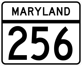
Maryland Route 256 is a state highway in the U.S. state of Maryland. The highway runs 5.28 miles (8.50 km) from MD 2 at Tracys Landing east to MD 468 in Shady Side. MD 256 connects the aforementioned communities with Deale on the shore of Herring Bay in southern Anne Arundel County. The highway was constructed at either end in the mid-1920s and completed through Deale in the early 1930s.
USS Helen Baughman (SP-1292) was a United States Navy patrol vessel in commission from 1917 to 1918.

The Emma Giles was the best known and most popular sidewheel passenger steamer that operated out of Baltimore, Maryland.

Maeve Fahey Kennedy McKean was an American public health official, human rights attorney, and academic. A member of the Kennedy family, she was a daughter of Maryland Lieutenant Governor Kathleen Kennedy Townsend and a granddaughter of Robert F. Kennedy.


