Related Research Articles
The Dix River is a 79.3-mile-long (127.6 km) tributary of the Kentucky River in central Kentucky in the United States. It begins in western Rockcastle County, about 5 miles (8 km) west of Mount Vernon. It flows generally northwest, in a tight meandering course, passing north of Stanford and east of Danville. Northeast of Danville it is impounded by the Dix Dam to form the Herrington Lake reservoir. The river flows about 2 miles (3 km) before joining the Kentucky River near High Bridge, about 20 miles (32 km) southwest of Lexington, in the region of the Kentucky River Palisades.
Cedar Creek, located in Lincoln County in south-central Kentucky, USA, is an 8-mile-long (13 km) tributary to the Dix River. Via the Dix, Kentucky and Ohio rivers, it is part of the Mississippi River watershed. In 2002, a section of Cedar Creek was impounded to form Cedar Creek Lake.
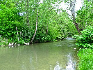
Silver Creek is a large creek that flows for approximately 40 miles (64 km) through Madison County, Kentucky, in the United States.
Hickman Creek is approximately 22 square mile tributary of the Kentucky River. Before flowing into the Kentucky River, Hickman Creek is formed from two separate creeks, East Hickman and West Hickman. West Hickman Creek flows through Fayette County, Kentucky and Jessamine County, Kentucky. Via the Kentucky and Ohio rivers, it is part of the Mississippi River watershed. Hickman Creek flows through 3 parks in Kentucky, Jacobson Park, Veterans Park and Belleau Woods Park.
Alpine Creek is a small river in San Mateo County, California. It flows about 5 miles (8 km), from its source near West Alpine Road about a mile southwest of Skyline Boulevard (CA 35), to its confluence with La Honda Creek to form San Gregorio Creek in La Honda at California State Route 84.
Dogwood Trace is a neighborhood in southwestern Lexington, Kentucky, United States. Its boundaries are South Elkhorn Creek to the north and east, Harrodsburg Road to the west, and the Jessamine County line to the south.

Ruddels Mills is an unincorporated community in Bourbon County, Kentucky. It was established by Captain Isaac Ruddell as a mill. The site is located where Hinkston Creek and Stoner Creek join to form the South Fork of the Licking River.
Drowning Creek is a stream located in Estill County, Kentucky, United States. It is a tributary of the Kentucky River.
Beefhide is an unincorporated community spanning across a county line between Letcher County and Pike County, Kentucky, United States.
Horse Creek is a creek a tributary of Goose Creek river in Clay County, Kentucky. It is 1.5 miles (2.4 km) upstream of Manchester on Goose at an altitude of 800 feet (240 m).
Defeated Creek is an unincorporated community in Letcher County, Kentucky, in the United States.
Stoner Creek is a stream in Bourbon and Clark counties, Kentucky, in the United States.
Taylors Creek is a stream in Campbell County, Kentucky, in the United States. A variant name is Duck Creek. It is a tributary of the Ohio River. Taylors Creek forms the border between the towns of Bellevue, Kentucky and Newport, Kentucky.
Sinking Creek is a stream in Jessamine County, Kentucky, in the United States.
Roundstone Creek is a stream located entirely within Rockcastle County, Kentucky.
Ruth is an unincorporated community in Pulaski County, in the U.S. state of Kentucky.
Pointer is an unincorporated community in Pulaski County, Kentucky.
Shaker Creek is a stream in the U.S. state of Kentucky. It is a tributary to the Kentucky River.
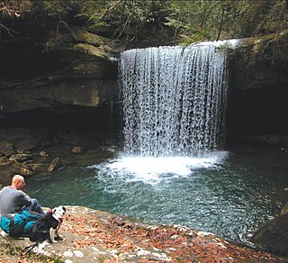
Dog Slaughter Falls is a 15 feet (4.6 m) to 20 feet (6.1 m) tall waterfall at the confluence of the Cumberland River and Dog Slaughter Creek, in the London Ranger District of the Daniel Boone National Forest in Whitley County, Kentucky. It is accessible via the Sheltowee Trace Trail, traveling downstream of Cumberland Falls, or via the Dog Slaughter Trail. The falls is rumored to be named for the drowning of unwanted pets, or the loss of hunting dogs to predatory wildlife.
Tates Creek is a stream in the U.S. state of Kentucky. It is a tributary to the Kentucky River.
References
- ↑ U.S. Geological Survey Geographic Names Information System: Dreaming Creek (Kentucky)
- ↑ Rennick, Robert M. (6 December 2013). From Red Hot to Monkey's Eyebrow: Unusual Kentucky Place Names. University Press of Kentucky. p. 10. ISBN 978-0-8131-4613-3.
37°47′07″N84°15′39″W / 37.785357°N 84.260764°W
| | This Madison County, Kentucky state location article is a stub. You can help Wikipedia by expanding it. |