Related Research Articles
The Little Kentucky River is a tributary of the Ohio River, approximately 37 miles (60 km) long, in northern Kentucky in the United States.
Chickasaw is a neighborhood in Louisville, Kentucky, USA. Its boundaries are West Broadway, 34th Street, Hale Avenue and Chickasaw Park.
Clifton Heights is a neighborhood two miles east of downtown Louisville, Kentucky USA. It was named because of its hilly location atop a ridge about 100 feet above the Ohio River floodplain, overlooking the adjacent community of Clifton. Though first planned in the 1890s as Summit Park, actual growth didn't begin until after World War I when automobiles made the hilly area accessible. Clifton Heights has had an African American presence since its founding, in 2000 they accounted for 21% of the population. Housing stock includes a variety of styles and time frames, from older shotgun houses and bungalows to suburban ranch homes built in the 1970s.
Hayfield-Dundee is a neighborhood in eastern Louisville, Kentucky. Its boundaries are Dundee Road, Emerson Avenue, Newburg Road, I-264, and Tremont Drive to the east. Prior to subdivision, much of the land had been part of the Hayfield Farm, owned by Dr. Charles Wilkens Short, a founding professor of the University of Louisville medical school.
Tygarts Creek is a tributary of the Ohio River in Carter and Greenup counties of northeastern Kentucky in the United States. It is 88 miles (142 km) long and drains an area of 339.6 square miles (880 km2). Via the Ohio, it is part of the watershed of the Mississippi River. Tygarts Creek is named for early Kentucky explorer Michael Tygart, who eventually drowned in the creek, somewhere near the mouth.

Harrods Creek is a neighborhood of Louisville, Kentucky centered near Harrods Creek at the intersection of River Road and Wolf Pen Branch Road. It is roughly bordered by the Ohio River to the west and US 42 to the east. Its ZIP code is 40027. Formerly an unincorporated community, it was designated a neighborhood of Louisville when the city merged with Jefferson County in 2003.

Riverside Gardens is a neighborhood of Louisville, Kentucky centered along Campground Road and Lees Lane. In 2007, the first stretch of the proposed 110-mile Louisville Loop bike and pedestrian trail was completed to Lees Lane in Riverside Gardens from Riverview Park. The project included a $2 million bridge over Mill Creek. The concrete trail is expected to be connected to Shawnee Park by spring of 2008. In the future, a wharf and riverfront park is planned for Riverside Gardens.
Lake Dreamland is a neighborhood of Louisville, Kentucky located along Campground Road and the Ohio River.
Springdale is a neighborhood in Louisville, Kentucky located along Brownsboro Road and Barbour Lane. The community is named for the family farm purchased by Laurence Young and his family in 1830, which was intersected by present-day Brownsboro Road, with the estate on the south side of the road. The Young family's Springdale farm today is the site of the Standard Country Club, as well as portions of Barbourmeade, Goose Creek and Brownsboro Farm. Though it is not a formally recognized neighborhood or district within Louisville, nor does it have official boundaries, older businesses and institutions in the community still retain the Springdale name, and the name was used to refer to the area until it was subdivided in the 1950s and '60s.
Longview is a neighborhood of Louisville, Kentucky located along Longview and Box Hill Lanes off River Road, and is near Route 60.
Goose Creek is a neighborhood of Louisville, Kentucky located where Goose Creek meets the Ohio River. It should not be confused with the adjacent incorporated city of Goose Creek.
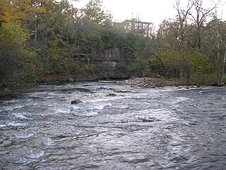
Beargrass Creek is the name given to several forks of a creek in Jefferson County, Kentucky. The Beargrass Creek watershed is one of the largest in the county, draining over 60 square miles (160 km2). It is fairly small, with an average discharge of 103 cubic feet per second at River Road in Louisville.

Fort Nelson, built in 1781 by troops under George Rogers Clark including Captain Richard Chenoweth, was the second on-shore fort on the Ohio River in the area of what is now downtown Louisville, Kentucky. Fort-on-Shore, the downriver and first on-shore fort, had proved to be insufficient barely three years after it was established. In response to continuing attacks from Native Americans and the threat of British attacks during the Revolutionary War, Fort Nelson was constructed between what is currently Main Street and the river, with its main gate near Seventh Street. It was named after Thomas Nelson Jr., then the governor of Virginia.
Silver Creek is a stream in southern Indiana in the United States. It drains a watershed of 97,442 acres (394.33 km2). The creek rises in Scott County and flows 38.0 miles (61.2 km), dropping 168 feet (51 m), before flowing into the Ohio River.
Perry Park is an unincorporated community, country club and golf resort in Owen County, Kentucky, near Owenton and Carrollton. It is located one hour southwest of Cincinnati, one hour northwest of Lexington, and forty-five minutes east of Louisville, and lies on the Kentucky River. The ZIP Code for Perry Park is 40363. Perry Park is located at coordinates 38°32′53″N84°59′59″W.
Wolf Creek is a neighborhood in far eastern Jefferson County, Kentucky, United States. Located directly east of Louisville along the Ohio River, Wolf Creek is bordered by Harrods Creek, Green Spring and Little Goose Creek. Its zip code is 40241. The neighborhood is quietly nestled amongst rolling hills and features heavy tree density, many small tributaries and natural wildlife.

Buchanan, originally named Mouth of Bear, is an unincorporated community located in Lawrence County, Kentucky, United States at the mouth of Bear Creek where it joins the Big Sandy River, five miles downstream from the mouth of Blaine Creek.
Goose Creek is a small stream in the Louisville Metro area of the U.S. state of Kentucky. It is a tributary of the Ohio River.
Lynn Camp Creek is a stream in Hart and LaRue counties, Kentucky, in the United States. It is a tributary of the Green River.
References
- ↑ U.S. Geological Survey Geographic Names Information System: Drennon Creek
- ↑ Collins, Lewis (1877). History of Kentucky. p. 339.
38°30′22″N85°01′44″W / 38.5061772°N 85.0288408°W
| | This Henry County, Kentucky state location article is a stub. You can help Wikipedia by expanding it. |