Eersel is a municipality and a town in southern Netherlands in the province of North Brabant. Eersel is situated in the Campine (Kempen) area.
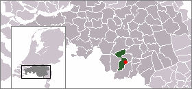
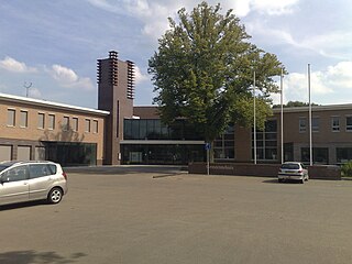
Steensel is a village on the Gender stream in the municipality of Eersel, North Brabant, the Netherlands. Steensel is part of the Acht Zaligheden, along with Eersel, Knegsel, Duizel, Wintelre, Netersel, Hulsel en Reusel. In 2007, Steensel had 1,376 inhabitants.
Vlijmen is a town in the Dutch province of North Brabant. It is located in the municipality of Heusden, about 6 km west of 's-Hertogenbosch.

Hei- en Boeicop is a small village in the Dutch province of Utrecht. Part of the municipality of Vijfheerenlanden, it lies about 9 km south of IJsselstein. The statistical area "Hei- en Boeicop", which includes the surrounding countryside, has a population of around 940.

Dodewaard is a town in the Dutch province of Gelderland. It is a part of the municipality of Neder-Betuwe, and lies about 7 km south of Wageningen.
Borkel en Schaft is a former municipality in the Netherlands, consisting of the villages of Borkel and Schaft. It was a separate municipality until 1934. The area is now part of the municipality of Valkenswaard. The spoken language is Kempenlands.
Obbicht en Papenhoven is a former municipality in the Dutch province of Limburg. It consisted of the villages Obbicht and Papenhoven, located on the River Meuse about 8 km northwest of Sittard.

Roggel is a village in the Dutch province of Limburg. It is located in the municipality of Leudal.
Huisseling en Neerloon is a former municipality in the Dutch province of North Brabant. It covered the villages of Huisseling and Neerloon.
Oploo, Sint Anthonis en Ledeacker was a municipality in the Dutch province of North Brabant. It was created in 1821, in a merger of Oploo and Sint Anthonis en Ledeacker. The municipality existed until 1994, when it became part of a larger municipality St. Anthonis.
Udenhout is a village and a former municipality in the Dutch province of North Brabant. It is located northeast of Tilburg, north of Berkel-Enschot and south of the National Parc Loonse en Drunense Duinen.
Vlierden is a village in the Dutch province of North Brabant. It is located in the municipality of Deurne, about 20 km east of Eindhoven.
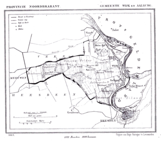
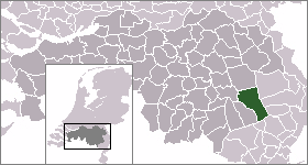
Wijk en Aalburg is a village in the Dutch province of North Brabant. It is located in the municipality of Aalburg, about 15 km northwest of 's-Hertogenbosch.
Knegsel is a village in the municipality of Eersel in the province of North Brabant, the Netherlands. Knegsel is part of the Acht Zaligheden, like Eersel, Duizel, Steensel, Wintelre, Netersel, Hulsel en Reusel.

Wintelre is a village in the municipality of Eersel in the province of North Brabant, the Netherlands. Wintelre is part of the Acht Zaligheden, like Eersel, Duizel, Steensel, Knegsel, Netersel, Hulsel en Reusel.

Korcabulaq is a village in the Lachin Rayon of Azerbaijan.

Stolec is a village in the administrative district of Gmina Złoczew, within Sieradz County, Łódź Voivodeship, in central Poland. It lies approximately 8 kilometres (5 mi) south-east of Złoczew, 26 km (16 mi) south of Sieradz, and 71 km (44 mi) south-west of the regional capital Łódź.
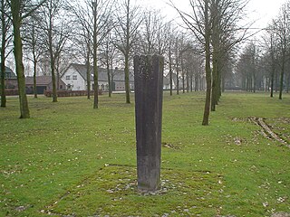
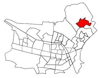
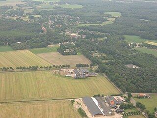
Heers is a hamlet in the south of the municipality of Veldhoven in the province of North Brabant, the Netherlands. Most of the buildings are concentrated around a town square with trees. At this town square is a chapel from 1990 located. There is also a monument, erected in 1966 for the local agricultural consolidation project. Heers has a long history. The hamlet is mentioned in books from the Middle Ages. Also, archaeological artefacts from the Bronze Age and the Roman Empire have been unearthed near the hamlet.
The Rural Municipality of Strathclair is a former rural municipality (RM) in the Canadian province of Manitoba. It was originally incorporated as a rural municipality on December 22, 1883. It ceased on January 1, 2015, as a result of its provincially mandated amalgamation with the RM of Shoal Lake to form the Rural Municipality of Yellowhead.


