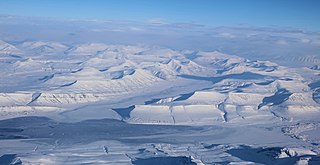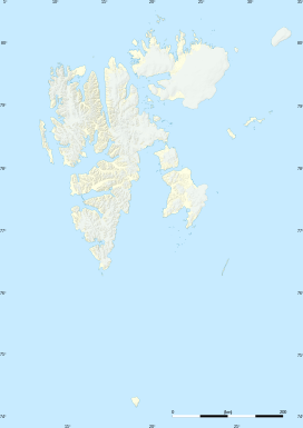
Edgeøya, anglicised as Edge Island, is a Norwegian island located in southeast of the Svalbard archipelago; with an area of 5,073 square kilometres (1,960 sq mi), it is the third-largest island in this archipelago. An Arctic island, it forms part of the Søraust-Svalbard Nature Reserve, home to polar bears and reindeer. An ice field covers its eastern side. The island takes its name from Thomas Edge, an English merchant and whaler. It is seldom visited today and development of tourist facilities is forbidden by law because of its nature reserve status.

Recherche Fjord is a small fjord on the south side of Bellsund, Spitsbergen. The glacier Recherchebreen debouches into the fjord from south, and Renardbreen from west.

Adventfjorden is a 7 km long and 4 km wide bay running south-eastwards from the southern side of Isfjorden, on the west coast of Spitsbergen in Svalbard. The name represents a corruption of Adventure Bay - probably named after the Hull-built whaleship Adventure, which operated in Isfjorden in 1656. The fjord was originally known as Klass Billen Bay. At the head of Adventfjorden is Adventdalen.
Ryke Yseøyane is a group of several small islands off the east coast of the island of Edgeøya in Svalbard, Norway. The islands are named after the Dutch whaler Ryke Yse of Vlieland, who discovered them about 1640–1645. The group was first marked by Hendrick Doncker, of Amsterdam, in 1663. Two Norwegian polar bear hunters wintered on Ryke Yseøyane for two subsequent winters in 1967–1969. During the second winter, one of them was lost in drifting ice. They are part of the Southeast Svalbard Nature Reserve.

Wedel Jarlsberg Land is the land area between Van Keulenfjorden and Hornsund on the southwestern part of Spitsbergen, Svalbard. The area is largely covered with glaciers, and is completely within the Sør-Spitsbergen National Park.

Torell Land is a land area at the southeast part of Spitsbergen, Svalbard. It is named after Otto Martin Torell. Two glaciers, Hornbreen and Hambergbreen, divide Torell Land from Sørkapp Land.

Grøndalen is a valley in Nordenskiöld Land at Spitsbergen, Svalbard. It has a length of about 19 kilometers. The valley stretches westwards from the mountain pass Grøndalspasset, and debouches into Grønfjorden, at the eastern side of the fjord. The river Grøndalselva flows through the valley.
Semmeldalen is a valley in Nordenskiöld Land at Spitsbergen, Svalbard. It has a length of about 8 kilometers, and is a tributary valley to Reindalen. The river Semmeldalselva flows through the valley. At the eastern side of the valley is the slope Høgsnythallet and the mountain Høgsnyta. The valley is partly included in the Nordenskiöld Land National Park.
Berzeliusdalen is a valley in Nordenskiöld Land at Spitsbergen, Svalbard. It has a length of about 16 kilometers, stretching from the mountain pass Skardalspasset down to the northern side of Van Mijenfjorden. The valley is named after Swedish chemist Jöns Jacob Berzelius. The river Berzeliuselva flows through the valley.
Recherchebreen is a glacier in Wedel Jarlsberg Land at Spitsbergen, Svalbard. The glacier has a length of about 16 kilometers (9.9 mi). It is located in a valley between Martinfjella and Observatoriefjellet, and debouches into Recherche Fjord. Among its tributary glaciers are Foldnutfonna, Varderyggfonna, Dollfusbreen, Ramondbreen and Bjørnbreen.
Dunderbukta is a bay in Wedel Jarlsberg Land at Spitsbergen, Svalbard. It has a width of approximately 3.5 kn, and is located between the headlands of Tunodden and Ispynten.
Foldnutane is a mountain in Wedel Jarlsberg Land at Spitsbergen, Svalbard. It has a length of about 2.5 kilometers, with two peaks of 698 and 658 m.a.s.l. respectively, and is located between Dunderdalen and the Recherchebreen glacier complex.
Qvigstadfjellet is a mountain in Nordenskiöld Land at Spitsbergen, Svalbard. It is named after Norwegian philologist and politician Just Knud Qvigstad. The mountain reaches a height of 770 m.a.s.l. It is located between the valley of Orustdalen and the glacier of Vestre Grønfjordbreen, south of Aldegondabreen.
Erdmannbreen is a glacier in Nordenskiöld Land at Spitsbergen, Svalbard. It is named after Swedish geologist Axel Joachim Erdmann. The glacier has a length of about six kilometers, and is surrounded by the mountains of Malmberget, Ytterdalsgubben and Kosterfjellet. The river of Ytterdalselva originates from Erdmannbreen and flows through the valley of Ytterdalen to the bay of Van Muydenbukta.

Ytterdalssåta is a mountain in Nordenskiöld Land at Spitsbergen, Svalbard. It has a height of 598 m.a.s.l. and is located between the plain of Lågnesflya and the valley of Ytterdalen. The mountain pass of Ytterskaret separates Ytterdalssåta from the mountain of Skarkampen further north.
Skarkampen is a mountain in Nordenskiöld Land at Spitsbergen, Svalbard. It has a height of 621 m.a.s.l. and is located between the plain of Lågnesflya and the valley of Ytterdalen. The mountain pass of Ytterskaret separates Skarkampen from the mountain of Ytterdalssåta further south.
Linnébreen is a glacier in Nordenskiöld Land at Spitsbergen, Svalbard. It is named after Swedish botanist Carl Linnaeus. The glacier has a length of about 3.5 kilometers, and flows from the mountain of Systemafjellet towards the valley of Linnédalen. It is proximate to the mountain of Christensenfjella.
Kvitskarvbreen is a glacier in Nathorst Land at Spitsbergen, Svalbard. It has a length of about 8.5 kilometers, and extend northwestwards from the mountain of Kvitskarvet to the valley of Bromelldalen. The glaciers of Lundbreen, Juvbreen and Zimmerbreen are all tributaries to Kvitskarvbreen.
Steenstrupdalen is a valley in Nathorst Land at Spitsbergen, Svalbard. It is named after Danish geologist Knud Johannes Vogelius Steenstrup. The valley is surrounded by the mountains of Otto Pettersonfjellet, Marlowfjellet and Brogniartfjella. The glaciers of Sysselmannbreen and Steenstrupbreen end up into the valley.
Davisdalen is a valley in Nathorst Land at Spitsbergen, Svalbard. It is named after American geomorphologist William Morris Davis. The valley has a length of about 5.5 kilometers, extending from the mountain ridge of Mjellegga southwards down to Davisodden, at the northern side of Van Keulenfjorden. A tributary valley to Davisdalen is Wittrockdalen.


