
Darrang is an administrative district in the state of Assam in India. The district headquarters are located at Mangaldoi. The district occupies an area of 1585 km2.

Nagaon district is an administrative district in the Indian state of Assam. At the time of the 2011 census it was the most populous district in Assam, before Hojai district was split from it in 2016.

Sonitpur district [Pron: ˌsə(ʊ)nɪtˈpʊə or ˌʃə(ʊ)nɪtˈpʊə] is an administrative district in the state of Assam in India. The district headquarters is located at Tezpur.

The Dooars or Duars are the alluvial floodplains in eastern-northeastern India that lie south of the outer foothills of the Himalayas and north of the Brahmaputra River basin. This region is about 30 km (19 mi) wide and stretches over about 350 km (220 mi) from the Teesta River in West Bengal to the Dhansiri River in Assam. The region forms the gateway to Bhutan. It is part of the Terai-Duar savanna and grasslands ecoregion.

Udalguri district (Pron:ˌʊdʌlˈgʊəri), also known as Odalguri, is a district in the Bodoland Territorial Region of the state of Assam in Northeastern India. Udalguri town is the headquarters of the district.
Khoirabari is a town in Udalguri district in the Indian state of Assam. Khoirabari serves as the Sub-divisional headquarters of Khoirabari Sub-division. The total geographical area of town is 56.93 hectares. Khoirabari Town has a total population of 873 peoples, out of which male population is 443 while female population is 430. Literacy rate of Khoirabari town village is 80.64% out of which 85.10% males and 76.05% females are literate.
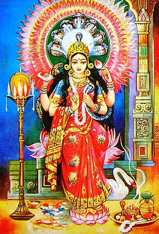
Ojapali is a traditional shamanistic type of indigenous folk dance from Assam in the northeastern region of India. Ojapali is believed to have evolved from Kathakata tradition and is performed in a group; it is believed to be one of the oldest art forms of Assam. Originally evolved in the Kamata state the western and northern part of river Brahmaputra later limited to Darrang area under the patronisation of Darrangi King Dharmanarayana. The repertoire of this performance consists of songs, dialogues, gesture, improvised acting and dramatisation etc. The group consists of an Oja, who leads the performance and four or five palies, who supplement the performance with continuously playing cymbal. Among the Palies Daina pali who stand on the right-hand side of the Oja is the active one and he and Oja take the performance forward. Many believe that Shankardev took inspiration from Ojapali to create his Ankiya Bhaona. Moreover he also created his own Sattriya Ojapali. Generally Darrangi Suknanni Ojapali sings the lyrics written by Sukabi Narayanadeva in Padmapurana. Padma Purana covers the story of serpent goddess Maroi(manasa devi). Ojapali is associated with Shakti Puja, including the deities manasa, kali, durga, kesikhaiti, kakogoshani etc.

Namkhola is a popular region in Khairabar tehsil, combined villages Bah Molla and Athiyabari in Darrang district, Assam, India. It is one of the fastest growing market place in north-western part of Darrang district.
Dangari is a village in Saikhowa Tehsil in Tinsukia District of Assam State, India. It is located 34 km towards East from District headquarters Tinsukia. 28 km from Saikhowa. 489 km from State capital Dispur. Dangari is surrounded by Sadiya Tehsil towards North, Hapjan Tehsil towards South, Saikhowa Tehsil towards west, Namsai Tehsil towards East.
Sipajhar is a small towns in Darrang district of Assam, India. It is around 50 km away from Dispur, capital city of Assam. The district headquarters of Mangaldoi is around 15 km from Sipajhar. National Highway 15 (India) goes through the town.
Channighat is a village panchayat in Narsingpur Tehsil in Cachar district of Assam State, India. It is located 39 km (24 mi) south of Silchar, 31 km (19 mi) from Narsingpur and 245 km (152 mi) from the state capital at Dispur.
Dholai is a village in Narsingpur Tehsil in Cachar District of Assam State, India. It is located 30 km towards South from District headquarters Silchar. 22 km from Narsingpur
Atul Chandra Barua was the 46th president of Asam Sahitya Sabha and a prominent name in the modern Assamese literature. He was an ACS officer and an Assamese writer. He worked for the cause of Darrangi culture and was conferred with the title "Darrang Ratna".

Dr Zoii Nath Sarmah is an Indian politician who has served as MLA from the Sipajhar constituency in Assam from 1991 to 2001 from Asom Gana Parishad ticket and he had joined Indian National Congress on 2016 and contested from Sipajhar constituency.
Charul Kora is a small scattered rural village in the Sivasagar tehsil, Sivasagar district, Assam state, India. In the census and other sources it is qualified as No.2 in order to distinguish it from the nearly homonymous village of Chaul Kora (No.1) in the same district, about 8 km to the southwest.
Chaul Kora or Chaulkara is a small rural village in the Sivasagar tehsil, Sivasagar district, Assam state, India. In the census and other sources it is qualified as No.1 in order to distinguish it from the nearly homonymous village of Charul Kora (No.2) in the same district, about 8 km to the northeast.
Khar-Khori or Khar Khori is a tiny village in the Sivasagar tehsil, Sivasagar district, Assam state, India. It is located about 330 km east by northeast of Dispur, 20 km west of Sivasagar, and 5 km southeast of the Brahmaputra river. Its PIN is 785640.

Borokalia Nashkara is a revenue village under South Salmara in Dhudri district. There are several other small villages associated with this village. A revenue village consisting of about 10 small villages. This also covered the Nashkara Gaon Panchayat. The distance from Nashkara village to the state capital Dispur is around 177 km. The state capital of Lucknow is different from Nashkara and is 245.5 km. Nearby prosperous capitals include Silong 184.6 km, Gangtok 213.7 km, Agartala 261.9 km.

Bhuragaon-kharupetia bridge is a 7.63-kilometre-long (4.74 mi) proposed concrete road bridge on National Highway-715A (NH 715A) over the Brahmaputra River in Assam. It will connect Kharupetia in Darrang district on the northern bank with Bhuragaon in Morigaon District on the southern bank.


