Related Research Articles

In geography, an oasis is a fertile land in a desert or semi-desert environment. Oases also provide habitats for animals and plants.

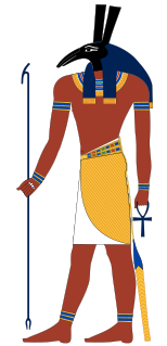
Set is a god of deserts, storms, disorder, violence, and foreigners in ancient Egyptian religion. In Ancient Greek, the god's name is given as Sēth (Σήθ). Set had a positive role where he accompanies Ra on his barque to repel Apep, the serpent of Chaos. Set had a vital role as a reconciled combatant. He was lord of the Red Land, where he was the balance to Horus' role as lord of the Black Land.

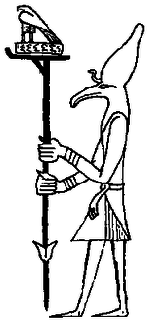
Ash was the ancient Egyptian god of oases, as well as the vineyards of the western Nile Delta and thus was viewed as a benign deity. Flinders Petrie in his 1923 expedition to the Saqqara found several references to Ash in Old Kingdom wine jar seals: "I am refreshed by this Ash" was a common inscription.

The Siwa Oasis is an urban oasis in Egypt between the Qattara Depression and the Great Sand Sea in the Western Desert, 50 km (30 mi) east of the Libyan border, and 560 km (348 mi) from Cairo. About 80 km (50 mi) in length and 20 km (12 mi) wide, Siwa Oasis is one of Egypt's most isolated settlements with about 33,000 people, mostly Berbers, who developed a unique and isolated desert culture and a language called Siwi; they are also fluent in the Egyptian dialect of Arabic which is called "Masry" meaning Egyptian.
Ha, in ancient Egyptian religion, was a god of the Western Desert & the fertile oasis of Western Desert of Egypt. He was associated with the Duat and pictured as a man wearing the hieroglyph symbol for desert hills on his head.

Dakhla Oasis, translates to the inner oasis, is one of the seven oases of Egypt's Western Desert. Dakhla Oasis lies in the New Valley Governorate, 350 km (220 mi.) from the Nile and between the oases of Farafra and Kharga. It measures approximately 80 km (50 mi) from east to west and 25 km (16 mi) from north to south.

The Thebaid or Thebais was a region in ancient Egypt, comprising the 13 southernmost nomes of Upper Egypt, from Abydos to Aswan.

El-Wahat el-Bahariya or el-Bahariya ; is a depression and a naturally rich oasis in the Western Desert of Egypt. It is approximately 370 km away from Cairo. The roughly oval valley extends from northeast to southwest, has a length of 94 km, a maximum width of 42 km and covers an area of about 2000 km².

The Kharga Oasis "the outer"; Coptic: (ϯ)ⲟⲩⲁϩ `ⲛϩⲏⲃ, (ϯ)ⲟⲩⲁϩ `ⲙⲯⲟⲓ (Di)Wah Ēnhib, "Oasis of Hib", (Di)Wah Ēmpsoy, "Oasis of Psoi") is the southernmost of Egypt's five western oases. It is located in the Western Desert, about 200 km to the west of the Nile valley. "Kharga" or "El Kharga" is also the name of a major town located in the oasis, the capital of New Valley Governorate. The oasis, which was known as the 'Southern Oasis' to the Ancient Egyptians and Oasis Magna to the Romans, is the largest of the oases in the Libyan desert of Egypt. It is in a depression about 160 km long and from 20 km to 80 km wide. Its population is 67,700 (2012).

The Theban Triad is a triad of Egyptian gods most popular in the area of Thebes, Egypt.

The Farafra depression is a 980 km2 (380 sq mi) geological depression, the second biggest by size in Western Egypt and the smallest by population, near latitude 27.06° north and longitude 27.97° east. It is in the large Western Desert of Egypt, approximately midway between Dakhla and Bahariya oases.

Egyptians speak a continuum of dialects. The predominant dialect in Egypt is Egyptian Colloquial Arabic or Masri/Masry, which is the vernacular language. Literary Arabic is the official language and the most widely written. The Coptic language is used primarily by Egyptian Copts and it is the liturgical language of Coptic Christianity.

The Faiyum Oasis is a depression or basin in the desert immediately to the west of the Nile south of Cairo in Egypt. The extent of the basin area is estimated at between 1,270 km2 (490 mi2) and 1,700 km2 (656 mi2). The basin floor comprises fields watered by a channel of the Nile, the Bahr Yussef, as it drains into a desert hollow to the west of the Nile Valley. The Bahr Yussef veers west through a narrow neck of land north of Ihnasya, between the archaeological sites of El Lahun and Gurob near Hawara; it then branches out, providing rich agricultural land in the Faiyum basin, draining into the large saltwater Lake Moeris. The lake was freshwater in prehistory but is today a saltwater lake. It is a source for tilapia and other fish for the local area.

Seheruibre Padibastet better known by his Hellenised name Petubastis III was a native ancient Egyptian ruler, who revolted against Persian rule.

Marmarica in ancient geography was a littoral area in Ancient Libya, located between Cyrenaica and Aegyptus. It corresponds to what is now the Libya and Egypt frontier, including the towns of Bomba, Timimi, Tobruk, Acroma, Bardiya, As-Salum, and Sidi Barrani. The territory stretched to the far south, encompassing the Siwa Oasis, which at the time was known for its sanctuary to the deity Amun. The eastern part of Marmarica, by some geographers considered a separate district between Marmarica and Aegyptus, was known as Libycus Nomus. In late antiquity, Marmarica was also known as Libya Inferior, while Cyrenaica was known as Libya Superior.

Baris is an oasis in Egypt. It contains the ancient Egyptian temple of Dosh.

The Western Desert of Egypt is an area of the Sahara that lies west of the river Nile, up to the Libyan border, and south from the Mediterranean sea to the border with Sudan. It is named in contrast to the Eastern Desert which extends east from the Nile to Red Sea. The Western Desert is mostly rocky desert, though an area of sandy desert, known as the Great Sand Sea, lies to the west against the Libyan border. The desert covers an area of 680,650 km2 (262,800 sq mi) which is two-thirds of the land area of the country. Its highest elevation is 1,000 m (3,300 ft) in the Gilf Kebir plateau to the far south-west of the country, on the Egypt-Sudan-Libya border. The Western Desert is barren and uninhabited save for a chain of oases which extend in an arc from Siwa, in the north-west, to Kharga in the south. It has been the scene of conflict in modern times, particularly during the Second World War.

Balat, is a small town in the New Valley Governorate, Egypt. Its population was estimated at 3,700 people in 2006.
References
- ↑ Margaret Bunson, Encyclopedia of Ancient Egypt (Infobase Publishing, 2014), p. 284.