
A windmill is a structure that converts wind power into rotational energy using vanes called sails or blades, by tradition specifically to mill grain (gristmills), but in some parts of the English-speaking world, the term has also been extended to encompass windpumps, wind turbines, and other applications. The term wind engine is also sometimes used to describe such devices.

Cohocton is a village in Steuben County, New York, United States. The population was 838 at the 2010 census. The name is derived from an Iroquois phrase for "log in the water."
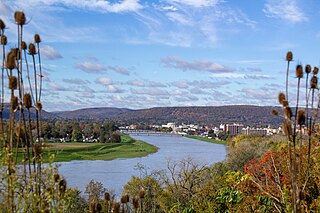
Cohocton is a town in Steuben County, New York, United States. The population was 2,268 at the 2020 census. The town contains a village, also called Cohocton and is located in the northwestern part of the county.
The Chemung River is a tributary of the Susquehanna River, approximately 46.4 miles (74.7 km) long, in south central New York and northern Pennsylvania in the United States. It drains a mountainous region of the northern Allegheny Plateau in the Southern Tier of New York. The valley of the river has long been an important manufacturing center in the region but has suffered a decline in the late 20th century.
The Cohocton River, sometimes referred to as the Conhocton River, is a 58.5-mile-long (94.1 km) tributary of the Chemung River in western New York in the United States. Via the Chemung River, it is part of the Susquehanna River watershed, flowing to Chesapeake Bay. The name "Cohocton" is derived from an Iroquois term, Ga-ha-to, meaning "log floating in the water" or "trees in the water".

The United Kingdom is the best location for wind power in Europe and one of the best in the world. The combination of long coastline, shallow water and strong winds make offshore wind unusually effective.

New York State Route 415 (NY 415) is a state highway located entirely within Steuben County, New York, in the United States. It is a 42.83-mile (68.93 km) north–south trunk road that parallels in part, the Cohocton River, Interstate 86 (I-86) and I-390. The southern terminus of the route is at an intersection with NY 414 in the city of Corning. Its northern terminus is at a junction with NY 15 and NY 21 south of the village of Wayland. NY 415 serves several villages bypassed by the Southern Tier Expressway and I-390, such as Bath and Cohocton. The road also runs concurrent with New York State Bicycle Route 17 from its southern terminus to County Route 70A (CR 70A) in Avoca.

Wind power is the fastest-growing renewable energy technology in Scotland, with 11,482 megawatts (MW) of installed wind power capacity by Q1 2023. This included 9,316 MW from onshore wind in Scotland and 2,166 MW of offshore wind generators.

New York State Route 371 (NY 371) is a north–south state highway in Steuben County, New York, in the United States. It runs for 4.83 miles (7.77 km) from an intersection with NY 415 in the village of Cohocton to a junction with NY 21 in the town of Cohocton. NY 371 follows the Cohocton River and the main line of the B&H Rail Corporation for virtually its entire length. Most of the route passes through rural areas located inside of a valley surrounding the river.

The Hepburn Wind Project is a wind farm built and owned by Hepburn Wind, a community co-operative, and supported by the Victorian Government. The location of the project is Leonards Hill, 10 kilometres (6.2 mi) south of Daylesford, Victoria, north-west of Melbourne, Victoria. It comprises two individual 2.05 MW wind turbines supplied by REpower System AG which are projected to produce enough energy for 2,300 households when the wind is blowing, almost as many houses are in the twin-towns of Daylesford and Hepburn Springs.
There are a number of wind power projects in the state of Maine, totaling more than 900 megawatts (MW) in capacity. In 2020 they were responsible for 24% of in-state electricity production. In 2019, Maine had more wind capacity than the other five New England states combined, at 923 MW.
New York has 2,192 MW of installed wind power capacity as of 2022. Most of New York's wind power is located in upstate New York as onshore wind farms. New York has set a goal of developing 9,000 MW of offshore installed wind power capacity by 2035 that will power an estimated 6 million homes. As of October 2022, New York has five offshore wind farms in development with approximately 4,300 MW installed capacity.

As of May 2024, wind power in the Netherlands has an installed capacity of 11,611 MW, 40.9% of which is based offshore. In 2022, the wind turbines provided the country with 18.37% of its electricity demand during the year. Windmills have historically played a major part in the Netherlands by providing an alternative to water driven mills.

The Dutch Hill/Cohocton Wind Farm is a 125 Megawatt wind farm in Cohocton, New York. It uses 50 2.5 MW turbines of the Clipper "Liberty" type, which were the largest found in the United States when they were put up for sale. The wind farm provides power for about 50,000 Northeastern homes. The wind farm is located in Steuben County. It was installed in 2008 and was developed and operated by First Wind.
The great majority of wind turbines around the world belong to individuals or corporations who use them to generate electric power or to perform mechanical work. As such, wind turbines are primarily designed to be working devices. However, the large size and height above surroundings of modern industrial wind turbines, combined with their moving rotors, often makes them among the most conspicuous objects in their areas. A few localities have exploited the attention-getting nature of wind turbines by placing them on public display, either with visitor centers on their bases, or with viewing areas farther away. The wind turbines themselves are generally of conventional horizontal-axis, three-bladed design, and generate power to feed electrical grids, but they also serve the unconventional roles of technology demonstration, public relations, and education.