Herkimer County is a county in the U.S. state of New York. As of the 2020 census, the population was 60,139. Its county seat is Herkimer. The county was created in 1791 north of the Mohawk River out of part of Montgomery County. It is named after General Nicholas Herkimer, who died from battle wounds in 1777 after taking part in the Battle of Oriskany during the Revolutionary War. The county is part of the Mohawk Valley region of the state.

Frankfort is the capital of the U.S. state of Kentucky and the seat of Franklin County. It is a home rule-class city. The population was 28,602 at the 2020 census, making it the thirteenth-most populous city in Kentucky. Located along the Kentucky River, Frankfort is the principal city of the Frankfort, Kentucky Micropolitan Statistical Area, which includes all of Franklin and Anderson counties.

Franklin County is a county located in the U.S. state of Kentucky. As of the 2020 census, the population was 51,541, making it the second-least populous capital county in the United States after Hughes County, South Dakota. Its county seat is Frankfort, the state capital. The county was formed in 1795 from parts of Woodford, Mercer and Shelby counties, and was named after the American inventor and statesman Benjamin Franklin. Franklin County is part of the Frankfort, Kentucky Micropolitan Statistical Area. It shares a name with Franklin County in Ohio, where Columbus is located. This makes it one of two pairs of capital cities in counties of the same name, along with Marion Counties in Oregon and Indiana.

Frankfort is a village in Will County and Cook County in the U.S. state of Illinois. It is a southern suburb of Chicago, and is approximately 28 miles south of the city. As of the 2020 census, the population was 20,296.

Tinley Park is a village in Cook County, Illinois, United States, and is a suburb of Chicago. Per the 2020 census, the population was 55,971, and it is among the fastest-growing suburbs southwest of Chicago.

West Frankfort is a city in Franklin County, Illinois. The population was 7,275 at the 2020 census. The city is well known for its rich history of coal. The city is part of the Metro Lakeland area.
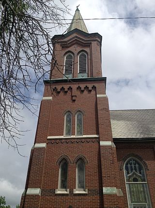
Frankfort is a village in the town of Frankfort, Herkimer County, New York, United States. The population was 2,598 at the 2010 census, out of 7,636 people in the entire town. Like the town, the village is named after an early settler, Lawrence (Lewis) Frank.

Frankfort is a town in Herkimer County, New York, United States. The town is named after one of its earliest settlers, Lawrence (Lewis) Frank. The town of Frankfort includes a village, also called Frankfort. Frankfort is located east of Utica, and the Erie Canal passes along its northern border. At the time of the 2020 census, the population was 7,011, down from 7,636 in 2010.

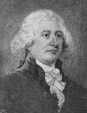
John Brown was an American lawyer and statesman who participated in the development and formation of the State of Kentucky after the American Revolutionary War.

Cherry Street is a one-way street in the New York City borough of Manhattan. It currently has two sections, mostly running along parks, public housing, co-op buildings, tenements, and crossing underneath the Manhattan Bridge.

Johnson Newlon Camden Jr. was a United States senator from Kentucky. His father, Johnson N. Camden, had been a United States Senator from West Virginia.

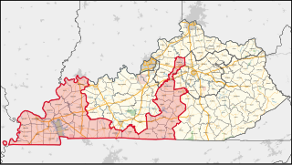
Kentucky's 1st congressional district is a congressional district in the U.S. state of Kentucky. Located in Western Kentucky, and stretching into Central Kentucky, the district takes in Henderson, Hopkinsville, Madisonville, Paducah, Murray, Danville, and Frankfort. The district is represented by Republican James Comer who won a special election to fill the seat of Rep. Ed Whitfield who resigned in September 2016. Comer also won election to the regular term to begin January 3, 2017.

Paul Sawyier, one of Kentucky's most renowned artists, was an American impressionist painter.
Mount Waldo is a small mountain about 1,060 feet (320 m) high in Waldo County, Maine. It is located in the town of Frankfort.

The 2008 congressional elections in Indiana were held on November 4, 2008, to determine who will represent the State of Indiana in the United States House of Representatives. Indiana has nine seats in the House, apportioned according to the 2000 United States census. Representatives are elected for two-year terms; those elected will serve in the 111th Congress from January 3, 2009, until January 3, 2011. The elections coincide with the 2008 U.S. presidential election.
Franklin City is an unincorporated community in Accomack County, Virginia, United States.

The 1848–49 United States Senate elections were held on various dates in various states. As these U.S. Senate elections were prior to the ratification of the Seventeenth Amendment in 1913, senators were chosen by state legislatures. Senators were elected over a wide range of time throughout 1848 and 1849, and a seat may have been filled months late or remained vacant due to legislative deadlock. In these elections, terms were up for the senators in Class 3.
Moyer Creek starts at Wheelock Pond near Jerusalem Hill, New York. Past Gulph, New York Moyer Creek follows a deep ravine, the Frankfort Gorge, south towards Frankfort, New York before converging with the Mohawk River in Frankfort, New York. The headwaters of Moyer Creek rise within a half mile of the source of the Unadilla River which is the most northerly headwater source of the Susquehanna and the closest to the Mohawk River.
Beech Hill is a summit in Herkimer County, New York. It is located north-northwest of Frankfort in the Town of Schuyler. Bell Hill is located north-northwest of Beech Hill.


