Look up द्वीप in Wiktionary, the free dictionary.
Dweep is a puzzle game published in 1999.
Contents
Dweep may also refer to:
Dweep is a puzzle game published in 1999.
Dweep may also refer to:

India is situated north of the equator between 8°4' north to 37°6' north latitude and 68°7' east to 97°25' east longitude. It is the seventh-largest country in the world, with a total area of 3,287,263 square kilometres (1,269,219 sq mi). India measures 3,214 km (1,997 mi) from north to south and 2,933 km (1,822 mi) from east to west. It has a land frontier of 15,200 km (9,445 mi) and a coastline of 7,516.6 km (4,671 mi).

The Bay of Bengal is the northeastern part of the Indian Ocean. The world's largest bay, geographically it is positioned between the Indian subcontinent and the Indochinese peninsula, located below the Bengal region.

The Andaman and Nicobar Islands is a union territory of India. It consists of 836 islands grouped into two island groups: the northern Andaman Islands and the southern Nicobar Islands, separated by a 150 km (93 mi) wide channel. Port Blair is the capital and largest city of the territory, located about 1,190 km (740 mi) from Chennai and 1,255 km (780 mi) from Kolkata in mainland India. The islands are sandwiched between the Bay of Bengal to the west and the Andaman Sea to the east with the northern-most point located 901 km (560 mi) from the mouth of Hooghly river. Indira Point at 6°45’10″N and 93°49’36″E at the southern tip of Great Nicobar is the southernmost point of India.
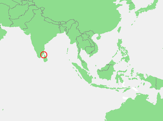
The Gulf of Mannar is a large shallow bay forming part of the Laccadive Sea in the Indian Ocean with an average depth of 5.8 m (19 ft). It lies between the southeastern tip of India and the west coast of Sri Lanka, in the Coromandel Coast region. The chain of low islands and reefs known as Adam’s Bridge or Rama Setu, which includes Mannar Island, separates the Gulf of Mannar from Palk Bay, which lies to the north between India and Sri Lanka. The estuaries of Thamirabarani River and Vaippar River of South India and the Malvathu Oya of Sri Lanka drain into the Gulf. The dugong is found here.

Mumbai Harbour, is a natural deep-water harbour in the southern portion of the Ulhas River estuary. The narrower, northern part of the estuary is called Thana Creek. The harbour opens to the Arabian Sea to the south. The historical island of Elephanta is one of the six islands that lie in the harbour.

Swaraj Dweep, earlier known as Havelock Island, is one of the largest islands in Ritchie's Archipelago, to the east of Great Andaman within the Andaman Islands. It belongs to the South Andaman administrative district, part of the Indian union territory of Andaman and Nicobar Islands. The island is 41 km (25 mi) northeast of the capital city, Port Blair.

Jambudvīpa is a name often used to describe the territory of Greater India in ancient Indian sources.
Uttarakuru is the name of a dvipa ('continent') in ancient Hindu and Buddhist mythology as well as Jain cosmology. The Uttarakuru country or Uttara Kuru Kingdom and its people are sometimes described as belonging to the real world, whereas at other times they are mythical or otherworldly spiritual beings. The name Uttara Kuru means "North Kuru". The Kurus were a tribe during the Vedic civilization of India. The Uttara Kuru were therefore a population to the north of the Kurus, or north of the Himalayas.
South 24 Parganas (Pron: pɔrɡɔnɔs; abbr. 24 PGS (S)), or sometimes South Twenty Four Parganas and Dakshin 24 Parganas, is a district in the Indian state of West Bengal, headquartered in Alipore. It is the largest district of West Bengal by area and second largest by population. It is the sixth most populous district in India (out of 640). On one side of the district there is the urban fringe of Kolkata, and on the other the remote riverine villages in the Sundarbans.
The Brahma Purana is one of the eighteen major Puranas collections of Hindu texts in Sanskrit. It is listed as the first Mahapurana in all anthologies, and is therefore also called Adi Purana. Another title for this text is Saura Purana, because it includes many chapters related to Surya, the sun god. The Brahma Purana is a compilation of geographical Mahatmya and sections on diverse topics.
Jambu or jumbu may refer to:

Shaheed Dweep, earlier known as Neil Island is an island of the Andaman Islands, located in Ritchie's Archipelago. It belongs to the South Andaman administrative district, part of the Indian union territory of Andaman and Nicobar Islands. The island is located 36 km (22 mi) northeast from Port Blair.
South Talpatti, also known as New Moore and Purbasha Island, was a small uninhabited offshore sandbar island in the Bay of Bengal, off the coast of the Ganges-Brahmaputra delta region. It emerged in the Bay of Bengal in the aftermath of the Bhola cyclone in November 1970, and disappeared around March 2010.
Dvipa is a term in Hindu cosmography. The Puranas describe a dvipa to be one of the seven islands or continents that are present on earth, each of them surrounded by an ocean. The same terminology is also used to refer to the seven regions of the cosmos.

Hope Island is a small tadpole shaped Island situated off the coast of Kakinada, India, in the Bay of Bengal.
Flat or flats may refer to:

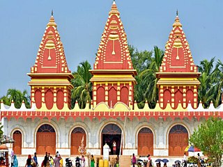
Jambudweep is a Digambara Jain temple in Hastinapur, Uttar Pradesh built by the Jain nunGyanmati in 1972. Jambudweep is a depiction of Jain cosmology Jambudvipa.