
Interstate 25 (I-25), also known as the Pan-America Freeway, is a major Interstate Highway in the western United States. It is primarily a north–south highway, serving as the main route through New Mexico, Colorado, and Wyoming. I-25 stretches from I-10 at Las Cruces, New Mexico to I-90 in Buffalo, Wyoming. It passes through or near Albuquerque, New Mexico; Pueblo, Colorado; Colorado Springs, Colorado; Denver, Colorado; Fort Collins, Colorado; and Cheyenne, Wyoming. The I-25 corridor is mainly rural, especially in Wyoming, excluding the Albuquerque, Pueblo, Colorado Springs, Denver, and Fort Collins metropolitan areas.

Interstate 70 (I-70) is a major east–west Interstate Highway in the United States that runs from I-15 near Cove Fort, Utah, to a park and ride lot just east of I-695 in Baltimore, Maryland. I-70 approximately traces the path of U.S. Route 40 east of the Rocky Mountains. West of the Rockies, the route of I-70 was derived from multiple sources. The Interstate runs through or near many major cities, including Denver, Topeka, Kansas City, St. Louis, Indianapolis, Columbus, Pittsburgh, and Baltimore. The sections of the Interstate in Missouri and Kansas have laid claim to be the first Interstate in the United States. The Federal Highway Administration (FHWA) has claimed the section of I-70 through Glenwood Canyon, Colorado, completed in 1992, to be the last piece of the Interstate Highway System, as originally planned, to open to traffic. The construction of I-70 in Colorado and Utah is considered an engineering marvel, as the route passes through the Eisenhower Tunnel, Glenwood Canyon, and the San Rafael Swell. The Eisenhower Tunnel is the highest point along the Interstate Highway System, with an elevation of 11,158 feet (3,401 m).

U.S. Route 40 or U.S. Highway 40 (US 40), also known as the Main Street of America, is a major east–west United States Highway traveling across the United States from the Mountain States to the Mid-Atlantic States. As with most routes whose numbers end in a zero, US 40 once traversed the entire United States. It is one of the first U.S. Highways created in 1926 and its original termini were in San Francisco, California, and Atlantic City, New Jersey. US 40 currently ends at a junction with I-80 in Silver Summit, Utah, just outside Salt Lake City. West of this point US 40 was functionally replaced with I-80, and as these segments of I-80 were constructed the western portion of US 40 was truncated several times.
Interstate 270 is the designation for four Interstate Highways in the United States, all of which are related to Interstate 70:

U.S. Route 85 (US 85) is a 1,479-mile-long (2,380 km) north–south United States Highway that travels in the Mountain and Northern Plains states of the United States. The southern terminus of the highway is at the Mexican border in El Paso, Texas, connecting with Mexican Federal Highway 45. The northern terminus is at the Canadian border in Fortuna, North Dakota, where the route continues north as Saskatchewan Highway 35. The highway route is part of the CanAm Highway. Sections of US 85 are designated as the Theodore Roosevelt Expressway.
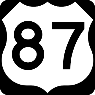
U.S. Highway 87 is a north–south United States highway that runs for 1,998 miles (3,215 km) from northern Montana to southern Texas, making it the longest north-south road to not have a "1" in its number and the third longest north-south road in the country, behind U.S. 41 and U.S. 1. Most of the portion from Billings, Montana to Raton, New Mexico is co-signed along Interstates 90 and 25. It is also co-signed along the majority of I-27 in Texas and future plans call for the interstate to be extended along the US 87 corridor. As of 2004, the highway's northern terminus is in Havre, Montana, at US 2 and its southern terminus is in Port Lavaca, Texas, at SH 238.
Interstate 180 (I-180) is a 1.09-mile-long (1.75 km) connector in the US state of Wyoming between I-80 and downtown Cheyenne.

Interstate 270 (I-270) is a 34.7-mile (55.8 km) auxiliary Interstate Highway in the U.S. state of Maryland that travels from I-495 just north of Bethesda in Montgomery County north to I-70 in the city of Frederick in Frederick County. It consists of the 32.6-mile (52.5 km) mainline as well as a 2.1-mile (3.4 km) spur that provides access to and from southbound I-495. I-270 is known as the Washington National Pike, and makes up the easternmost stretch of the Dwight D. Eisenhower Highway. Most of the southern part of the route in Montgomery County passes through suburban areas around Rockville and Gaithersburg that are home to many biotech firms. This portion of I-270 is up to 12 lanes wide and consists of a local–express lane configuration as well as high-occupancy vehicle lanes that are in operation during peak travel times. North of the Gaithersburg area, the road continues through the northern part of Montgomery County, passing Germantown and Clarksburg as a six- to eight-lane highway with an HOV lane in the northbound direction only. North of here, I-270 continues through rural areas into Frederick County and toward the city of Frederick as a four-lane freeway.
Interstate 270 (I-270) is a seven-mile-long (11 km) auxiliary Interstate Highway located in the northeastern part of the Denver metropolitan area in the US state of Colorado. It overlaps U.S. Highway 36 (US 36) for its entire length and is also a part of the Dwight D. Eisenhower Highway, which spans from I-270 and the Capital Beltway in Bethesda, Maryland, to I-80/US 101 in San Francisco, California. The western terminus of I-270 is at the interchange with I-25 and US 36. It heads eastward to an interchange with I-76, where the mileposts reset because of a previous freeway extension. The freeway heads southeast and comes to meet Vasquez Boulevard, where it enters Commerce City. The road crosses Quebec Street before ending at I-70.

The Southern Rocky Mountain Front is a megaregion of the United States, otherwise known as a megalopolis, with population centers consisting mainly of the Front Range Urban Corridor and the Albuquerque–Santa Fe–Las Vegas combined statistical area, located along the eastern and southern face of the Southern Rocky Mountains in the U.S. states of Wyoming, Colorado, and New Mexico. The region comprises the southern portion of the Rocky Mountain Front geographic region of Canada and the United States, extending into the Southwestern United States. The Southern Rocky Mountain Front had a population of 5,467,633 according to the 2010 United States census. The region is one of the fastest-growing regions in the United States, and its population is projected to grow by 87% to 10,222,370 by 2050. In 2005 the GDP of the region was $229,202,000,000 making up 2% of the United States GDP.
Interstate 70 (I-70) is a part of the Interstate Highway System that runs from Cove Fort, Utah, to Baltimore, Maryland. In Maryland, the Interstate Highway runs 93.62 miles (150.67 km) from the Pennsylvania state line in Hancock east to the Interstate's eastern terminus near its junction with I-695 at a park and ride in Baltimore. I-70 is the primary east–west Interstate in Maryland; the Interstate Highway connects Baltimore—and Washington, D.C., via I-270—with Western Maryland. The Interstate serves Frederick and Hagerstown directly and provides access to Cumberland via its junction with I-68 at Hancock. I-70 runs concurrently with its predecessor highway, U.S. Route 40 (US 40), from Hancock to Indian Springs in Washington County and from Frederick to West Friendship in Howard County.
Interstate 70 (I-70) is a transcontinental Interstate Highway in the United States, stretching from Cove Fort, Utah, to Baltimore, Maryland. In Colorado, the highway traverses an east–west route across the center of the state. In western Colorado, the highway connects the metropolitan areas of Grand Junction and Denver via a route through the Rocky Mountains. In eastern Colorado, the highway crosses the Great Plains, connecting Denver with metropolitan areas in Kansas and Missouri. Bicycles and other non-motorized vehicles, normally prohibited on Interstate Highways, are allowed on those stretches of I-70 in the Rockies where no other through route exists.
In the US state of Colorado, Interstate 25 (I-25) follows the north–south corridor through Colorado Springs and Denver. The highway enters the state from the north near Carr and exits the state near Starkville. The highway also runs through the cities of Fort Collins, Broomfield, Loveland, and Pueblo. The route is concurrent with U.S. Route 87 (US 87) through the entire length of the state. I-25 replaced US 87 and most of US 85 for through traffic.
State Highway 224 (SH 224) is a 3.634-mile (5.848 km) state highway in Adams County, Colorado, United States, that connects U.S. Route 36 (US 36) on the Sherrelwood–Twin Lakes line with U.S. Route 6/U.S. Route 85 (US 6/US 85) in Commerce City. SH 224 is locally signed as East 70th Avenue and East 74th Avenue.
Dwight D. Eisenhower Highway (Wyoming) can refer to:
Dwight D. Eisenhower Highway (Maryland) can refer to:
Dwight D. Eisenhower Highway (Colorado) can refer to: