Łuczywno is a village in the administrative district of Gmina Osiek Mały, within Koło County, Greater Poland Voivodeship, in west-central Poland. It lies approximately 6 kilometres (4 mi) west of Osiek Mały, 13 km (8 mi) north-west of Koło, and 109 km (68 mi) east of the regional capital Poznań.
Dębno Poproboszczowskie is a village in the administrative district of Gmina Babiak, within Koło County, Greater Poland Voivodeship, in west-central Poland. It lies approximately 5 kilometres (3 mi) south of Babiak, 12 km (7 mi) north of Koło, and 120 km (75 mi) east of the regional capital Poznań.
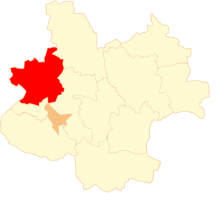
Lipie Góry is a village in the administrative district of Gmina Babiak, within Koło County, Greater Poland Voivodeship, in west-central Poland. It lies approximately 6 kilometres (4 mi) south-east of Babiak, 12 km (7 mi) north of Koło, and 122 km (76 mi) east of the regional capital Poznań.
Ruchenna is a village in the administrative district of Gmina Koło, within Koło County, Greater Poland Voivodeship, in west-central Poland. It lies approximately 4 kilometres (2 mi) north of Koło and 118 km (73 mi) east of the regional capital Poznań.
Borecznia Wielka is a village in the administrative district of Gmina Osiek Mały, within Koło County, Greater Poland Voivodeship, in west-central Poland. It lies approximately 5 kilometres (3 mi) east of Osiek Mały, 12 km (7 mi) north of Koło, and 119 km (74 mi) east of the regional capital Poznań.
Drzewce is a village in the administrative district of Gmina Osiek Mały, within Koło County, Greater Poland Voivodeship, in west-central Poland. It lies approximately 5 kilometres (3 mi) west of Osiek Mały, 9 km (6 mi) north-west of Koło, and 115 km (71 mi) east of the regional capital Poznań.
Felicjanów is a village in the administrative district of Gmina Osiek Mały, within Koło County, Greater Poland Voivodeship, in west-central Poland. It lies approximately 3 kilometres (2 mi) south-east of Osiek Mały, 8 km (5 mi) north of Koło, and 117 km (73 mi) east of the regional capital Poznań.
Lipiny is a village in the administrative district of Gmina Osiek Mały, within Koło County, Greater Poland Voivodeship, in west-central Poland. It lies approximately 5 kilometres (3 mi) north of Osiek Mały, 14 km (9 mi) north of Koło, and 115 km (71 mi) east of the regional capital Poznań.
Maciejewo is a village in the administrative district of Gmina Osiek Mały, within Koło County, Greater Poland Voivodeship, in west-central Poland. It lies approximately 4 kilometres (2 mi) north of Osiek Mały, 14 km (9 mi) north of Koło, and 113 km (70 mi) east of the regional capital Poznań.
Młynek is a village in the administrative district of Gmina Osiek Mały, within Koło County, Greater Poland Voivodeship, in west-central Poland. It lies approximately 6 kilometres (4 mi) south of Osiek Mały, 6 km (4 mi) north-west of Koło, and 115 km (71 mi) east of the regional capital Poznań.
Nowa Wieś is a village in the administrative district of Gmina Osiek Mały, within Koło County, Greater Poland Voivodeship, in west-central Poland. It lies approximately 5 kilometres (3 mi) south-west of Osiek Mały, 8 km (5 mi) north-west of Koło, and 113 km (70 mi) east of the regional capital Poznań.
Osiek Mały is a village in Koło County, Greater Poland Voivodeship, in west-central Poland. It is the seat of the gmina called Gmina Osiek Mały. It lies approximately 10 kilometres (6 mi) north of Koło and 115 km (71 mi) east of the regional capital Poznań.
Osiek Wielki is a village in the administrative district of Gmina Osiek Mały, within Koło County, Greater Poland Voivodeship, in west-central Poland. It lies approximately 5 kilometres (3 mi) south-east of Osiek Mały, 6 km (4 mi) north of Koło, and 118 km (73 mi) east of the regional capital Poznań.
Rosocha is a village in the administrative district of Gmina Osiek Mały, within Koło County, Greater Poland Voivodeship, in west-central Poland. It lies approximately 4 kilometres (2 mi) south-east of Osiek Mały, 8 km (5 mi) north of Koło, and 118 km (73 mi) east of the regional capital Poznań.
Smólniki Racięckie is a village in the administrative district of Gmina Osiek Mały, within Koło County, Greater Poland Voivodeship, in west-central Poland. It lies approximately 6 kilometres (4 mi) west of Osiek Mały, 12 km (7 mi) north-west of Koło, and 109 km (68 mi) east of the regional capital Poznań.
Szarłatów is a village in the administrative district of Gmina Osiek Mały, within Koło County, Greater Poland Voivodeship, in west-central Poland. It lies approximately 5 kilometres (3 mi) west of Osiek Mały, 11 km (7 mi) north-west of Koło, and 110 km (68 mi) east of the regional capital Poznań.
Trzebuchów is a village in the administrative district of Gmina Osiek Mały, within Koło County, Greater Poland Voivodeship, in west-central Poland. It lies approximately 4 kilometres (2 mi) north-east of Osiek Mały, 12 km (7 mi) north of Koło, and 118 km (73 mi) east of the regional capital Poznań.
Witowo is a village in the administrative district of Gmina Osiek Mały, within Koło County, Greater Poland Voivodeship, in west-central Poland. It lies approximately 3 kilometres (2 mi) south-west of Osiek Mały, 9 km (6 mi) north-west of Koło, and 114 km (71 mi) east of the regional capital Poznań.
Osiek nad Notecią is a village in the administrative district of Gmina Wyrzysk, within Piła County, Greater Poland Voivodeship, in west-central Poland. It lies approximately 5 kilometres (3 mi) south-east of Wyrzysk, 39 km (24 mi) east of Piła, and 84 km (52 mi) north of the regional capital Poznań.