Coordinates: 51°34′11″N2°30′27″W / 51.56972°N 2.50750°W

A geographic coordinate system is a coordinate system that enables every location on Earth to be specified by a set of numbers, letters or symbols. The coordinates are often chosen such that one of the numbers represents a vertical position and two or three of the numbers represent a horizontal position; alternatively, a geographic position may be expressed in a combined three-dimensional Cartesian vector. A common choice of coordinates is latitude, longitude and elevation. To specify a location on a plane requires a map projection.
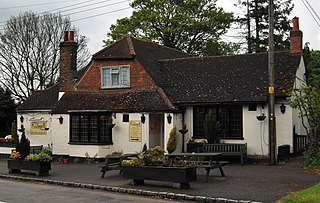
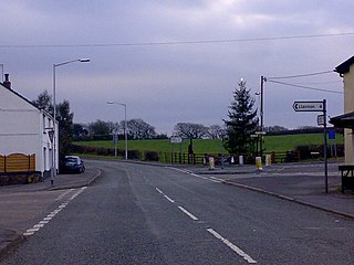
Earthcott is a hamlet in the civil parish of Alveston in South Gloucestershire, England, between Latteridge and Rudgeway on the B4059 road between the A38 road and Yate. It has a letter box and a small village green, but no other services. Its main industry is farming.

A hamlet is a small human settlement. In different jurisdictions and geographies, hamlets may be the size of a town, village or parish, be considered a smaller settlement or subdivision or satellite entity to a larger settlement. The word and concept of a hamlet have roots in the Anglo-Norman settlement of England, where the old French hamlet came to apply to small human settlements. In British geography, a hamlet is considered smaller than a village and distinctly without a church.

In England, a civil parish is a type of administrative parish used for local government, they are a territorial designation which is the lowest tier of local government below districts and counties, or their combined form, the unitary authority. Civil parishes can trace their origin to the ancient system of ecclesiastical parishes which historically played a role in both civil and ecclesiastical administration; civil and religious parishes were formally split into two types in the 19th century and are now entirely separate. The unit was devised and rolled out across England in the 1860s.

Alveston in South Gloucestershire, England, is a village, civil parish and former manor inhabited in 2014 by about 3000 people The village lies about 1 mile (1.6 km) south of Thornbury and approximately 10 miles (16 km) north of Bristol. Alveston is twinned with Courville sur Eure, France. It has two hotels, a variety of small shops, several parks and fields, two churches and a Hyundai car dealership. Alveston is the gateway to the first Severn Bridge from the A38 road and from Thornbury. It is also the home of Thornbury Cricket Club and Marlwood secondary school. The civil parish also includes the villages of Rudgeway and Earthcott.
The place-name 'Earthcott' is first attested in the Domesday Book of 1086, where it appears as 'Herdicote'. It derives from the Old English 'eorthe-cot' meaning 'earth hut' ('cot' as in the modern English words 'dovecote' and 'cottage'). [1]

Domesday Book is a manuscript record of the "Great Survey" of much of England and parts of Wales completed in 1086 by order of King William the Conqueror. The Anglo-Saxon Chronicle states:
Then, at the midwinter [1085], was the king in Gloucester with his council .... After this had the king a large meeting, and very deep consultation with his council, about this land; how it was occupied, and by what sort of men. Then sent he his men over all England into each shire; commissioning them to find out "How many hundreds of hides were in the shire, what land the king himself had, and what stock upon the land; or, what dues he ought to have by the year from the shire."
Old English, or Anglo-Saxon, is the earliest historical form of the English language, spoken in England and southern and eastern Scotland in the early Middle Ages. It was brought to Great Britain by Anglo-Saxon settlers probably in the mid-5th century, and the first Old English literary works date from the mid-7th century. After the Norman conquest of 1066, English was replaced, for a time, as the language of the upper classes by Anglo-Norman, a relative of French. This is regarded as marking the end of the Old English era, as during this period the English language was heavily influenced by Anglo-Norman, developing into a phase known now as Middle English.
Traditions of Earthcott include a village bonfire night, and Christmas Eve carol singing, normally done on the back of a tractor-trailer, with regular stops for mince pies and hot toddy.

Christmas Eve is the evening or entire day before Christmas Day, the festival commemorating the birth of Jesus. Christmas Day is observed around the world, and Christmas Eve is widely observed as a full or partial holiday in anticipation of Christmas Day. Together, both days are considered one of the most culturally significant celebrations in Christendom and Western society.

A Christmas carol is a carol whose lyrics are on the theme of Christmas, and which is traditionally sung on Christmas itself or during the surrounding holiday season. Christmas carols may be regarded as a subset of the broader category of Christmas music.

A mince pie is a sweet pie of British origin, filled with a mixture of dried fruits and spices called "mincemeat", that is traditionally served during the Christmas season in much of the English-speaking world. Its ingredients are traceable to the 13th century, when returning European crusaders brought with them Middle Eastern recipes containing meats, fruits and spices.
Earthcott should not be confused with the nearby hamlet of Gaunt's Earthcott.

Gaunt's Earthcott, sometimes spelt Gaunts Earthcott, is a hamlet in the civil parish of Almondsbury in South Gloucestershire, England. It consists of a ruined chapel, a few houses and two farms, Green Farm and Court Farm. The village is located approximately 2.5 miles (4 km) from Rudgeway and the A38 road and about the same distance from Frampton Cotterell and Winterbourne. The village is located close to the interchange between the M4 and M5 motorways. There is no real industry as such and the main economic activity in the area is farming.