San Diego is a city on the Pacific Ocean coast in Southern California located immediately adjacent to the Mexico–United States border. With a population of over 1.3 million residents, the city is the eighth-most populous in the United States and the second-most populous in the state of California after Los Angeles. The city is the seat of San Diego County, which has a population of nearly 3.3 million people as of 2021. San Diego is known for its mild year-round Mediterranean climate, extensive beaches and parks, its long association with the United States Navy, and its recent emergence as a healthcare and biotechnology development center.
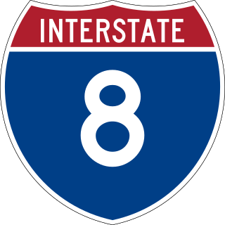
Interstate 8 (I-8) is an Interstate Highway in the southwestern United States. It runs from the southern edge of Mission Bay at Sunset Cliffs Boulevard in San Diego, California, almost at the Pacific Ocean, to the junction with I-10, just southeast of Casa Grande, Arizona. In California, the freeway travels through the San Diego metropolitan area as the Ocean Beach Freeway and the Mission Valley Freeway before traversing the Cuyamaca Mountains and providing access through the Imperial Valley, including the city of El Centro. Crossing the Colorado River into Arizona, I-8 continues through the city of Yuma across the Sonoran Desert to Casa Grande, in between the cities of Phoenix and Tucson.
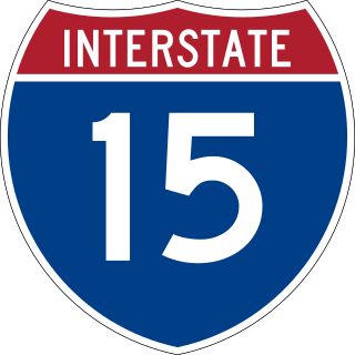
Interstate 15 (I-15) is a major Interstate Highway in the Western United States, running through Southern California and the Intermountain West. I-15 begins near the Mexican border in San Diego County and stretches north to Alberta, Canada, passing through the states of California, Nevada, Arizona, Utah, Idaho, and Montana. The Interstate serves the cities of San Diego, San Bernardino, Las Vegas, Salt Lake City, Idaho Falls, and Great Falls. It also passes close to the urban areas of Los Angeles, Orange, and Riverside counties, California. The stretches of I-15 in Idaho, Utah, and Arizona have been designated as the "Veterans Memorial Highway". The southern end is at a junction with I-8 and State Route 15 (SR 15) in San Diego, and the northern end is at a connection with Alberta Highway 4 at the Sweetgrass–Coutts Border Crossing.

Chula Vista is a city in San Diego County, California, United States. It is also the second-largest city in the San Diego metropolitan area, the seventh largest city in Southern California, the fifteenth largest city in the state of California, and the 78th-largest city in the United States. The population was 275,487 as of the 2020 census, up from 243,916 as of the 2010 census. Located about halfway—7.5 miles (12.1 km)—between the two downtowns of San Diego and Tijuana in the South Bay, the city is at the center of one of the richest culturally diverse zones in the United States. Chula Vista is so named because of its scenic location between the San Diego Bay and coastal mountain foothills.

Santee is a city in San Diego County, California, United States. The population was 60,037 at the 2020 census. It is a part of the East County region. The city is bisected by the San Diego River, a linear greenbelt that includes parks, trails and more than 1,100 acres (450 ha) of natural habitat.

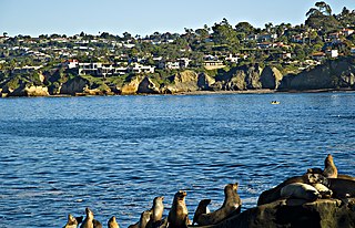
La Jolla is a hilly, seaside neighborhood within the city of San Diego, occupying 7 miles (11 km) of curving coastline along the Pacific Ocean. The population reported in the 2010 census was 46,781. The climate is mild, with an average daily temperature of 70.5 °F (21.4 °C).

The Kumeyaay, also known as 'Iipai-Tiipai or by the historical Spanish name Diegueño, is a tribe of Indigenous peoples of the Americas who live at the northern border of Baja California in Mexico and the southern border of California in the United States. They are an indigenous people of California.

State Route 78 (SR 78) is a state highway in the U.S. state of California that runs from Oceanside east to Blythe, traversing nearly the entire width of the state. Its western terminus is at Interstate 5 (I-5) in San Diego County and its eastern terminus is at I-10 in Riverside County. The route is a freeway through the heavily populated cities of northern San Diego County and a two-lane highway running through the Cuyamaca Mountains to Julian. In Imperial County, SR 78 travels through the desert near the Salton Sea and passes through the city of Brawley and the Algodones Dunes before turning north on the way to its terminus in Blythe.
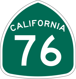
State Route 76 (SR 76) is a state highway 52.63 miles (84.70 km) long in the U.S. state of California. It is a much used east–west route in the North County region of San Diego County that begins in Oceanside near Interstate 5 (I-5) and continues east. The highway is a major route through the region, passing through the community of Bonsall and providing access to Fallbrook. East of the junction with I-15, SR 76 goes through Pala and Pauma Valley before terminating at SR 79.

Campo is an unincorporated community in the Mountain Empire area of southeastern San Diego County, California, United States. The population was 2,955 at the 2020 United States census, up from 2,684 at the 2010 census. For statistical purposes, the United States Census Bureau has defined Campo as a census-designated place (CDP). The census definition of the area may not precisely correspond to local understanding of the area with the same name.
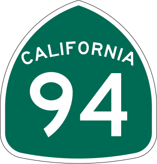
State Route 94 (SR 94) is a state highway in the U.S. state of California that is 63.324 miles (101.910 km) long. The western portion, known as the Martin Luther King Jr. Freeway, begins at Interstate 5 (I-5) in Downtown San Diego and continues to the end of the freeway portion past SR 125 in Spring Valley. The non-freeway segment of SR 94 that continues east through the mountains to I-8 near Boulevard is known as Campo Road.

The South Bay, also known as South County, is a region in southwestern San Diego County, California consisting of the cities and unincorporated communities of Bonita, Chula Vista, East Otay Mesa, Imperial Beach, Lincoln Acres, National City, and South San Diego.
Otay Mesa is a community in the southern exclave of the city of San Diego, just north of the U.S.–Mexico border.

Route 15, consisting of the contiguous segments of State Route 15 (SR 15) and Interstate 15 (I-15), is a major north–south state highway and Interstate Highway in the U.S. state of California, connecting San Bernardino, Riverside, and San Diego Counties. The route consists of the southernmost 289.24 miles (465.49 km) of I-15, which extends north through Nevada, Arizona, Utah, Idaho, and Montana to the Canada–US border. It is a major thoroughfare for traffic between San Diego and the Inland Empire, as well as between Southern California, Las Vegas, Nevada, and the Intermountain West.
California is the most populated U.S. state, with an estimated population of 38.9 million as of 2023. It has people from a wide variety of ethnic, racial, national, and religious backgrounds.
San Diego–Tijuana is an international transborder agglomeration, straddling the border of the adjacent North American coastal cities of San Diego, California, United States, and Tijuana, Baja California, Mexico. The 2020 population of the region was 5,456,577, making it the largest bi-national conurbation shared between the United States and Mexico, and the second-largest shared between the US and another country. The conurbation consists of the San Diego metropolitan area, in the United States and the municipalities of Tijuana, Rosarito Beach (126,980), and Tecate (108,440) in Mexico. It is the third most populous region in the California–Baja California region, smaller only than the metropolitan areas of Greater Los Angeles and the San Francisco Bay Area.

U.S. Route 80 (US 80) was a U.S. highway in California that continued east across the country to Georgia. The western terminus of US 80 was in San Diego, California, and it continued east through the city on several different alignments through the years. The highway went through the Cuyamaca Mountains, encountering many switchbacks, before descending to El Centro. After passing through the sand dunes, the highway crossed the Colorado River into Yuma, Arizona.
There are 34 routes assigned to the "S" zone of the California Route Marker Program, which designates county routes in California. The "S" zone includes county highways in Imperial, Orange, Riverside, San Diego, and Santa Barbara counties.

San Diego County, officially the County of San Diego, is a county in the southwestern corner of the U.S. state of California. As of the 2020 census, the population was 3,298,634, making it California's second-most populous county and the fifth-most populous in the United States. Its county seat is San Diego, the second-most populous city in California and the eighth-most populous city in the United States. It is the southwesternmost county in the 48 contiguous United States, and is a border county. It is also home to 18 Native American tribal reservations, the most of any county in the United States.
The 2018 California lieutenant gubernatorial election was held on November 6, 2018, to elect the Lieutenant Governor of California. Incumbent Democratic lieutenant governor Gavin Newsom was ineligible to run for reelection due to term limits and ran for Governor of California instead. Democrats Eleni Kounalakis and Ed Hernandez faced each other in the general election, as no Republican finished in the top two positions of the nonpartisan blanket primary that was held on June 5, 2018.