
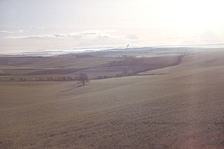
The South Downs are a range of chalk hills in the south-eastern coastal counties of England that extends for about 260 sq mi (670 km2) across the south-eastern coastal counties of England from the Itchen valley of Hampshire in the west to Beachy Head, in the Eastbourne Downland Estate, East Sussex, in the east. The Downs are bounded on the northern side by a steep escarpment, from whose crest there are extensive views northwards across the Weald. The South Downs National Park forms a much larger area than the chalk range of the South Downs, and includes large parts of the Weald.
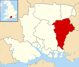
East Hampshire is a local government district in Hampshire, England. Its council is based in Petersfield. Other towns are Alton and Bordon.

Petersfield is a market town and civil parish in the East Hampshire district of Hampshire, England. It is 15 miles (24 km) north of Portsmouth. The town has its own railway station on the Portsmouth Direct line, the mainline rail link connecting Portsmouth and London. Situated below the northern slopes of the South Downs, Petersfield lies wholly within the South Downs National Park.

Selborne is a village in Hampshire, England, 3.9 miles (6.3 km) south of Alton, and just within the northern boundary of the South Downs National Park. The village receives visitors because of its links with the naturalist Revd. Gilbert White, a pioneer of birdwatching.
The Dorset Downs are an area of chalk downland in the centre of the county Dorset in south west England. The downs are the most western part of a larger chalk formation which also includes Cranborne Chase, Salisbury Plain, Hampshire Downs, Chiltern Hills, North Downs and South Downs.
Hangers Way is a 21-mile-long-distance (34 km) footpath through Hampshire, England from Alton railway station to Queen Elizabeth Country Park where it meets the South Downs Way National Trail.
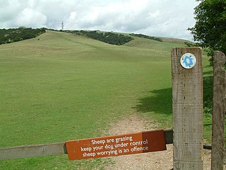
Queen Elizabeth Country Park is a large country park situated on the South Downs in southern England. It is located on the A3 road three miles south of Petersfield, Hampshire and lies within the South Downs National Park.

The Shropshire Hills are a dissected upland area and one of the natural regions of England. They lie wholly within the county of Shropshire and encompass several distinctive and well-known landmarks, such as the Long Mynd, Wenlock Edge, The Wrekin and the Clees.

Selborne Common is a 99.6-hectare (246-acre) biological Site of Special Scientific Interest west of Selborne in Hampshire. It is a Nature Conservation Review site, Grade I, and is part of the East Hampshire Hangers Special Area of Conservation. It is managed by the National Trust.

Noar Hill is a 63-hectare (160-acre) biological Site of Special Scientific Interest south of Selborne in Hampshire. It is a Nature Conservation Review site, Grade 2, and part of East Hampshire Hangers Special Area of Conservation. An area of 20 hectares is a nature reserve managed by the Hampshire and Isle of Wight Wildlife Trust.

East Hampshire is a constituency represented in the House of Commons of the UK Parliament since 2010 by Damian Hinds of the Conservative Party.
East Hampshire Area of Outstanding Natural Beauty (AONB) in England was designated in 1962. The designation was revoked in March 2010, together with the neighbouring Sussex Downs AONB, upon the establishment of the South Downs National Park. The southern part of the area is mainly rolling chalk downland used for farming that is a westward extension of the Sussex Downs. The north and east includes steep wooded hills and heathland.

Steep is a village and civil parish in the East Hampshire district of Hampshire, England. Its nearest town is Petersfield, which lies 1.4 miles (2.3 km) south of the village, just off the A3 road. The nearest railway station is Petersfield, at 1.6 miles (2.6 km) south of the village. It has two public houses, The Harrow and the Cricketers Inn, with the former being an 18th-century Grade II listed building. According to the 2011 census, it had a population of 1,391.
At 249 metres (817 ft), Wheatham Hill is one of the highest hills in the county of Hampshire, England. It is part of the North Hampshire Downs.

51.14°N 1.24°W

The Thames Basin Heaths are a natural region in southern England in Berkshire, Hampshire and Surrey, a slightly mottled east-west belt of ecologically recognised and protected land.

Selborne Hill is one of the highest points in the county of Hampshire, England. It is one of the East Hampshire Hangers, a line of prominent hills on the eastern scarp slope of the Hampshire Downs, and reaches 211 metres (692 ft) above sea level. Its prominence of 53 metres qualifies it as one of the county's Tumps.
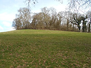
King John's Hill is the site of an Iron Age hillfort located in Hampshire, in southeast England. The hill is situated in the parish of Worldham, in East Hampshire District. It is a Scheduled Ancient Monument with a list entry identification number of 1020314, and a Monument Number of 243207.
